Maple Rapids in Clinton County, Michigan — The American Midwest (Great Lakes)
Memorial to Early Pioneers
⎯⎯⎯
Tribute to Early Indians
Photographed by Karin Sherrill
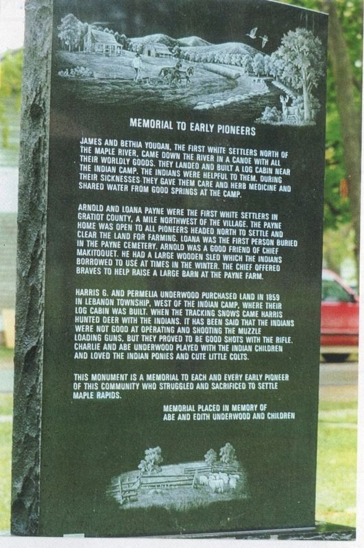
1. Memorial to Early Pioneers side of the marker
Memorial to Early Pioneers
James and Bethia Youdan, the first white settlers north of the Maple River, came down the river in a canoe with all their worldly goods. They landed and built a log cabin near the Indian camp. The Indians were helpful to them. During their sicknesses they cave them care and herb medicine and shared water from good springs at the camp.
Arnold and Loana Payne were the first white settlers in Gratiot County, a mile northwest of the village. The Payne home was open to all pioneers headed north to settle and clear the land for farming. Loana was the first person buried in the Payne Cemetery. Arnold was a good friend of Chief Makitoquet. He had a large wooden sled which the Indians borrowed to use at times in the winter. The chief offered braves to help raise a large barn at the Payne Farm.
Harris G. and Permelia Underwood purchased land in 1859 in Lebanon Township, west of the Indian camp where their log cabin was built. When the tracking snows came, Harris hunted deer with the Indians. It has been said that the Indians were not good at operating and shooting the muzzle loading guns, but they proved to be good shots with the rifle. Charlie and Abe Underwood played with the Indian children and loved the Indian ponies and cute little colts.
This monument is a memorial to each and every early pioneer of the community who struggled and sacrificed to settle Maple Rapids.
Memorial placed in memory of Abe and Edith Underwood and their children.
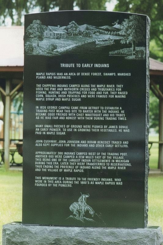
Tribute to Early Indians
Maple Rapids was an area of dense forest, swamps, marshes, plains, and wilderness.
The Chippewa Indians camped along the Maple River. They used the Pine and Mayworth creeks and tributaries for fishing, hunting, and trapping for food and fur. They raised corn, squash, Irish potatoes, and were famous for
this page online
In 1826 George Campau came from Detroit and established a trading post near this site to barter with the Indians. He became good friends with Chief Makitoquet and his tries as he was fair and honest with them during trading times.
Many small patches of ground were plowed by James Sowle an early pioneer, to use use in growing their vegetables. he was paid in maple sugar.
John Cushway, John Johnson, and Hiram Benedict traded and also kept supplies for the Indians and other early settlers.
Approximately 300 Indians camped west of the trading post. Another 600 were camped a few miles east of the village. This being one of the largest Indian settlements in Michigan during this era. Later they were transferred to reservations, thus ending the presence of Indians along the Maple River and the Village of Maple Rapids.
This monument is a tribute to the friendly Indians, who were in the area during the 1800s as Maple Rapids was founded by the pioneers.
Topics. This historical marker is listed in these topic lists: Indigenous Peoples and Communities • Industry & Commerce •
Photographed by Karin Sherrill
2. Tribute to Early Indians side of the marker
Location. 43° 6.274′ N, 84° 41.647′ W. Marker is in Maple Rapids, Michigan, in Clinton County. It is on West Main Street east of Poplar Street, on the right when traveling east. Touch for map. Marker is at or near this postal address: 216 W Main St, Maple Rapids MI 48853, United States of America. Touch for directions.

Regionally, this marker is in Mid-Michigan and in Greater Lansing. It is also in the American Midwest. Globally, it is in North America, the Western Hemisphere, the Western World, and the Anglosphere. Historically, it finds itself in what was once the Northwest Territory.
Other nearby markers. At least 8 other markers are within 10 miles of this marker, measured as the crow flies: Clement Sohn (approx. 7.4 miles away); St. John the Baptist Church / St. John the Baptist Cemetery (approx. 7.7 miles away); Greenbush United Methodist Church (approx. 7.8 miles away); Dustin John Kaleyta Memorial Flagpole (approx. 9.3 miles away); Clinton County Medal of Honor Memorial (approx. 9.7 miles away); Clinton County Veterans Memorial (approx. 9.7 miles away); a different marker also named Clinton County Veterans Memorial (approx. 9.9 miles away); a different marker also named Clinton County Veterans Memorial (approx. 9.9 miles away).
Credits. This page was last revised on September 25, 2026. It was originally submitted on August 11, 2026, by Karin Sherrill of Gilbert, Arizona. This page has been viewed 9 times since then. Photos: 1. submitted on August 11, 2026, by Karin Sherrill of Gilbert, Arizona. 2. submitted on August 12, 2026, by Karin Sherrill of Gilbert, Arizona. • Devry Becker Jones was the editor who published this page.
