Napanee in Greater Napanee in Lennox and Addington County, Ontario — Central Canada (North America)
The Quakers of Adolphustown
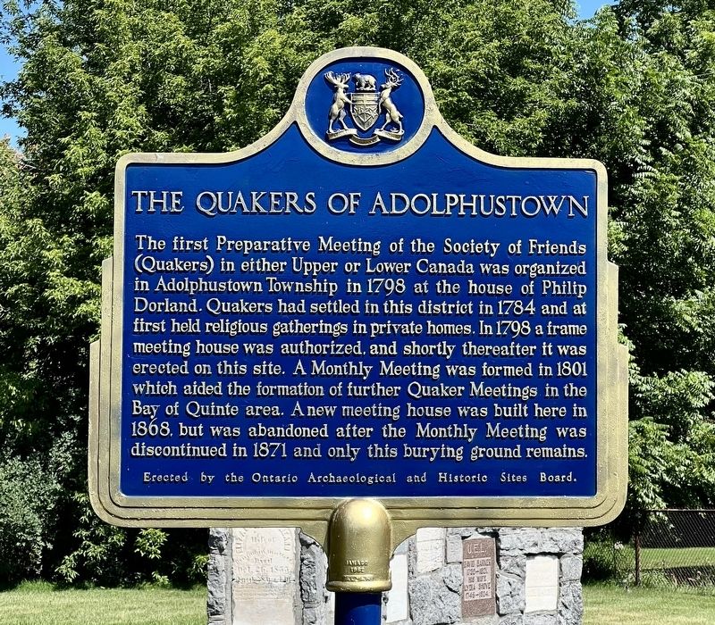
Photographed by Tim Boyd, July 31, 2026
1. The Quakers of Adolphustown Marker
Topics and series. This historical marker is listed in these topic lists: Cemeteries & Burial Sites • Religion & Religious Structures • Settlements & Settlers. In addition, it is included in the Canada, Ontario Heritage Trust, and the Quakerism series lists. A significant historical year for this entry is 1798.
Location. 44° 5.869′ N, 77° 1.685′ W. Marker is in Greater Napanee, Ontario, in Lennox and Addington County. It is in Napanee. It is on Quaker Hill Road 0.1 kilometers west
this page online

Regionally, this marker is in Eastern Ontario and specifically in Southeastern Ontario. It is also in Central Canada. Globally, it is in North America, on the Great Lakes, in the Western Hemisphere, in the Western World, and in the Anglosphere. Historically, it finds itself in what was once a British colony, the Viceroyalty of New France, the Haudenosaunee (Iroquois) Confederacy, and Rupert’s Land.
Other nearby markers. At least 8 other markers are within 11 kilometers of this marker, measured as the crow flies: Old Hay Bay Church / La vielle église de la Baie Hay (approx. 0.8 kilometers away); Hay Bay Church (approx. 0.8 kilometers away); Bay of Quinte Loyalist Settlement (approx. 5.8 kilometers away); The Royal Union Flag (approx. 5.9 kilometers away); a different marker also named The Royal Union Flag (approx. 6.8 kilometers away); Sir Rodmond P. Roblin 1853-1937 (approx. 7.9 kilometers away); United Church (approx. 10.3 kilometers

Photographed by Tim Boyd, July 31, 2026
2. The Quakers of Adolphustown Marker
Facing east towards South Shore Road

Photographed by Tim Boyd, July 31, 2026
3. Preserved gravestones in the Adolphustown Quaker Burying Ground
Credits. This page was last revised on August 12, 2026. It was originally submitted on August 11, 2026, by Tim Boyd of Hamilton, Ontario. This page has been viewed 13 times since then. Photos: 1, 2, 3. submitted on August 11, 2026, by Tim Boyd of Hamilton, Ontario. • Andrew Ruppenstein was the editor who published this page.
