Marker Logo
THE HISTORICAL
MARKER DATABASE
“Bite-Size Bits of Local, National, and Global History”
Greybull in Big Horn County, Wyoming — The American West (Mountains)
 

Sheep Mountain

Wyoming
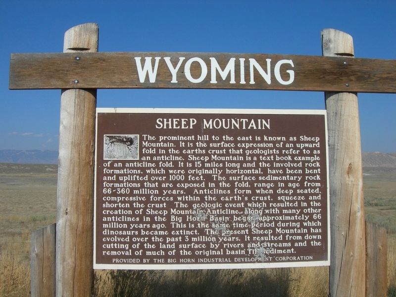
 
 
Sheep Mountain Marker image. Click for full size.
Photographed by Jimmy Emerson, September 2, 2011
1. Sheep Mountain Marker
Inscription. The prominent hill to the east is known as Sheep Mountain. It is the surface expression of an upward fold in the earths crust that geologists refer to as an anticline. Sheep Mountain is a text book example of an anticline fold. It is 15 miles long and the involved rock formations, which were originally horizontal, have been bent and uplifted over 1000 feet. The surface sedimentary rock formations that are exposed in the fold, range in age from 66-360 million years. Anticlines form when deep seated, compressive forces within the earth's crust, squeeze and shorten the crust The geologic event which resulted in the creation of Sheep Mountain Anticline, along with many other anticlines in the Big Horn Basin began approximately 66 million years ago. This is the same time period during which dinosaurs became extinct. The present Sheep Mountain has evolved over the past 3 million years. It resulted from down cutting of the land surface by rivers and streams and the removal of much of the original basin fil sediment.
 
Erected by Big Horn Industrial Development Corporation.
 
Topics. This historical marker
Paid Advertisement
Click or scan to see
this page online
is listed in these topic lists: LandmarksNatural Features.
 
Location. 44° 38.112′ N, 108° 15.406′ W. Marker is in Greybull, Wyoming, in Big Horn County. It is on U.S. 310, on the right when traveling west. Touch for map. Marker is at or near this postal address: US-310, Greybull WY 82426, United States of America. Touch for directions.

Regionally, this marker is in Wyoming’s Bighorn Basin. It is also in the American Mountain West and in the Lewis & Clark Corridor. Globally, it is in North America, the Rocky Mountains, the Western Hemisphere, the Western World, and the Anglosphere.

Other nearby markers. At least 3 other markers are within 16 miles of this marker, measured as the crow flies: Mason-Lovell Ranch (approx. 14.3 miles away); Henry Gilbert, Jr. Memorial (approx. 15.4 miles away); The Jeep (approx. 15.4 miles away).
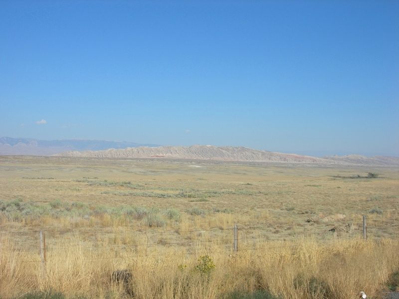
 
Sheep Mountain image. Click for full size.
Photographed by Jimmy Emerson, September 2, 2011
2. Sheep Mountain
 
 
Credits. This page was last revised on August 13, 2026. It was originally submitted on August 11, 2026, by Jimmy Emerson of Dalton, Georgia. This page has been viewed 15 times since then. Photos:   1, 2. submitted on August 11, 2026, by Jimmy Emerson of Dalton, Georgia. • Andrew Ruppenstein was the editor who published this page.

m=308135

CeraNet Cloud Computing sponsors the Historical Marker Database.
This website earns income from purchases you make after using our links to Amazon.com. We appreciate your support.
Paid Advertisement
Aug. 25, 2026