Charleston in Charleston County, South Carolina — The American South (South Atlantic)
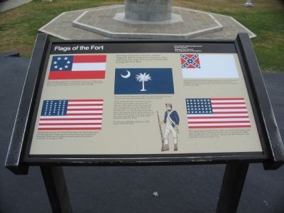
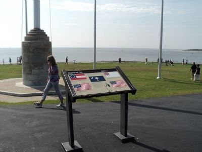
Flags of the Fort
Photographed by Craig Swain, May 3, 2010
1. Flags of the Fort Marker
(Top Left):
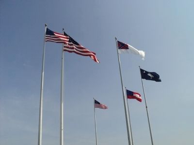
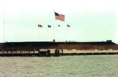
The First official flag of the Confederacy, known as the "Stars and Bars," or "First National," was raised in April 1861 when Southern forces occupied Fort Sumter at the start of the Civil War.
(Lower Left):
Flying at the far left, the United States flag with thirty-three stars was the flag of the Union garrison which occupied the fort from December 1860 until Confederate bombardment forced their surrender in mid-April 1861.
(Center):
The color and symbols of the South Carolina state flag represent important events in South Carolina's military history.
Early South Carolina regiments wore blue uniforms with a silver crescent on their caps. In 1776, a flag with a silver crescent on a blue field flew over the palmetto log fort on Sullivan's Island, now the site of Fort Moultrie. In a key Revolutionary War battle, the small garrison of the palmetto log fort repulsed an attack by British warships; the white palmetto tree on the blue field commemorates this battle.
The flag was
this page online
(Upper Right):
The second official Confederate flag, called the "Second National," replaced the first banner in 1863. It flew over the fort until Confederate troops withdrew from all Charleston harbor defenses in February 1865.
(Lower Right):
The United States flag at the far right was raised in February, 1865 when Union forces reoccupied the fort at the end of the Civil War. Note the 35 stars; two new states, Kansas and West Virginia, had joined the Union during the war.
Erected by Fort Sumter National Monument, South Carolina - National Park Service - U.S. Department of the Interior.
Topics and series. This historical marker is listed in this topic list: War, US Civil. In addition, it is included in the Vexillology series list. A significant historical month for this entry is February 1865.
Location. 32° 45.137′ N, 79° 52.473′ W. Marker is in Charleston, South Carolina, in Charleston County. It can be reached from the Fort Sumter Ferry Terminal. Located at Fort Sumter National Monument and only reached by boat. See links below for more information about access to the site. Touch for map. Marker
Photographed by Bill Coughlin, August 4, 2013
2. Flags of the Fort Marker

Regionally, this marker is in Historic Charleston and in the Lowcountry. It is also in the American South, specifically in the Deep South, and on the Eastern Seaboard. Globally, it is in the North Atlantic Region, North America, the Western Hemisphere, the Western World, and the Anglosphere. Historically, it finds itself in what was once the territory of the Mississippian Culture, one of the original Thirteen Colonies, one of the Confederate States of America, and the Antebellum South.
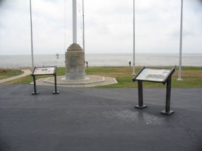
Other nearby markers. At least 8 other markers are within walking distance of this marker: Fort Moultrie (here, next to this marker); Major Robert Anderson (here, next to this marker); Morris Island (a few steps from this marker); Charleston Besieged (a few steps from this marker); Fort Johnson (a few steps from this marker); 8-inch (200 Pounder) Parrott (a few steps from this marker); Fort Sumter Today (within shouting distance of this marker); Fort Sumter 1861-65 (within shouting distance of this marker). Touch for a list and map of all
Photographed by Craig Swain
3. Markers near the Flagpoles
Another marker is no longer nearby. Morris Island (was a few steps from this marker but has been replaced with another marker now near it).
Photographed by Bill Coughlin, August 4, 2013
4. Raising the Flags at Fort Sumter
Photographed by Craig Swain, May 3, 2010
5. Fort Sumter's Flagpoles
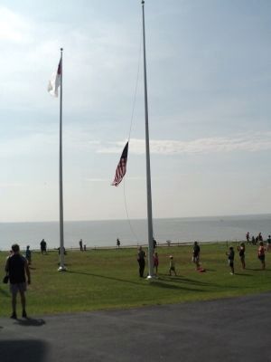
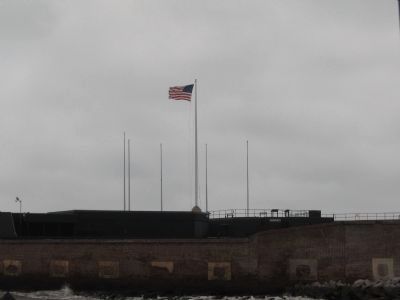
On the day of this visit, not all flags were flying.
Photographed by Bill Coughlin, August 4, 2013
6. Flags of Fort Sumter
Photographed by Mike Stroud, July 1991
7. Flags of the Fort
Credits. This page was last revised on January 4, 2026. It was originally submitted on May 17, 2010, by Craig Swain of Leesburg, Virginia. This page has been viewed 2,354 times since then and 128 times this year. Photos: 1. submitted on May 17, 2010, by Craig Swain of Leesburg, Virginia. 2. submitted on August 18, 2013, by Bill Coughlin of Woodland Park, New Jersey. 3. submitted on May 17, 2010, by Craig Swain of Leesburg, Virginia. 4. submitted on August 18, 2013, by Bill Coughlin of Woodland Park, New Jersey. 5. submitted on May 18, 2010, by Craig Swain of Leesburg, Virginia. 6. submitted on August 18, 2013, by Bill Coughlin of Woodland Park, New Jersey. 7. submitted on May 18, 2010, by Mike Stroud of Bluffton, South Carolina.
