
Wesleyville in Port Hope in Northumberland County, Ontario — Central Canada (North America)
Wesleyville Village Heritage
The Wesley Church- 2082 Lakeshore Road, Port Hope and the historic road
| — | Friends Rejuvenating Wesleyville Village | — |
Photographed by Tim Boyd, July 31, 2026
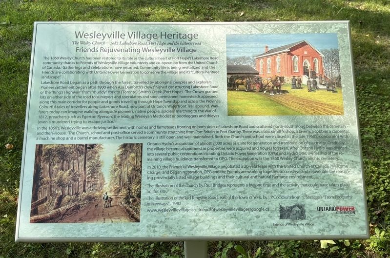
1. Wesleyville Village Heritage Marker
Lakeshore Road began as a path through the forest, travelled by aboriginal peoples and explorers. Pioneer settlement began after 1800 when Asa Danforth's crew finished constructing Lakeshore Road or the "King's Highway" from "muddy" York to (Toronto) Smith's Creek (Port Hope). The Crown granted lots on either side of the road to surveyors and speculators and soon permanent homesteads appeared along this main corridor for people and goods travelling through Hope Township and across the Province. Colourful tales of travellers along Lakeshore Road, now part of Ontario's Waterfront Trail abound. Wayfarers today can imagine walking alongside pioneers, native people, soldiers marching to the War of 1812,
this page online
In the 1860's, Wesleyville was a thriving settlement with homes and farmsteads fronting on both sides of Lakeshore Road and scattered north-south along between the cemetery - and the Y-House. The Church, school and post-office served a community stretching from Port Britain to Port Granby. There was a blacksmith's shop, a tavern, a cobbler a carpenter, a machine shop and a barrel manufacturer. The historic cemetery is still open and well maintained. Both the Church and school were closed in the late 1960's, concutrent with Ontario Hydro's acquisition of almost 2,000 acres as a site for generation and transmission of electricity. Gradually the village became abandoned as properties were acquired and houses forsaken. After Ontario Hydro was divided into several public corporations including Ontario Power Generation (OPG) and Hydro One, ownership of the remaining village buildings transferred to OPG. The exception was the 1860 Wesley Church and its cemetery.
In 2010, the Friends of Wesleyville
Photographed by Tim Boyd, July 31, 2026
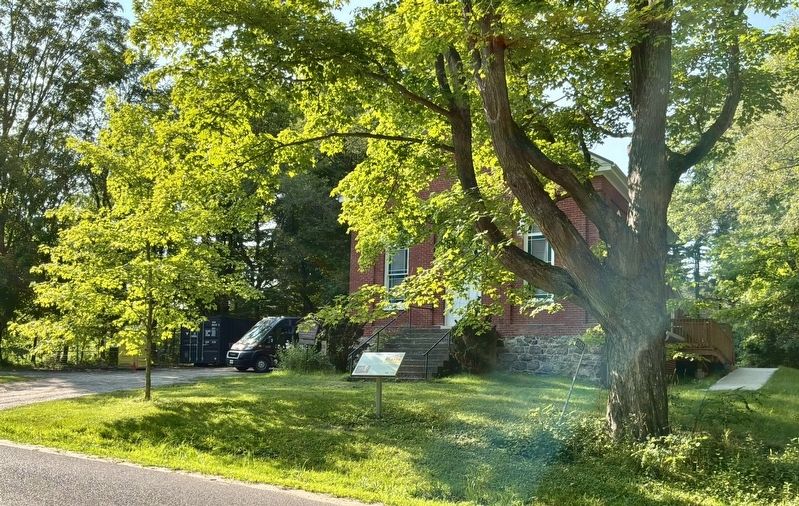
2. Wesleyville Village Heritage Marker
Erected by Friends of Wesleyville Village, Ontario Power Generation.
Topics. This historical marker is listed in these topic lists: Religion & Religious Structures • Roads & Vehicles. A significant historical year for this entry is 1860.
Location. 43° 55.535′ N, 78° 24.921′ W. Marker is in Port Hope, Ontario, in Northumberland County. It is in Wesleyville. It is on Lakeshore Road 2.5 kilometers west of Wesleyville Road, on the right when traveling west. Touch for map. Marker is at or near this postal address: 2082 Lakeshore Rd, Port Hope ON L1A 3V7, Canada. Touch for directions.

Regionally, this marker is in the Kawarthas Northumberland Area and in Eastern Ontario. It is also in Central Canada. Globally, it is in North America, on the Great Lakes, in the Western Hemisphere, in the Western World, and in the Anglosphere. Historically,
Photographed by Tim Boyd, July 31, 2026
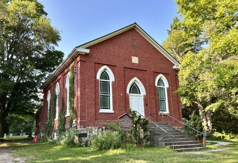
3. Wesleyville Church in 2026
Other nearby markers. At least 8 other markers are within 11 kilometers of this marker, measured as the crow flies: A different marker also named Wesleyville Village Heritage (within shouting distance of this marker); a different marker also named Wesleyville Village Heritage (about 120 meters away, measured in a direct line); Sgt. Edward Edwin Dodds (approx. 9.6 kilometers away); Hope Chapel (approx. 9.7 kilometers away); The Eldorado Refinery / La Raffinerie Eldorado (approx. 9.8 kilometers away); The Little Station House (approx. 10.1 kilometers away); Thomas Curtis Clarke 1827-1901 (approx. 10.1 kilometers away); Cenotaph Plaque (approx. 10.1 kilometers away). Touch for a list and map of all markers in Port Hope.
Credits. This page was last revised on August 16, 2026. It was originally submitted on August 13, 2026, by Tim Boyd of Hamilton, Ontario. This page has been viewed 9 times since then. Photos: 1, 2, 3. submitted on August 13, 2026, by Tim Boyd of Hamilton, Ontario. • Andrew Ruppenstein was the editor who published this page.
