Louisa in Louisa County, Virginia — The American South (Mid-Atlantic)
Louisa Court House
Raiders Intercepted
| — | The Battle of Trevilian Station | — |
Photographed by Evan Dwyer, June 11, 2026
1. Louisa Court House Marker
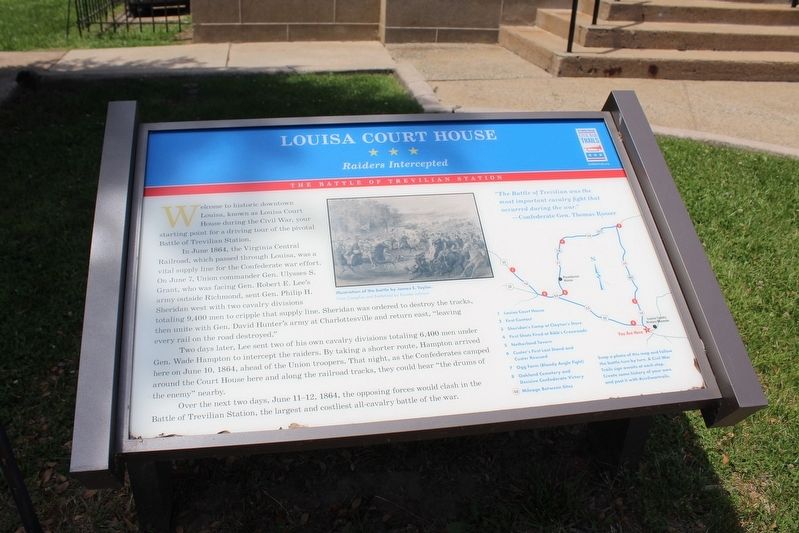
In June 1864, the Virginia Central Railroad, which passed through Louisa, was a vital supply line for the Confederate war effort. On June 7, Union commander Gen. Ulysses S. Grant, who was facing Gen. Robert E. Lee's army outside Richmond, sent Gen. Philip H. Sheridan west with two cavalry divisions totaling 9,400 men to cripple that supply line. Sheridan was ordered to destroy the tracks, then unite with Gen. David Hunter's army at Charlottesville and return east, "leaving every rail on the road destroyed."
Two days later, Lee sent two of his own cavalry divisions totaling 6,400 men under Gen. Wade Hampton to intercept the raiders. By taking a shorter route, Hampton arrived here on June 10, 1864, ahead of the Union troopers. That night, as the Confederates camped around the Court House here and along the railroad tracks, they could hear "the drums of the enemy" nearby.
Over the next two days, June 11-12, 1864, the opposing forces would clash in the Battle
this page online
"The Battle of Trevilian was the most important cavalry fight that occurred during the war."
- Confederate Gen. Thomas Rosser
Photo Caption:
Illustration of the battle by James E. Taylor.
From Campfire and Battlefield by Rossiter Johnson
List of stops:
1 Louisa Court House
2 First Contact
3 Sheridan's Camp at Clayton's Store
4 First Shots Fired at Bibb's Crossroads
5 Netherland Tavern
6 Custer's First Last Stand and Custer Rescued
7 Ogg Farm (Bloody Angle Fight)
8 Oakland Cemetery and Decisive Confederate Victory
Snap a photo of this map and follow the battle turn by turn. A Civil War Trails sign awaits at each stop. Create some history of your own and post it with #civilwartrails.
Erected by Virginia Civil War Trails.
Topics. This historical marker is listed in these topic lists: Railroads & Streetcars • War, US Civil. A significant historical date for this entry is June 10, 1864.
Location. 38° 1.493′ N, 78° 0.205′ W. Marker is in Louisa, Virginia, in Louisa County. It is at the intersection of West Main Street (U.S. 33) and Elm Avenue,
Photographed by Evan Dwyer, June 11, 2026
2. Louisa Court House Marker
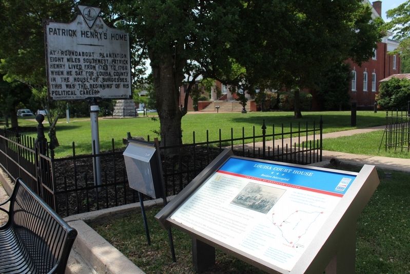
The courthouse that stood during the Civil War was just beyond the tree shown. The stone threshold for that courthouse is still on the lawn and has its own marker. The courthouse that replaced it, built in 1905-6, is across the lawn in the background.

Regionally, this marker is in the Piedmont and in Central Virginia. It is also in the American South and specifically in the Upper South. Globally, it is in North America, the Western Hemisphere, the Western World, and the Anglosphere. Historically, it finds itself in what was once the territory of the Mississippian Culture, one of the original Thirteen Colonies, one of the Confederate States of America, and the Antebellum South.
Other nearby markers. At least 8 other markers are within walking distance of this marker: Second Louisa County Courthouse Threshold (here, next to this marker); Patrick Henry's Home (a few steps from this marker); Confederate Memorial (within shouting distance of this marker); In Memory of All Veterans (within shouting distance of this marker); John Mercer Langston Birthplace (within shouting distance of this marker); Bicentennial Monument (within
Photographed by Evan Dwyer, June 11, 2026
3. Louisa Court House Threshold
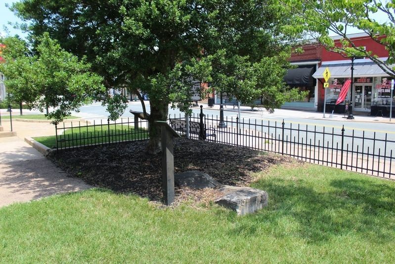
The marker is in the background behind the tree. This view shows the stone threshold for the 1818 courthouse, marking where the entrance to that building once was. The road is Main Street.
Another marker is no longer nearby. Louisa Court House (was a few steps from this marker but has been replaced with another marker now near it).
More about this marker. This is one of several markers interpreting the Battle of Trevilian Station, June 11-12, 1864. See the Battle of Trevilian Station Virtual Tour by Markers linked below for additional related markers. Note this marker re-numbers the Civil War Trails driving stop tours, shortening the route to eight stops instead of the original nine shown on older markers. This is because the Poindexter House property, still in private hands, never received its intended marker. However, if the visitor follows the driving tour as on the map, the visitor will notice that most of the markers still include the Poindexter House as Stop 5 even with recent replacements. There is a trailhead for the Trevilian Station Battlefield across the road from the Poindexter House, worth
Photographed by Craig Swain, January 12, 2008
4. Close Up of the Drawing of the Old Courthouse
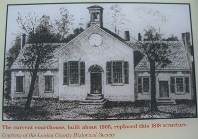
This image was on the previous iteration of this Civil War Trails marker and shows the Civil War-era building. Note the worn threshold in this illustration, immediately beneath the door, and compare it to the stone threshold shown in the previous image.
Related marker. Click here for another marker that is related to this marker. This marker has replaced the linked marker in the same location.
Also see . . .
1. American Battlefield Trust - Trevilian Station. An authoritative source for information on the battle and battlefield preservation. (Submitted on August 15, 2026, by Evan Dwyer of Richmond, Virginia.)
2. Trevilian Station Battlefield Foundation. The TSBF has worked to preserve core areas of the Trevilian Station Battlefield, including the C.G. Trevilian House, which is open for tours seasonally, and a replica of the Netherland Tavern where an annual dinner is hosted. The website includes information about the battle, their efforts, and the Trevilian Station Driving Tour, as well as how to find information about hiking and horseback trails through the battlefield. (Submitted on August 15, 2026, by Evan Dwyer of Richmond, Virginia.)
3. Battle of Trevilian Station Virtual Tour by Markers.
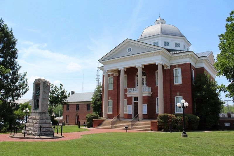
Photographed by Evan Dwyer, June 11, 2026
5. 'Modern' Louisa Court House
The 1905-6 Courthouse. The Confederate memorial at left was erected in 1905. The Jail left of the Courthouse was built in 1868. The clerk's office, just to the right of the Courthouse and largely obscured by bushes, was originally constructed in 1830 (though doubled by an addition in 1895) and is the only remaining structure from the antebellum Courthouse complex.
Credits. This page was last revised on August 15, 2026. It was originally submitted on August 15, 2026, by Evan Dwyer of Richmond, Virginia. This page has been viewed 352 times since then. Photos: 1, 2, 3. submitted on August 15, 2026, by Evan Dwyer of Richmond, Virginia. 4. submitted on January 19, 2008, by Craig Swain of Leesburg, Virginia. 5. submitted on August 15, 2026, by Evan Dwyer of Richmond, Virginia.
