Butte in Silver Bow County, Montana — The American West (Mountains)
Chasing the Minerals
Photographed by Cosmos Mariner, July 6, 2024
1. Chasing the Minerals Marker
The Boulder Batholith
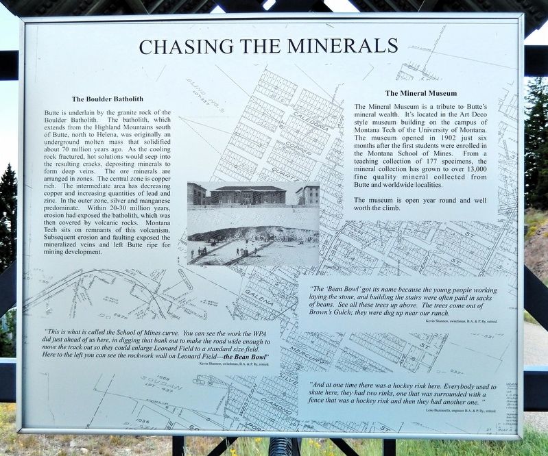
Butte is underlain by the granite rock of the Boulder Batholith. The batholith, which extends from the Highland Mountains south of Butte, north to Helena, was originally an underground molten mass that solidified about 70 million years ago. As the cooling rock fractured, hot solutions would seep into the resulting cracks, depositing minerals to form deep veins. The ore minerals are arranged in zones. The central zone is copper rich. The intermediate area has decreasing copper and increasing quantities of lead and zinc. In the outer zone, silver and manganese predominate. Within 20-30 million years, erosion had exposed the batholith, which was then covered by volcanic rocks. Montana Tech sits on remnants of this volcanism. Subsequent erosion and faulting exposed the mineralized veins and left Butte ripe for mining development.
The Mineral Museum
The Mineral Museum is a tribute to Butte's mineral wealth. It's located in the Art Deco style museum building on the campus of Montana Tech of the University of Montana. The museum opened in 1902 just six months after the first students were enrolled in the Montana
this page online
The museum is open year round and well worth the climb.
“This is what is called the School of Mines curve. You can see the work the WPA did just ahead of us here, in digging that bank out to make the road wide enough to move the track out so they could enlarge Leonard Field to a standard size field. Here to the left you can see the rockwork wall on Leonard Field — the Bean Bowl”
—Kevin Shannon, switchman B.A. & P. Ry., retired.
“The ‘Bean Bowl’ got its name because the young people working laying the stone, and building the stairs were often paid in sacks of beans. See all these trees up above. The trees come out of Brown's Gulch; they were dug up near our ranch.”
—Kevin Shannon, switchman B.A. & P. Ry., retired.
“And at one time there was a hockey rink here. Everybody used to skate here, they had two rinks, one that was surrounded with a fence that was a hockey rink and then they had another one.”
—Leno Bazzanella, engineer B.A. & P. Ry., retired.
Erected by Montana's
Photographed by Cosmos Mariner, July 6, 2024
2. Chasing the Minerals Marker
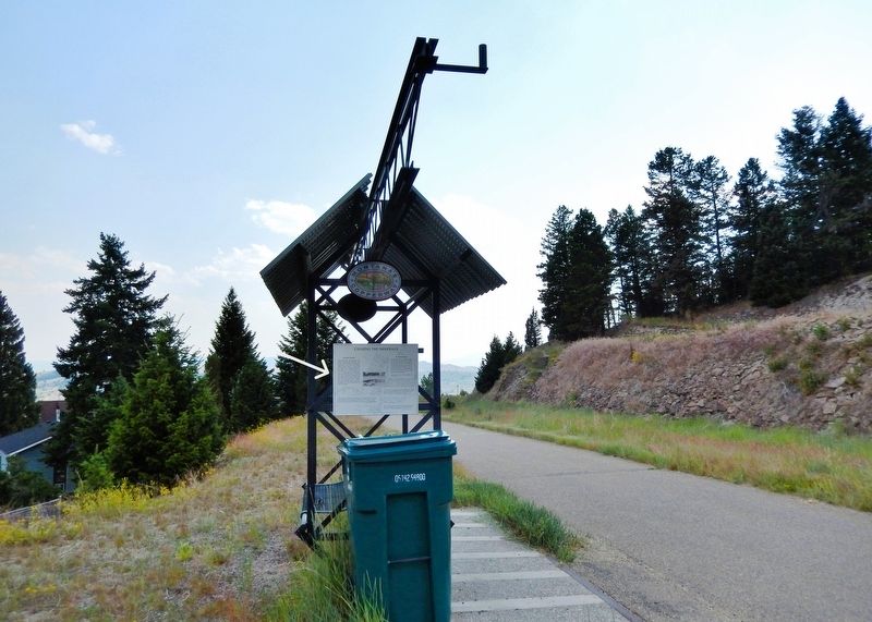
Looking southwest along the Butte, Anaconda & Pacific (BA&P) Hill Trail. The marker is mounted on the north side frame of a shaded park bench.
Topics and series. This historical marker is listed in these topic lists: Education • Natural Resources • Science & Medicine. In addition, it is included in the Works Progress Administration (WPA) projects series list. A significant historical year for this entry is 1902.
Location. 46° 0.642′ N, 112° 33.345′ W. Marker is in Butte, Montana, in Silver Bow County. It can be reached from the intersection of West Park Street and North Western Avenue, on the left when traveling west. The marker is on the Butte, Anaconda & Pacific (BA&P) Hill Trail, about 185 meters south of West Park Street. Touch for map. Marker is in this post office area: Butte MT 59701, United States of America. Touch for directions.

Regionally, this marker is in andspecifically outhwest Montana, in Gold West Country, in Mining Country. It is also in the American Mountain West and in the Lewis & Clark Corridor. Globally, it is in North America, the Rocky Mountains, the Western Hemisphere, the Western World, and the Anglosphere. Historically, it finds itself in what was once Rupert’s Land and also the Louisiana Purchase.
Other nearby markers. At
Photographed by Cosmos Mariner, July 6, 2024
3. School of Mines Curve and Leonard Field (a.k.a., the “Bean Bowl”)
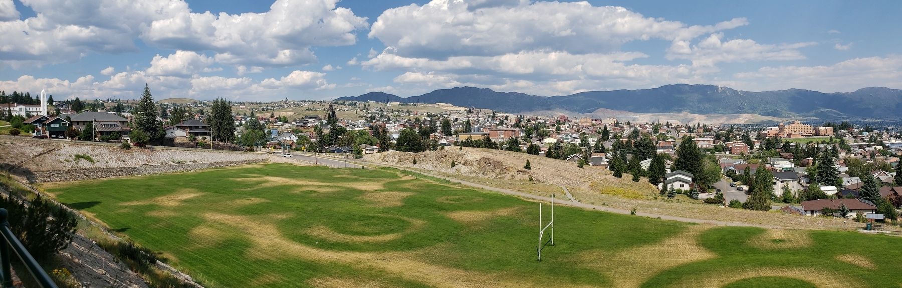
Looking northeast across Leonard Field from atop the hill. The Butte, Anaconda & Pacific (BA&P) Hill Trail borders the far side of the field from left to right (north to south). You can see the work the WPA did digging the bank (center – far edge of field) out to make room for the track so they could enlarge Leonard Field to standard size.
The historical marker is mounted on the north (left) side of the shaded park bench visible at the bottom right.
Related markers. Click here for a list of markers that are related to this marker.
Also see . . . Landscaping at Montana Tech University (Living New Deal).
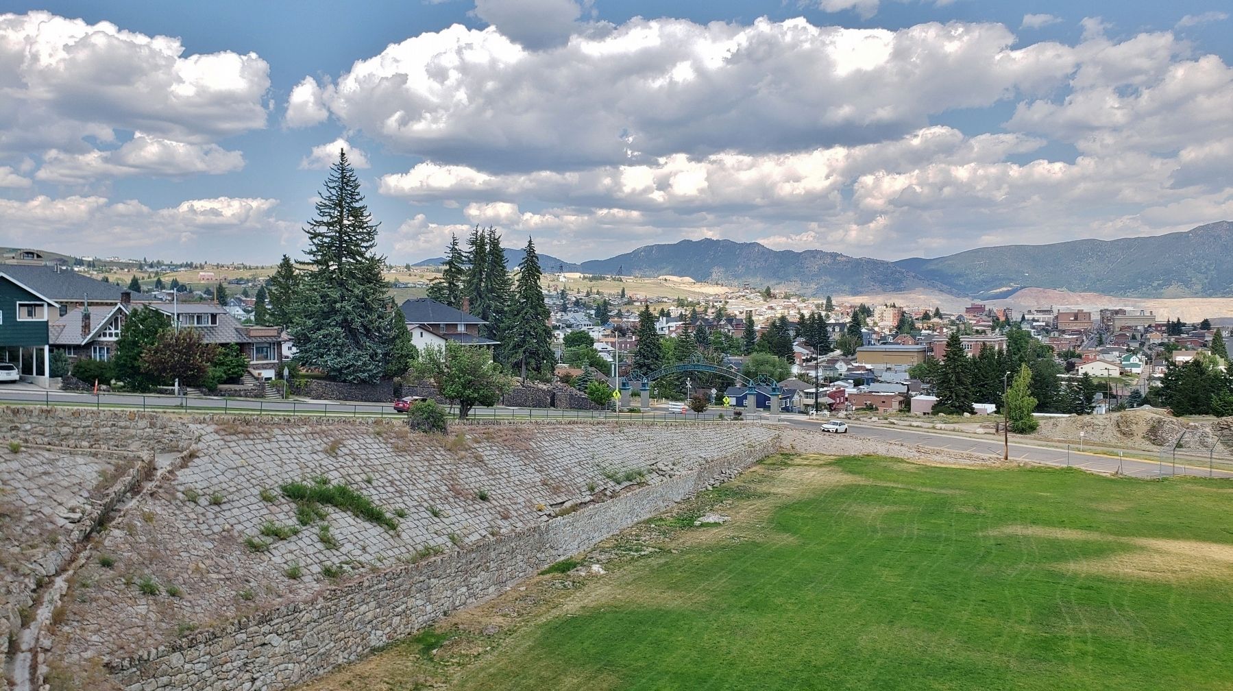
Excerpt: Montana’s Big Timber Pioneer newspaper reported in 1938 that 40 WPA laborers were “doing a $40,000 job of tree painting, landscaping, road oiling, leveling and general beautification” at what was then known as the Montana [State] School of Mines, now Montana Tech of the University of Montana. Most evidence of such renovations is long gone, but one rock wall we observed looks(Submitted on August 16, 2026, by Cosmos Mariner of Cape Canaveral, Florida.)suspiciously like WPA work. WPA employment was vital to the welfare of unemployed miners around Butte, Montana during the Great Depression.Photographed by Cosmos Mariner, July 6, 20244. Leonard Field Retaining WallsLooking east across the north end of Leonard Field. There are substantial stone retaining walls around the north and west sides of Leonard Field that look like W.P.A. handiwork.
Credits. This page was last revised on August 17, 2026. It was originally submitted on August 16, 2026, by Cosmos Mariner of Cape Canaveral, Florida. This page has been viewed 19 times since then. Photos: 1, 2, 3. submitted on August 16, 2026, by Cosmos Mariner of Cape Canaveral, Florida. 4. submitted on August 17, 2026, by Cosmos Mariner of Cape Canaveral, Florida.
