Lakewood in New Orleans in Orleans Parish, Louisiana — The American South (West South Central)
Metairie Cemetery
Photographed by Cajun Scrambler, September 10, 2010
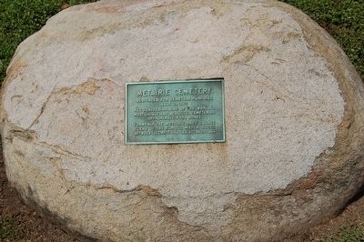
1. Metairie Cemetery Marker
July 2, 1872
Recognized as one of the world's
most unique and beautiful cemeteries
Approximately 150 acres
Formerly the Metairie Race Course
Scene of the famous match races
between LeCompte and Lexington in 1854
Topics. This historical marker is listed in these topic lists: Cemeteries & Burial Sites • Sports. A significant historical month for this entry is July 1949.
Location. 29° 59.047′ N, 90° 6.936′ W. Marker is in New Orleans, Louisiana, in Orleans Parish. It is in Lakewood. It can be reached from Pontchartrain Boulevard 0.2 miles north of Metarie Road (Louisiana Highway 611-9), on the left when traveling north. Touch for map. Marker is at or near this postal address: 5100 Pontchartrain Blvd, New Orleans LA 70124, United States of America. Touch for directions.

Regionally, this marker is in one of the River Parishes. It is also in the American South, specifically in the Deep South, on the Gulf Coast, and in the Great River Road Region. Globally, it is in North America, a Gulf of Mexico state, the Western Hemisphere, the Western World, and the Anglosphere. Historically,
this page online
Other nearby markers. At least 8 other markers are within walking distance of this marker: A different marker also named Metairie Cemetery (about 400 feet away, measured in a direct line); William Charles Cole Claiborne (approx. 0.2 miles away); General John Bell Hood, CSA (approx. 0.3 miles away); Charity Hospital Cemetery (approx. 0.4 miles away); The New Orleans Katrina Memorial (approx. 0.4 miles away); Holt Cemetery (approx. half a mile away); a different marker also named Holt Cemetery (approx. half a mile away); a different marker also named Holt Cemetery (approx. 0.6 miles away). Touch for a list and map of all markers in New Orleans.
Additional commentary.
1.
Metairie Cemetery is the burial place of baseball Hall-of-Famer Mel Ott.
— Submitted August 23, 2026, by Carl Gordon Moore Jr. of North East, Maryland.
Photographed by Cajun Scrambler, September 10, 2010
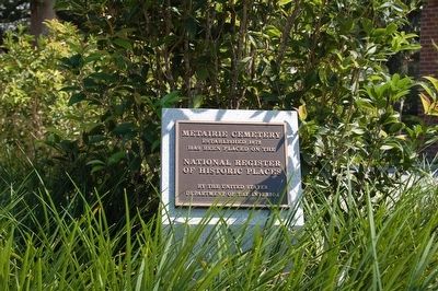
2. Metairie Cemetery NRHP Marker
Photographed by Cajun Scrambler, September 10, 2010
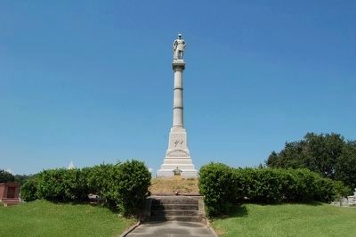
3. Metairie Cemetery Northern VA Monument
...The Army of Northern Virginia, Louisiana Division, Benevolent Association, built a tumulus in the eastern curve of the race track’s infield interior. Atop the tumulus stands a 38 foot column, upon which is a statue of Lieutenant General Thomas “Stonewall” Jackson. The tumulus was dedicated on May 10, 1881. When former Confederate President Jefferson Davis died while visiting New Orleans on December 6, 1889, he was buried in one of the front vaults of this tumulus. (Davis’ remains were transferred to a permanent burial place in Richmond, VA in 1893.) …- GONOLA
Photographed by Cajun Scrambler, September 10, 2010
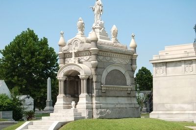
4. Metairie Cemetery
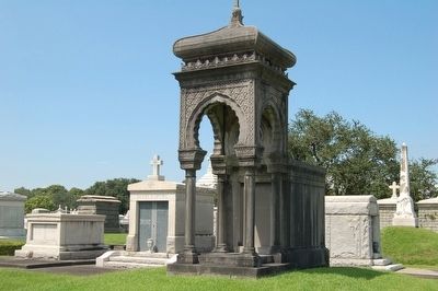
September 10, 2010
5. Metairie Cemetery
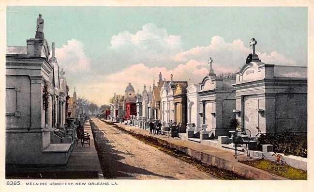
Postcard by the Detroit Photographic Co., 1908
6. Metairie Cemetery, New Orleans, La.
September 10, 2010
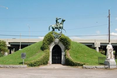
7. Army of Tennessee Tumulus
Army of Tennessee Tumulus. Sculptor Alexander Doyle made the equestrian statue.
Photographed by Cajun Scrambler, January 28, 2011
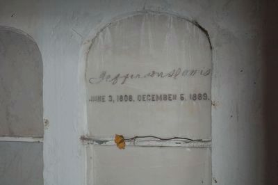
8. Former Jefferson Davis burial site.
Former Jefferson Davis resting place located inside the Army of Northern Virginia tumulus. Can be accessed from side opposite the statue faces.
Credits. This page was last revised on September 13, 2026. It was originally submitted on August 16, 2015. This page has been viewed 1,752 times since then and 135 times this year. Last updated on August 16, 2026. Photos: 1, 2, 3. submitted on August 16, 2015. 4. submitted on August 16, 2015, by Cajun Scrambler of Assumption, Louisiana. 5. submitted on August 16, 2015. 6. submitted on August 18, 2015. 7, 8. submitted on March 27, 2016. • Devry Becker Jones was the editor who published this page.
