Near Affton in St. Louis County, Missouri — The American Midwest (Upper Plains)
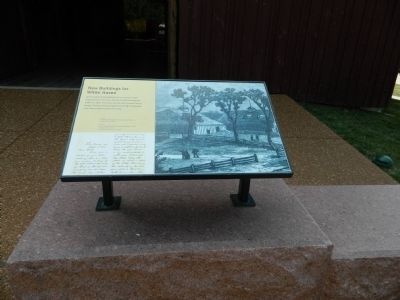
New Buildings for White Haven
Photographed by Beverly Pfingsten, June 14, 2012
1. New Buildings for White Haven Marker
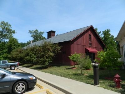
Grant's plans for developing the farm resulted in many improvements, including a barn and stable built between 1869 and 1872. The stable you see today housed Grant's horses. The barn that also appears in the 1875 illustration of the farm sheltered cattle and sheep.
[Caption:]
Letter from Grant to his caretaker, William Elrod September 4, 1871.
Topics and series. This historical marker is listed in these topic lists: Agriculture • Animals. In addition, it is included in the Former U.S. Presidents: #18 Ulysses S. Grant series list. A significant historical date for this entry is September 4, 1864.
Location. 38° 33.08′ N, 90° 21.136′ W. Marker is near Affton, Missouri, in St. Louis County. It can be reached from Grant Road west of Gravois Road (Missouri Highway 30), on the right when traveling west. Touch for map. Marker is at or near this postal address: 7400 Grant Road, Saint Louis MO 63123, United States of America. Touch for directions.

Regionally, this marker is in Greater St. Louis. It is also in the American Midwest, in the Lewis & Clark Corridor, in the Corn Belt, and in the Great River Road Region. Globally, it
this page online
Other nearby markers. At least 8 other markers are within walking distance of this marker: Grant's Departure / ~150 Years Ago (here, next to this marker); Changes at White Haven / ~150 Years Ago - Grants Horses (here, next to this marker); Working Plantation / ~150 Years Ago - Emancipation (within shouting distance of this marker); A Slave Plantation (within shouting distance of this marker); White Haven (within shouting distance of this marker); On "Grant's Trail" Through History (within shouting distance of this marker); Early Owners of the Farm (about 300 feet away, measured in a direct line); A Place Called Home / ~150 Years Ago—Petersburg (about 300 feet away). Touch for a list and map of all markers in Affton.
Photographed by Beverly Pfingsten, June 14, 2012
2. Horse Barn
Credits. This page was last revised on August 17, 2026. It was originally submitted on September 3, 2012, by Bill Pfingsten of Bel Air, Maryland. This page has been viewed 552 times since then and 44 times this year. Last updated on August 16, 2026, by Garrett Koch of Saint Louis, Missouri. Photos: 1, 2. submitted on September 3, 2012, by Bill Pfingsten of Bel Air, Maryland. • Devry Becker Jones was the editor who published this page.
