Chattanooga in Hamilton County, Tennessee — The American South (East South Central)
Claude Ramsey Parkway
Photographed by Darren Jefferson Clay, June 7, 2026
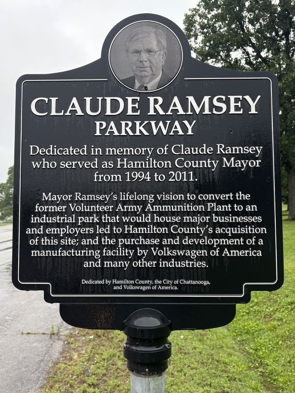
1. Claude Ramsey Parkway Marker
Dedicated in memory of Claude Ramsey who served as Hamilton County Mayor from 1994 to 2011.
Mayor Ramsey's lifelong vision to convert the former Volunteer Army Ammunition Plant to an industrial park that would house major businesses and employees led to Hamilton County's acquisition of this site; and the purchase and development of a manufacturing facility by Volkswagen of America and many other industries.
Topics. This historical marker is listed in this topic list: Industry & Commerce. A significant historical year for this entry is 1994.
Location. 35° 4.324′ N, 85° 9.37′ W. Marker is in Chattanooga, Tennessee, in Hamilton County. It is at the intersection of Claude Ramsey Parkway and Bonny Oaks Drive (Tennessee Highway 317), on the right when traveling north on Claude Ramsey Parkway. Touch for map. Marker is in this post office area: Chattanooga TN 37421, United States of America. Touch for directions.

Regionally, this marker is in the American South, specifically in the Upper South, in Appalachia, and specifically in Southern Appalachia. Globally, it is in North America, the Western Hemisphere, the Western World,
this page online
Other nearby markers. At least 8 other markers are within 3 miles of this marker, measured as the crow flies: Booker T. Washington School (approx. 1½ miles away); Bonny Oaks School (approx. 1½ miles away); Silverdale Confederate Cemetery (approx. 1½ miles away); N.B. Forrest Camp U.C.V and U.D.C. Chapters (approx. 1½ miles away); Bonny Oaks (approx. 1½ miles away); Order of the Southern Cross (approx. 1.6 miles away); Harrison Academy (approx. 2.8 miles away); Cast Down Your Buckets (approx. 2.8 miles away). Touch for a list and map of all markers in Chattanooga.
Other markers no longer nearby. Cleburne's Fort (was approx. ¼ mile away but has been confirmed missing); Confederate Cemetery (was approx. 1½ miles away but has been confirmed missing).
Photographed by Darren Jefferson Clay, June 7, 2026
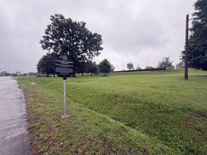
2. Claude Ramsey Parkway Marker
Credits. This page was last revised on August 20, 2026. It was originally submitted on August 16, 2026, by Darren Jefferson Clay of Duluth, Georgia. This page has been viewed 13 times since then. Photos: 1, 2. submitted on August 17, 2026, by Darren Jefferson Clay of Duluth, Georgia. • James Hulse was the editor who published this page.
