Cool district in Rotterdam, South Holland, Netherlands — Northwestern Europe
Coolsingelpoort
⎯⎯⎯
Coolsingel Gate

Photographed by Andrew Ruppenstein, March 21, 2024
1. Coolsingelpoort / Coolsingel Gate Marker

Na het bombardement in de meidagen van 1940 ging het overgrote deel van het ziekenhuis verloren. Tot 1980 was het westelijke deel van het ziekenhuis nog in gebruik om in 1983 definitief te worden afgebroken.
De poort en plataan, inmiddels opgenomen in de Lijnbaan, herinneren nog aan deze historie.
This gate served as the western rear entrance to the Coolsingel Hospital. The hospital opened in 1851 based on a design by W.N. Rose and was expanded in 1888 with pavilions designed by G.J. de Jongh. The gate was located on what was then Crispijnlaan.
Following the bombing in May 1940, the vast majority of the hospital was destroyed. The western section of the hospital remained in use until 1980 before being finally demolished in 1983.
The gate and the plane tree—now incorporated into the Lijnbaan—serve as reminders of this history.
Topics. This historical marker is listed in this topic list: Science & Medicine. A significant historical year for this entry is 1851.
Location. 51° 55.152′ N, 4° 28.663′ E. Marker is in Rotterdam, Zuid-Holland (South Holland). It is in Cool district. It is on Lijnbaan south of Aert van Nesstraat, on the right when traveling south. Touch for map. Marker is at or near this postal address: Lijnbaan 101, Rotterdam, Zuid-Holland 3012 ER, Netherlands. Touch for directions.

Regionally, it is in Europe, the European Union, Atlantic Europe, the Benelux Low Countries, the Schengen Area, Western Europe, and the Western World. Historically, it finds itself in
this page online
Other nearby markers. At least 8 other markers are within walking distance of this marker: Monument Voor Joodse Oorlogslachtoffers / Jewish War Victims Memorial (approx. 0.4 kilometers away); Verzetskruis Herdenkingsmonument / Resistance Cross Memorial (approx. half a kilometer away); Helmersstraat (approx. half a kilometer away); Wijkpark / Neighborhood Park - de Reus van Rotterdam / the Giant of Rotterdam (approx. half a kilometer away); International Congregational Council (approx. 0.6 kilometers away); Waalse kerk / Eglise Wallonne / Walloon Church (approx. 0.6 kilometers away); Gouvernestraat (approx. 0.6 kilometers away); Nieuwe Delftse Poort / New Delft Gate (approx. 0.6 kilometers away). Touch for a list and map of all markers in Rotterdam.
Also see . . . Coolsingelziekenhuis (Wikipedia, in Dutch). Excerpt on the destruction and remembrance of the hospital (in translation):
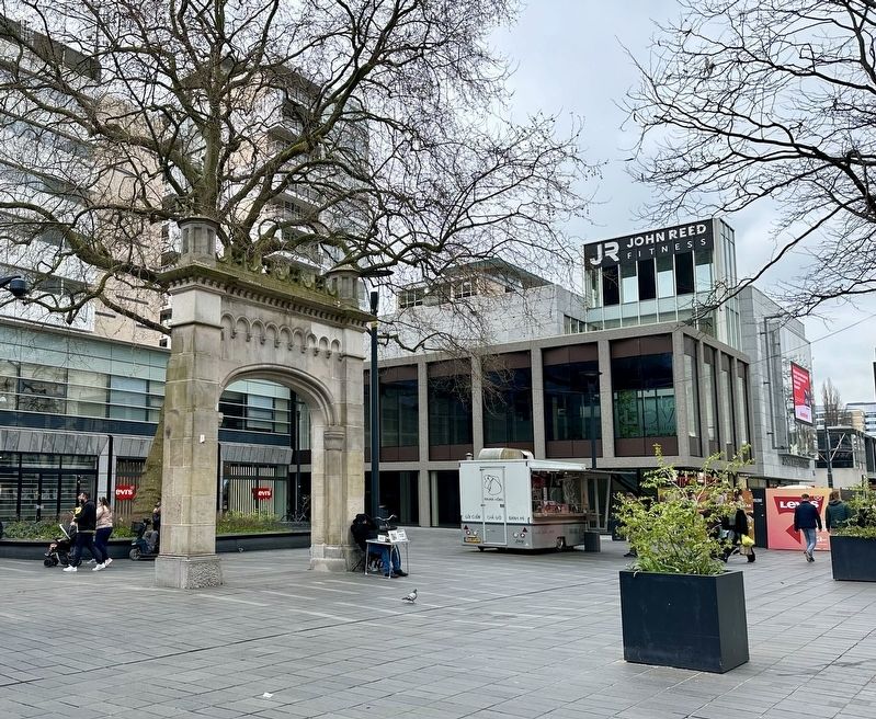
During the 1940 bombing of Rotterdam, the hospital was severely damaged, despite a large red cross painted on its roof. Patients were evacuated only just in time. Only(Submitted on August 18, 2026.)the outer walls remained standing, along with the entrance gate at the rear of the building, facing what was then Crispijnlaan. Several pavilions survived the war and remained in use until December 1960.Photographed by Andrew Ruppenstein, March 21, 20242. Coolsingelpoort / Coolsingel Gate and markerView of the east side of the gate. The marker is set in the pavement in front of the gate and is not really visible from any distance.
In 1941, construction began on the Rotterdamsche Bank building on the site where the hospital's main building had stood; the bank was completed in 1948. Work on the Lijnbaan began in 1949; upon its opening in 1953, the street still ended abruptly against a blank wall belonging to the remains of the hospital. It was not until the 1960s—after the Dijkzigt hospital had taken over the role of the Coolsingel Hospital—that the Lijnbaan was extended as far as Binnenwegplein. The Coolsingel Gate was rebuilt on Lijnbaanplein, rotated 180 degrees from its original orientation. The adjacent plane tree also dates back to the pre-war era. Together, they form the only tangible reminder of the Coolsingel Hospital.
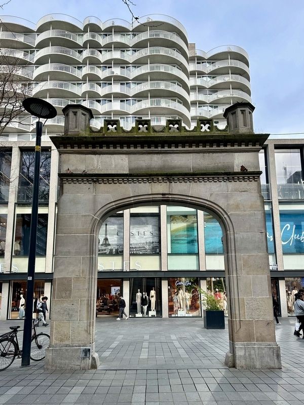
In 2006, plans were proposed to donate the gate to the Erasmus Medical Center so it could be placed near the new hospital complex. The Roterodamum Historical Society successfully persuaded local politicians to block this move, ensuringthat the memory of the Coolsingel Hospital would be preserved.Photographed by Andrew Ruppenstein, March 21, 20243. Coolsingelpoort / Coolsingel Gate and markerView of the west side of the gate

Detroit Publishing Company (courtesy Library of Congress), circa 1905
4. Rotterdam Coolsingel Hospital
Credits. This page was last revised on August 18, 2026. It was originally submitted on August 17, 2026, by Andrew Ruppenstein of Lamorinda, California. This page has been viewed 10 times since then. Photos: 1. submitted on August 17, 2026, by Andrew Ruppenstein of Lamorinda, California. 2, 3, 4. submitted on August 18, 2026, by Andrew Ruppenstein of Lamorinda, California.
