
Menai Bridge in Isle of Anglesey, Wales, United Kingdom — Northwestern Europe (the British Isles)
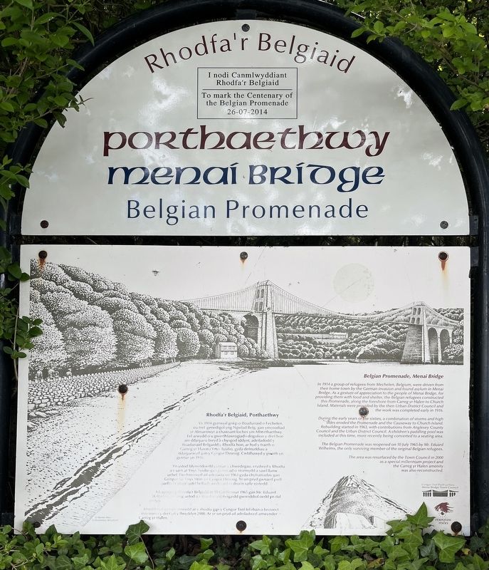
Porthaethwy Menai Bridge
Belgian Promenade
⎯⎯⎯
Rhodfa’r Belgiaid
Photographed by Ray Gurganus, May 15, 2026
1. Porthaethwy Menai Bridge Marker
During the early years of the sixties a combination of storms and high tides eroded the promenade and the Causeway to Church Island. Rebuilding started in 1963 with contributions from Anglesey County Council and the Urban District Council. A children's padding pool was included at this time, more recently being converted to a seating area.
The Belgian Promenade was reopened on 10 July 1965 by Mr. Eduard Wilhelms, the only surviving member of the original Belgian refugees.
The area was resurfaced by the Town Council in 2000 as a special millennium project and the Carreg yr Halen amenity was also reconstructed.
(Welsh text not transcribed)
Erected by Menai Bridge Town Council.
this page online
Topics. This historical marker is listed in these topic lists: Bridges & Viaducts • Parks & Recreational Areas. A significant historical date for this entry is July 10, 1914.
Location. 53° 13.354′ N, 4° 10.12′ W. Marker is in Menai Bridge, Wales, in Isle of Anglesey. It can be reached from Beach Road. Touch for map. Marker is at or near this postal address: 11 Beach Road, Menai Bridge, Wales LL59 5HD, United Kingdom. Touch for directions.

Regionally, this marker is in North Wales. Globally, it is on the Atlantic Ocean, in the North Atlantic Region, on the Atlantic Arc, in Europe, on the Celtic Fringe, in Atlantic Europe, on one of the British Isles, in the Western World, and in the Anglosphere. Historically, it finds itself in what was once the Roman Empire.
Other nearby markers. At least 2 other markers are within 3 kilometers of this marker, measured as the crow flies: Church Island (about 150 meters away, measured in a direct line); Bangor Timeline - every step tells a story... (approx. 2.8 kilometers away).
Photographed by Ray Gurganus, May 15, 2026
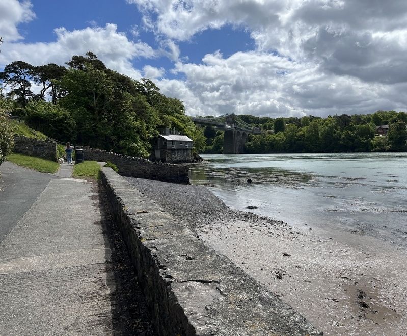
2. Belgian Promenade, with the Menai Bridge in the distance
Credits. This page was last revised on August 28, 2026. It was originally submitted on August 18, 2026, by Ray Gurganus of Washington, District of Columbia. This page has been viewed 7 times since then. Photos: 1, 2. submitted on August 18, 2026, by Ray Gurganus of Washington, District of Columbia. • Andrew Ruppenstein was the editor who published this page.
