Lucan in Lucan Biddulph in Middlesex County, Ontario — Central Canada (North America)
St. James Anglican Church & Cemetery

Photographed by Tim Boyd, August 14, 2026
1. St. James Anglican Church & Cemetery Marker
Many burials occurred in the 1840s with the earliest tombstone in existence being that of Wm. Ward Jan. 12, 1841.
By 1850, after parishioners had petitioned for a new church to be established, a frame church was erected on the glebe. This 12 acre plot of land set aside for church property was granted by the Canada Company at the request of Col. James Hodgins. The nearby frame rectory was built in 1861 with Rev. Stearne Tighe as the first resident rector. In 1857, St. James joined the newly-formed Diocese of Huron.
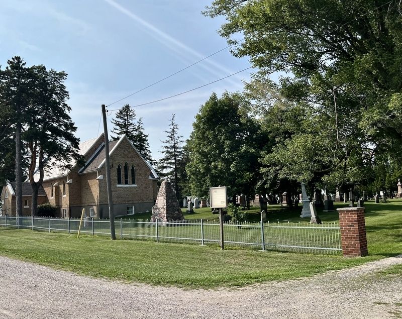
The present brick church replaced the frame building in about 1872.
In 1890, St. James separated from Holy Trinity Church in Lucan, joining St. Thomas in Granton and Trinity Church in Prospect Hill as a new parish. This union dissolved after a few years and St. James rejoined Holy Trinity.
Earlier, a new brick rectory had
this page online
In 1924 a new set of stained glass windows were dedicated to the memory of previous ministers.
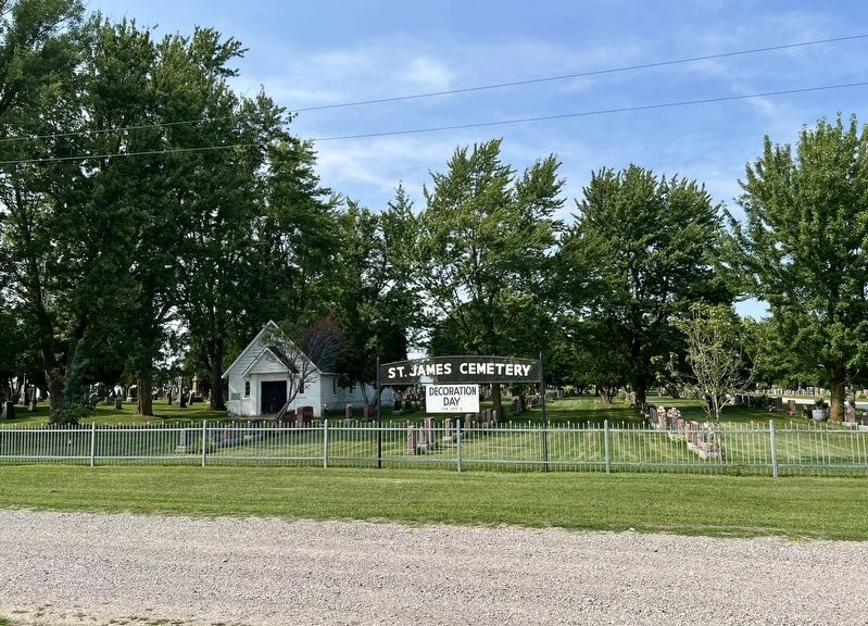
The mausoleum, built in 1926 and now incorporated into the chapel, was dedicated in 1958. In 1959, a bell-less belfry was replaced by a new turret with a cross. A new chimney was built and exterior walls were repainted. The entire interior was also redecorated.
Services in the summer of 1965 were held in the chapel while the church underwent major decorations, including floors and the joining of seats to form a centre aisle.
In 1999 the red paint was removed and the exterior was restored to its original state.
The iron fence at the front of the property was donated in 1924 by Hon. Ray Lawson, former Lieut. Governor of Ontario. This fence was replaced in 2002 by members of the congregation of St. James.
Erected by Middlesex County. (Marker Number 9.)
Topics. This historical marker is listed in these topic lists: Cemeteries & Burial Sites • Religion & Religious Structures. A significant historical date for this entry is January 12, 1841.
Location. 43° 11.976′ N,
Photographed by Tim Boyd, August 14, 2026
2. St. James Anglican Church & Cemetery Marker

Regionally, this marker is in the Southwest Ontario Area and in Southwestern Ontario. It is also in Central Canada. Globally, it is in North America, the Western Hemisphere, the Western World, and the Anglosphere. Historically, it finds itself in what was once a British colony, the Viceroyalty of New France, the Haudenosaunee (Iroquois) Confederacy, and Rupert’s Land.
Other nearby markers. At least 8 other markers are within 3 kilometers of this marker, measured as the crow flies: Lieut-Col. James Hodgins (a few steps from this marker); Sauble Hill - Wilberforce Cemetery (approx. 0.7 kilometers away); Lewis or Grundy Corners (approx. 2.5 kilometers away); The Wilberforce Settlement / L’Établissement Wilberforce (approx. 2.8 kilometers

Photographed by Tim Boyd, August 14, 2026
3. St. James Anglican Church in 2026
Photographed by Tim Boyd, August 14, 2026
4. St. James Cemetery
Credits. This page was last revised on August 18, 2026. It was originally submitted on August 18, 2026, by Tim Boyd of Hamilton, Ontario. This page has been viewed 16 times since then. Photos: 1, 2, 3, 4. submitted on August 18, 2026, by Tim Boyd of Hamilton, Ontario. • Andrew Ruppenstein was the editor who published this page.
