Menai Bridge in Isle of Anglesey, Wales, United Kingdom — Northwestern Europe (the British Isles)
Church Island
Ynys Tysilio

Photographed by Ray Gurganus, May 15, 2026
1. Church Island Marker
Tysilio's Church
St Tysilio was the son of a Welsh king in mid-Wales. He became a monk and reputedly built the first church here in 637, as you can see above the door. The present building dates from the 13th century. Regular services are held in the church during the summer and occasionally during the winter. It is a popular venue for weddings and baptisms. The church is usually open to visitors between April and October.
The earliest gravestones on the island are near the church. They date from the 18th century. There are some older of the four of the church. To the left of this board you will find a path leading up to the War Memorial on the top of the rock. To the right of this path you can find the newer part of the graveyard, where you an also see the bier house where the grave diggery tools use to be kept. There was a cottage on that spot until the 1920s.
You
this page online
Nearby Ynys Welltog is home to a colony of grey heron. In the main channel of the Strait at low water look out for cormorant and shag. In summer you can see terns from Africa over the water. In winner Church bland is visited by finches and thrushes.
You find salt-tolerant plants such as samphire below the high-water mark on the seashore and the mud fats behind you. In the graveyard
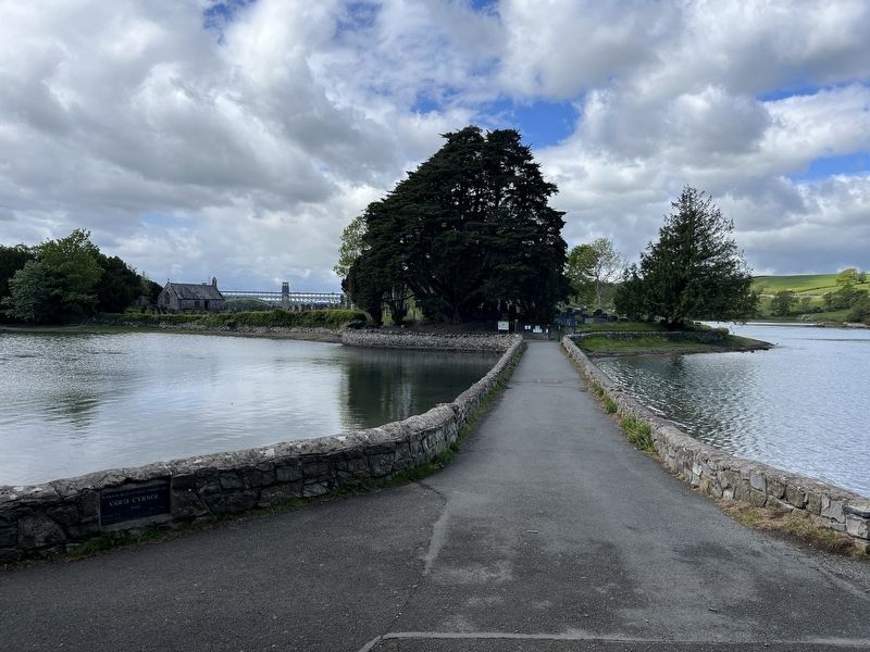
Photographed by Ray Gurganus, May 15, 2026
2. Causeway and Church Island
The gravestones on Church Island are mainly made of slate from the quarries of Snowdonia. One of the greatest Welsh poets of the 20th century, Cynan is buried by the perimeter path to your right. For information about Cynan and others who are buried on the island, use the QR code below.
(Welsh text not transcribed)
Topics. This historical marker is listed in these topic lists: Cemeteries & Burial Sites • Religion & Religious Structures. A significant historical year for this entry is 637 CE.
Location. 53° 13.391′ N, 4° 10.242′ W. Marker is in Menai Bridge, Wales, in Isle of Anglesey. It can be reached from Beach Road. Touch for map. Marker is at or near this postal address: 11 Beach Rd, Menai Bridge, Wales LL59 5EA, United Kingdom. Touch for directions.

Regionally, this marker is in North Wales. Globally, it is on the Atlantic Ocean, in the North Atlantic Region, on the Atlantic
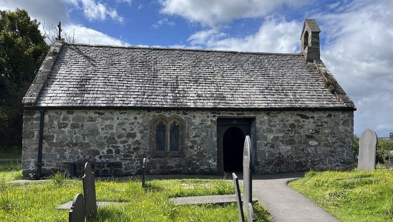
Photographed by Ray Gurganus, May 15, 2026
3. St Tysilio's Church
Other nearby markers. At least 2 other markers are within 3 kilometers of this marker, measured as the crow flies: Porthaethwy Menai Bridge (about 150 meters away, measured in a direct line); Bangor Timeline - every step tells a story... (approx. 2.9 kilometers away).

Photographed by John Valentine and Sons, circa 1905
4. Menai Straits and Church Island
Credits. This page was last revised on August 28, 2026. It was originally submitted on August 18, 2026, by Ray Gurganus of Washington, District of Columbia. This page has been viewed 12 times since then. Photos: 1, 2, 3. submitted on August 18, 2026, by Ray Gurganus of Washington, District of Columbia. 4. submitted on August 28, 2026. • Andrew Ruppenstein was the editor who published this page.
