South Loop in Chicago in Cook County, Illinois — The American Midwest (Great Lakes)
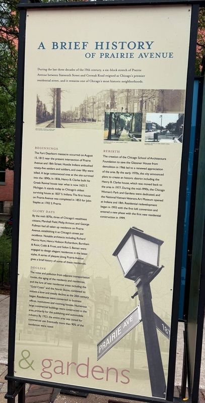
A Brief History of Prairie Avenue
Photographed by Sean P. Flynn, August 14, 2026
1. A Brief History of Prairie Avenue Marker
Beginnings
The Fort Dearborn massacre occurred on August 15, 1812 near the present intersection of Prairie Avenue and 18th Street. Hostile Indians ambushed ninety-five settlers and soldiers, and over fifty were killed. A large cottonwood tree at the site survived into the 1890s. In 1836, Henry B. Clarke built his Greek Revival house near what is now 1625 S. Michigan. It stands today as Chicago's oldest surviving house at 1827 S. Indiana. The first house on Prairie Avenue was completed in 1853 for John Staples at 1702 S. Prairie.
Glory Days
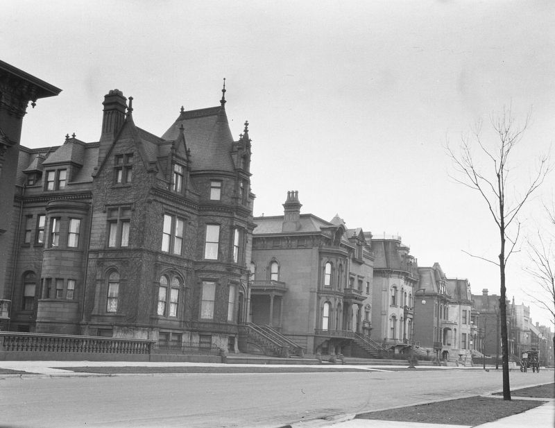
By the mid-1870s, three of Chicago's wealthiest citizens, Marshall Field, Philip Armour, and George Pullman had all taken up residence on Prairie Avenue, establishing it as Chicago's street par excellence. Notable architects including Richard Morris Hunt, Henry Hobson Richardson, Burnham & Root, Cobb & Frost, and Solon S. Beman were engaged to design elegant residences in the latest styles. A series of plaques along Prairie Avenue gives a brief history of some of these residences.
Decline
The noise and pollution from adjacent transportation routes, the aging of the residents and residences. and the lure of new residential areas including the "Gold Coast" and the North Shore, combined to initiate a slow and steady decline as the 20th century began. Residences were converted to business offices, institutions and rooming houses. Numerous large commercial buildings were constructed in the area, primarily for the publishing and automobile industry. By 1923, the entire area was zoned for commercial use. Eventually more than 90% of
this page online
Rebirth
The creation of the Chicago School of Architecture Foundation to save the Glessner House from demolition in 1966 led to a renewed appreciation of the area. By the early 1970s, the city announced plans to create an historic district including the Henry B. Clarke house, which was moved back to the area in 1977. During the mid-1990s, the Chicago Women's Park and Gardens were dedicated, and the National Vietnam Veterans Art Museum opened at Indiana and 18th. Residential redevelopment began in 1993 with the first loft conversion and entered a new phase with the first new residential construction in 1999.
Topics and series. This historical marker is listed in these topic lists: Architecture • Roads & Vehicles • Settlements & Settlers • War of 1812. In addition, it is included in the Chicago's Surviving Pre-Fire Structures series list. A significant historical date for this entry is August 15, 1812.
Location. 41° 51.469′ N, 87° 37.297′ W. Marker is in Chicago, Illinois, in Cook County. It is in South Loop. It is on East 18th Street west of South Prairie Avenue, on the right when traveling east. The marker
Photographed by Sean P. Flynn, August 14, 2026
2. Chicago Women's Park and Gardens Marker
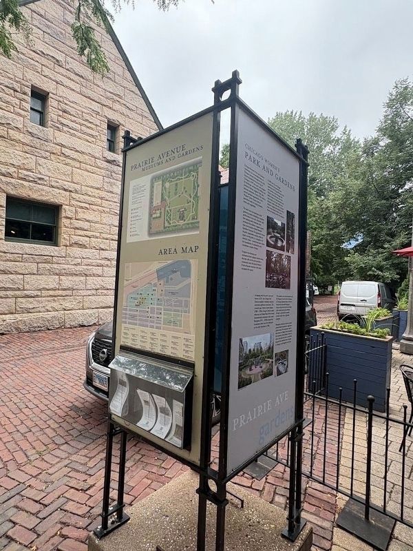
In the background on the left is the Glessner House, a National Historic Landmark, and to the right is the entrance to Chicago Women's Park. The Brief History of Prairie Avenue marker is on the rear side of this kiosk.

Regionally, this marker is on Chicago’s South Side. It is also in the American Midwest. Globally, it is in North America, on the Great Lakes, in the Western Hemisphere, in the Western World, and in the Anglosphere. Historically, it finds itself in what was once the Viceroyalty of New France, the territory of the Mississippian Culture, and the Northwest Territory.
Other nearby markers. At least 8 other markers are within walking distance of this marker: Chicago Women's Park and Gardens (here, next to this marker); Clarke House / Glessner House (here, next to this marker); Outside the District (within shouting distance of this marker); A Heritage Preserved (within shouting distance of this marker); John J. and Frances M. Glessner House (within shouting distance of this marker); Visionary (within shouting distance of this marker); Lost Houses of Prairie Avenue: 1600-1700 Blocks
Photographed by Sean P. Flynn, August 14, 2026
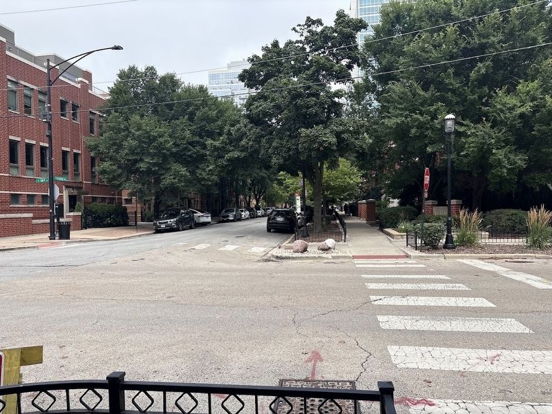
3. Prairie Avenue today, looking north from 18th Street
Another marker is no longer nearby. John J. Glessner House (was within shouting distance of this marker but has been replaced with another marker now near it).
More about this marker. As referenced on this marker, several other markers can be found on the fence into Chicago Women's Park along Prairie Avenue. There is also a Chicago Landmark plaque for the district at the corner of 18th and Prairie.
Charles R. Clark, photographer; courtesy of Chicago History Museum (ICHi-066015), circa 1905
4. Prairie Avenue residences north of 18th Street, 1905
Credits. This page was last revised on August 19, 2026. It was originally submitted on August 19, 2026, by Sean P. Flynn of Oak Park, Illinois. This page has been viewed 16 times since then. Photos: 1, 2, 3, 4. submitted on August 19, 2026, by Sean P. Flynn of Oak Park, Illinois.
