South Loop in Chicago in Cook County, Illinois — The American Midwest (Great Lakes)
Lost Houses of Prairie Avenue: 1800-1900 Blocks (West Side)

Photographed by Sean P. Flynn, August 14, 2026
1. Lost Houses of Prairie Avenue: 1800-1900 Blocks (West Side) Marker
Rand McNally & Company, 1893
1808 S. Prairie Avenue
Osborn R. Keith Residence. Built 1886; Cobb & Frost, architects The second of Keith's houses on the street, it was later owned by Stanley Field, long-time President of the Field Museum. The north wall was retained during demolition in 1968 to preserve the private courtyard of the adjacent Glessner house.
1812 S. Prairie Avenue
George H. Wheeler Residence. Built 1884; Burnham & Root, architects
A picturesque brick row house in the Dutch vernacular style built for George Wheeler, a grain elevator owner and later president of the Chicago City Railway Company. Razed 1968.
1824 S. Prairie Avenue
Samuel B. Pomeroy Residence. Built 1857; architect unknown
One of the earliest houses on the street, it received a fashionable new stone façade in the early 1880s, during the ownership of George B. Marsh. Razed in the 1940s.
1834 S. Prairie Avenue
Fernando Jones Residence. Built 1866; John M. Van Osdel, architect
Built
this page online
1912 S. Prairie Avenue
Byran P. Moulton Residence. Built 1882; architect unknown
This expansive Chateauesque style home became the residence of future Illinois governor Frank O. Lowden in 1898, and was later home to the widow of railroad magnate T. B. Blackstone. Razed 1939.
1936 S. Prairie Avenue
Daniel M. Thompson-Samuel W. Allerton Residence. Built 1870; Lavall B. Dixon, architect
The first $100,000 house on the South Side helped to establish the prominence of Prairie Avenue. Meatpacker Samuel Allerton married Thompson's daughter and took over ownership of the house in 1879. In 1915, it was razed and replaced by the Hump Hairpin Mfg. Co. factory.
Topics. This historical marker is listed in these topic lists: Architecture • Indigenous Peoples and Communities • Railroads & Streetcars • Settlements & Settlers. A significant historical year for this entry is 1857.
Location. 41° 51.431′ N, 87° 37.254′ W.
Photographed by Sean P. Flynn, August 14, 2026
2. Lost Houses of Prairie Avenue: 1800-1900 Blocks (West Side) Marker, on the right

Regionally, this marker is on Chicago’s South Side. It is also in the American Midwest. Globally, it is in North America, on the Great Lakes, in the Western Hemisphere, in the Western World, and in the Anglosphere. Historically, it finds itself in what was once the Viceroyalty of New France, the territory of the Mississippian Culture, and the Northwest Territory.
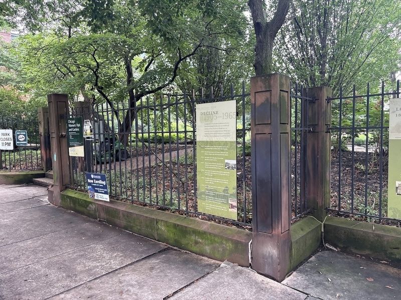
Other nearby markers. At least 8 other markers are within walking distance of this marker: Decline 1905-1965 (here, next to this marker); Lost Houses of Prairie Avenue: 2000-2100 Blocks (a few steps from this marker); Glory Days 1872-1904 (a few steps from this marker); Rebirth 1966-2004 (a few steps from this marker); Lost Houses of Prairie Avenue: 1800-1900 Blocks (East Side)

Photographed by Sean P. Flynn, August 14, 2026
3. Prairie Avenue Historic District
Chicago Women's Park and Gardens is in the distance, with several markers affixed to its Prairie Avenue fence.

Chicago Daily News collection, Chicago History Museum (DN-0064217), circa 1915
4. 1824 S. Prairie
According to the photo's caption from the Chicago History Museum, the building was home to the Risk Hotel in 1915. A rare Chicago survivor of the Fire of 1871, it was eventually torn down in the 1940s.

Photographed by Charles R. Clark; courtesy of Chicago History Museum (ICHi-071926), circa 1914
5. Allerton Residence at 1936 S. Prairie
The building was torn down about a year after this photo was taken and replaced by a manufacturing plant. A modern condo complex stands at the location today.
Credits. This page was last revised on August 19, 2026. It was originally submitted on August 19, 2026, by Sean P. Flynn of Oak Park, Illinois. This page has been viewed 18 times since then. Photos: 1, 2, 3, 4, 5. submitted on August 19, 2026, by Sean P. Flynn of Oak Park, Illinois.
