South Loop in Chicago in Cook County, Illinois — The American Midwest (Great Lakes)
Beginnings 1812-1871

Photographed by Sean P. Flynn, August 14, 2026
1. Beginnings (1812-1871) Marker
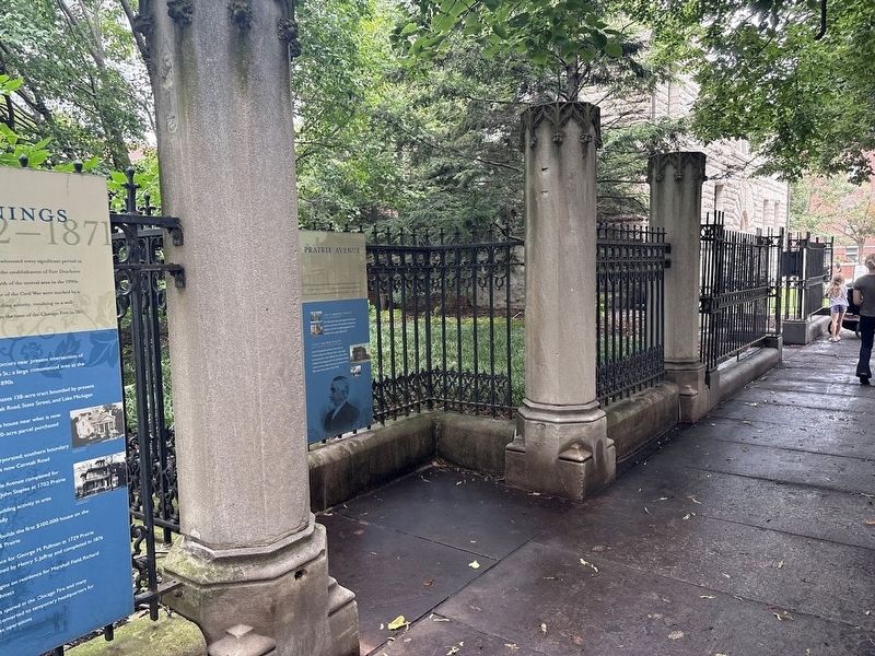
1812 Ft. Dearborn massacre occurs near present intersection of Prairie Avenue and 18th St.; a large cottonwood tree at the spot survives into the 1890s
1834 Elijah D. Harmon purchases 138-acre tract bounded by present day 16th Street, Cermak Road, State Street, and Lake Michigan
1836 Henry B. Clarke builds house near what is now 1625 S. Michigan on 20-acre parcel purchased from Harmon
1837 City of Chicago incorporated; southern boundary established at what is now Cermak Road
1853 First house on Prairie Avenue completed for brick manufacturer John Staples at 1702 Prairie
1865 End of Civil War; building activity in area increases dramatically
1870 Daniel Thompson builds the first $100,000 house on the South Side at 1936 Prairie
1870 Details of residence for George M. Pullman at 1729 Prairie announced; designed by Henry S. Jaffray and completed in 1876
1871 Construction begins on residence for Marshall Field; Richard Morris Hunt architect
1871 Prairie Avenue is spared in the Chicago Fire and many residences are converted to temporary headquarters for owner's business operations
Topics and series. This historical marker is listed in these topic lists: Notable Buildings • Settlements & Settlers • War of 1812 • War, US Civil. In addition, it is included in the Chicago's Surviving Pre-Fire Structures, the Historic Trees, and the The Great Chicago Fire of 1871 series lists. A significant historical year for this entry is 1812.
Location. 41° 51.45′ N,
this page online

Regionally, this marker is on Chicago’s South Side. It is also in the American Midwest. Globally, it is in North America, on the Great Lakes, in the Western Hemisphere, in the Western World, and in the Anglosphere. Historically, it finds itself in what was once the Viceroyalty of New France, the territory of the Mississippian Culture, and the Northwest Territory.
Other nearby markers. At least 8 other markers are within walking distance of this marker: Lost Houses of Prairie Avenue: 1600-1700 Blocks (here, next to this marker); A Heritage Preserved (a few steps from this marker); Lost Houses of Prairie Avenue: 1800-1900 Blocks (East Side) (a few steps from this marker); Outside the District
Photographed by Sean P. Flynn, August 14, 2026
2. Two markers at Chicago Women's Park: Beginnings 1812-1871 and Lost Houses of Prairie Avenue
The Glessner House, a National Historic Landmark, is in the background.
Another marker is no longer nearby. John J. Glessner House (was within shouting distance of this marker but has been replaced with another marker now near it).

Photographed by Sean P. Flynn, August 14, 2026
3. 1800 S. Prairie Avenue block
The Chicago Landmark plaque for the Prairie Avenue District is in the foreground. Several markers about the history of this district are affixed to the fence in the rear.
Courtesy of Chicago History Museum (ICHi-038227)
4. 1729 S. Prairie
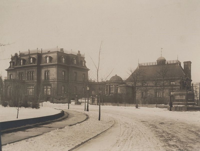
The photo shows the George Pullman house and, on the far right, the memorial to the 1812 Fort Dearborn Massacre, which Pullman erected near the presumed site where it happened. That memorial was moved in 1931 to the lobby of the Chicago Historical Society, where it sat for more than 50 years. When the Prairie Avenue District was revitalized in the 1990s, it was moved back to close to its original spot for a few years, until it was removed by the city's Office of Public Art and placed in storage.
Credits. This page was last revised on August 19, 2026. It was originally submitted on August 19, 2026, by Sean P. Flynn of Oak Park, Illinois. This page has been viewed 18 times since then. Photos: 1, 2, 3, 4. submitted on August 19, 2026, by Sean P. Flynn of Oak Park, Illinois.
