Allouez in Brown County, Wisconsin — The American Midwest (Great Lakes)
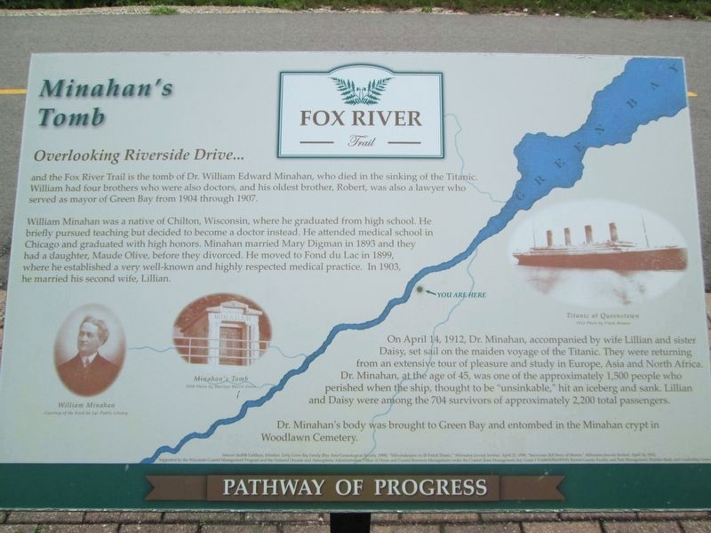
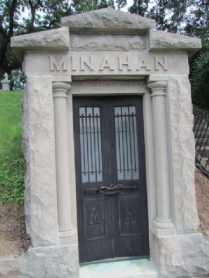
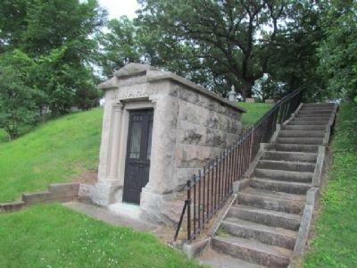
Minahan's Tomb
Overlooking Riverside Drive…
| — | Fox River Trail | — |
Photographed by Jim Schaettle, August 12, 2026
1. Minahan's Tomb Marker
and the Fox River Trail is the tomb of Dr. William Edward Minahan, who died in the sinking of the Titanic. William had four brothers who were also doctors, and his oldest brother, Robert, was also a lawyer who served as mayor of Green Bay from 1904 through 1907.
William Minahan was a native of Chilton, Wisconsin, where he graduated from high school. He briefly pursued teaching but decided to become a doctor instead. He attended medical school in Chicago and graduated with high honors. Minahan married Mary Digman in 1893 and they had a daughter, Maude Olive, before they divorced. He moved to Fond du Lac in 1899, where he established a very well-known and highly respected medical practice. In 1903 he married his second wife, Lillian.
On April 14, 1912, Dr. Minahan, accompanied by his wife Lillian and sister Daisy, set sail on the maiden voyage of the Titanic. They were returning from an extensive tour of pleasure and study in Europe, Asia and North Africa. Dr. Minahan, at the age of 45, was one of the approximately 1,500 people who perished when the ship, thought to be “unsinkable,” hit an iceberg and sank. Lillian
this page online
Dr. Minahan's body was brought to Green Bay and entombed in the Minahan crypt in Woodlawn Cemetery.
Topics. This historical marker is listed in this topic list: Cemeteries & Burial Sites. A significant historical date for this entry is April 14, 1912.
Location. 44° 29.522′ N, 88° 1.341′ W. Marker is in Allouez, Wisconsin, in Brown County. It can be reached from Riverside Drive (State Highway 57) south of Allouez Terrace. The marker stands along the Fox River Trail opposite Woodlawn Cemetery. Touch for map. Marker is at or near this postal address: 1651 Fox River Trail (Green Bay to Greenleaf), Green Bay WI 54301, United States of America. Touch for directions.

Regionally, this marker is in the Fox River Valley. It is also in the American Midwest and in the Corn Belt. Globally, it is in North America, on the Great Lakes, in the Western Hemisphere, in the Western World, and in the Anglosphere. Historically, it finds itself in what was once the Viceroyalty of New France, the territory of the Mississippian Culture, and the Northwest Territory.
Other nearby markers. At
Photographed by Robert L Weber, June 6, 2011
2. Minahan's Tomb Marker
This is a photo of the marker before it was restored.
More about this marker. On the left are photos of "William Minahan" and "Minahan's Tomb". On the right is a photo of the "Titanic"
Related markers. Click here for a list of markers that are related to this marker. Historic markers along the Fox River Trail
Also see . . . Fox River Trail. (Submitted on June 27, 2011, by Bernard Fisher of Richmond, Virginia.)
Additional commentary.
1. missing marker
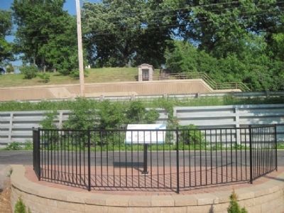
Marker is currently missing. Hopefully it will be replaced soon. The tomb can be seen from where the marker is supposed to be.
— Submitted March 8, 2012, by Bob (peach) Weber of Dewey, Arizona.
Photographed by Robert L Weber, June 6, 2011
3. Minahan's Tomb and Marker
Photographed by Robert L Weber, June 6, 2011
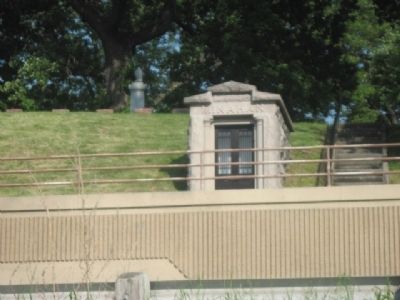
4. Minahan's Tomb
Photographed by Robert L Weber, June 27, 2011
5. Minahan's Tomb
Photographed by Robert L Weber, June 27, 2011
6. Minahan's Tomb
Credits. This page was last revised on August 25, 2026. It was originally submitted on June 10, 2011, by Bob (peach) Weber of Dewey, Arizona. This page has been viewed 3,125 times since then and 108 times this year. Last updated on August 21, 2026, by Bob (peach) Weber of Dewey, Arizona. Photos: 1. submitted on August 15, 2026, by Jim Schaettle of Madison, Wisconsin. 2, 3, 4. submitted on June 10, 2011, by Bob (peach) Weber of Dewey, Arizona. 5, 6. submitted on June 27, 2011, by Bob (peach) Weber of Dewey, Arizona. • Devry Becker Jones was the editor who published this page.
