Near Megler in Pacific County, Washington — The American West (Northwest)
Salmon Fortunes

Photographed by Barry Swackhamer, June 10, 2026
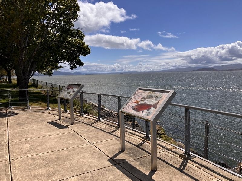
1. Salmon Fortunes Marker
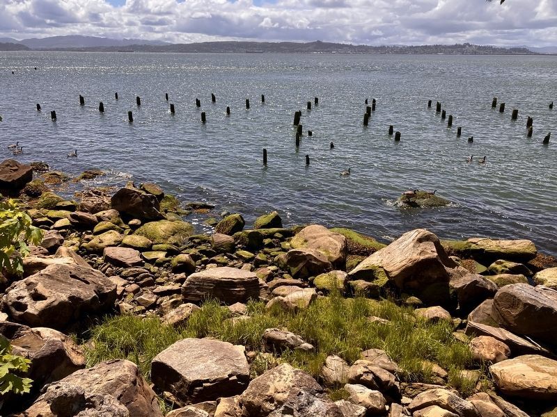
Caption: Joseph Megler operated a cannery and fish buying station during the 1870s and 1880s. The pilings still visible today supported a salmon receiving station where fishing boats unloaded their catch.
By the late 1800s, salmon trading had expanded to include fish canned in tins. More than 40 salmon canneries operated along the lower Columbia River, employing thousands of people. Like local Chinookan people, fishing crews used seine nets to catch vast piles of fish. Women and children labored in canning lines. Salmon was packed, sealed, and shipped to far-flung destinations.
At first, the salmon runs seemed never-ending. By 1900, however, Columbia River salmon populations were already in decline. The industry gradually shifted north, leaving abandoned canneries and workers behind, and Chinookan people struggle to maintain access to the resource today.
Erected by National Park Service.
Topics. This historical marker is listed in these topic lists: Animals • Indigenous Peoples and Communities • Industry & Commerce
this page online
Location. 46° 14.936′ N, 123° 51.668′ W. Marker is near Megler, Washington, in Pacific County. It is on Lewis and Clark Trail Highway (State Highway 401) near Hungry Harbor Lane, on the right when traveling east. Touch for map. Marker is in this post office area: Naselle WA 98638, United States of America. Touch for directions.

Regionally, this marker is in Southwest Washington State. It is also on the American Pacific Coast, in the Pacific Northwest, and in the Lewis & Clark Corridor. Globally, it is in North America, on the Ring of Fire, on the Pacific Rim, in the Western Hemisphere, in the Western World, and in the Anglosphere.
Other nearby markers. At least 8 other markers are within 3 miles of this marker, measured as the crow flies: Crossing the River (here, next to this marker); Dangerous Days in "Dismal Nitch" (within shouting distance of this marker); Lewis & Clark at Dismal Nitch (about 600 feet away, measured in a direct line); Chief Skamokawa/"Great joy in camp" (about 600 feet away); St. Mary's Church (approx. 2.3 miles away); The Business of Trade
Photographed by Barry Swackhamer, June 10, 2026
2. Salmon Fortunes Marker
The marker is on the left in the distance.
Another marker is no longer nearby. Columbia River Explorers (was approx. 1.3 miles away but has been confirmed missing).
Photographed by Barry Swackhamer, June 10, 2026
3. Pilings of the Megler Cannery
Credits. This page was last revised on August 21, 2026. It was originally submitted on August 21, 2026, by Barry Swackhamer of Brentwood, California. This page has been viewed 13 times since then. Photos: 1, 2, 3. submitted on August 21, 2026, by Barry Swackhamer of Brentwood, California.
