Hurstbridge in Nillumbik Shire, Victoria, Australia — Oceania
Stroll through history
| — | Hurstbridge Heritage Trail | — |
Photographed by Dean Barton-Ancliffe, July 7, 2026
1. Stroll through history Marker
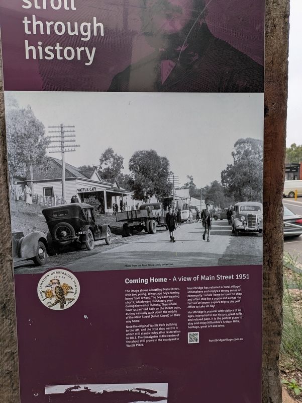
Coming Home - A view of Main Street 1951
The Image shows a bustling Main Street, with two young, school age boys coming home from school. The boys are wearing shorts, which were mandatory even during the winter months. They would have just arrived back on the steam train as they casually walk down the middle of the Main Street (Amos Street) on their way home.
Note the original Wattle Cafe building to the left, and the little shop next to it which still stands today after restoration in 2013. The Eucalyptus in the centre of the photo still grows in the courtyard in Wattle Place.
Hurstbridge has retained a 'rural village' atmosphere and enjoys a strong sense of community. Locals 'come to town' to shop and often stop for a cuppa and a chat - in fact we've known a quick trip to the post office to take all day!
Hurstbridge is popular with visitors of all ages, interested in our history, great cafés and relaxed pace. It is the perfect place to stay and enjoy Nillumbik's Artisan Hills heritage, great art and wine.
hurstbridgevillage.com.au
Erected 2024.
Topics. This historical marker is listed in these
this page online
Location. 37° 38.352′ S, 145° 11.596′ E. Marker is in Hurstbridge, Victoria, in Nillumbik Shire. It is on Heidelberg - Kinglake Road (Route C746) 0.1 kilometers north of Parker Road, on the left when traveling south. Touch for map. Marker is at or near this postal address: 804-806 Heidelberg - Kinglake Road, Hurstbridge VIC 3099, Australia. Touch for directions.

Regionally, it is in Oceania, in Australasia, in the Pacific Ocean, in South Pacific, on the Pacific Rim, in the Western World, and in the Anglosphere. Historically, it finds itself in what was once a British colony.
Other nearby markers. At least 8 other markers are within 11 kilometers of this marker, measured as the crow flies: Post Office & Former Observer Office (within shouting distance of this marker); Moonrise (approx. 5.5 kilometers away); The Orchard c.1904 (approx. 5.5 kilometers away); Walter Withers (approx. 9.2 kilometers away); Eltham Avenue of Honour (North) (approx. 10 kilometers away); Swimming Pool on the Plenty River (approx. 10.2 kilometers away);

Photographed by Dean Barton-Ancliffe, July 7, 2026
2. Stroll through history Marker along Main Street
Also see . . . Hurstbridge Heritage Trail. Contains Map and Pictures of all 30 sites (Submitted on August 21, 2026, by Dean Barton-Ancliffe of Rowville, Victoria.)
Credits. This page was last revised on August 27, 2026. It was originally submitted on August 21, 2026, by Dean Barton-Ancliffe of Rowville, Victoria. This page has been viewed 10 times since then. Photos: 1, 2. submitted on August 21, 2026, by Dean Barton-Ancliffe of Rowville, Victoria. • Andrew Ruppenstein was the editor who published this page.
