Kingston in Sierra County, New Mexico — The American Mountains (Southwest)
Emory Pass
Black Range Mountains
| — | Elevation: 8228 ft. | — |
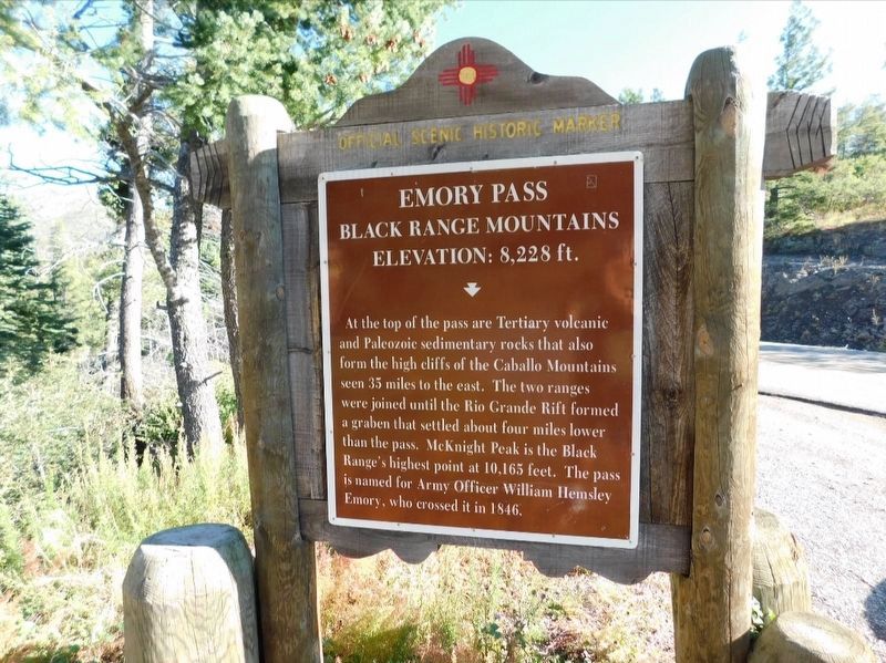
Photographed by Jimmy Emerson, October 3, 2021
1. Emory Pass Marker
Topics. This historical marker is listed in this topic list: Natural Features. A significant historical year for this entry is 1846.
Location. 32° 54.606′ N, 107° 45.983′ W. Marker is in Kingston, New Mexico, in Sierra County. It is on State Highway 152, on the left when traveling west. Touch for map. Marker is at or near this postal address: NM Hwy 152, Winston NM 87943, United States of America. Touch for directions.

Regionally, this marker is in Southwest New Mexico and in the Rio Grande Valley. It is also in the American Borderlands and in the Southwest. Globally, it is in North America, the Western Hemisphere, the Western World, and the Anglosphere. Historically, it finds itself
this page online
Other nearby markers. At least 8 other markers are within 13 miles of this marker, measured as the crow flies: A different marker also named Emory Pass (within shouting distance of this marker); James McNally (approx. 3½ miles away); Percha Creek (approx. 9.4 miles away); Miller Drug Store (approx. 11½ miles away); Sadie Orchard (approx. 11.6 miles away); Hillsboro (approx. 11.6 miles away); Ebin (Eben) Stanley (approx. 11.7 miles away); Mimbres Valley (approx. 12.2 miles away).
Credits. This page was last revised on August 27, 2026. It was originally submitted on August 22, 2026, by Jimmy Emerson of Dalton, Georgia. This page has been viewed 15 times since then. Photo 1. submitted on August 22, 2026, by Jimmy Emerson of Dalton, Georgia. • Andrew Ruppenstein was the editor who published this page.
