Dulce in Rio Arriba County, New Mexico — The American Mountains (Southwest)
Jicarilla Apache Reservation Centennial Highway
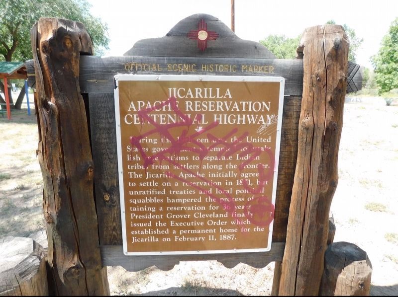
Photographed by Jimmy Emerson, September 3, 2025
1. Jicarilla Apache Reservation Centennial Highway Marker
Topics. This historical marker is listed in these topic lists: Indigenous Peoples and Communities • Settlements & Settlers. A significant historical year for this entry is 1851.
Location. 36° 56.012′ N, 106° 59.875′ W. Marker is in Dulce, New Mexico, in Rio Arriba County. It is on U.S. 64, on the right when traveling west. Touch for map. Marker is at or near this postal address: 13546 US-64, Dulce NM 87528, United States of America. Touch for directions.

Regionally, this marker is in Northern New Mexico. It is also in the American Southwest, in the Mountain West, and at the Four Corners. Globally, it is in North America, the Rocky
this page online
Other nearby markers. At least one other marker is within walking distance of this marker: Jicarilla Apache (Tribe) (approx. one mile away).
Credits. This page was last revised on August 27, 2026. It was originally submitted on August 22, 2026, by Jimmy Emerson of Dalton, Georgia. This page has been viewed 15 times since then. Photo 1. submitted on August 22, 2026, by Jimmy Emerson of Dalton, Georgia. • Andrew Ruppenstein was the editor who published this page.
