South Side in Billings in Yellowstone County, Montana — The American West (Mountains)
Indigenous Homeland
Photographed by Cosmos Mariner, July 4, 2024
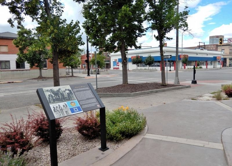
1. Indigenous Homeland Marker
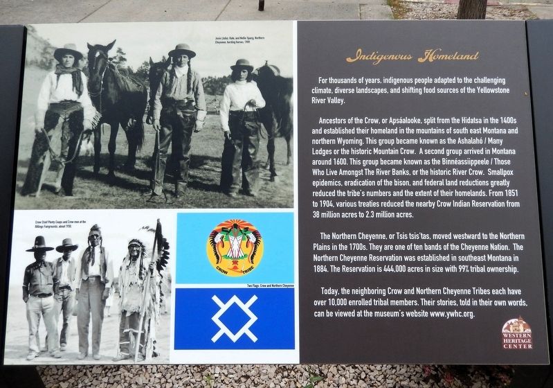
For thousands of years, indigenous people adapted to the challenging climate, diverse landscapes, and shifting food sources of the Yellowstone River Valley.
Ancestors of the Crow, or Apsáalooke, split from the Hidatsa in the 1400s and established their homeland in the mountains of south east Montana and northern Wyoming. This group became known as the Ashalahó / Many Lodges or the historic Mountain Crow. A second group arrived in Montana around 1600. This group became known as the Binnéassiippeele / Those Who Live Amongst The River Banks, or the historic River Crow. Smallpox epidemics, eradication of the bison, and federal land reductions greatly reduced the tribe's numbers and the extent of their homelands. From 1851 to 1904, various treaties reduced the nearby Crow Indian Reservation from 38 million acres to 2.3 million acres.
The Northern Cheyenne, or Tsis tsis'tas, moved westward to the Northern Plains in the 1700s. They are one of ten bands of the Cheyenne Nation. The Northern Cheyenne Reservation was established in southeast Montana in 1884. The Reservation is 444,000 acres in size with 99% tribal ownership.
Today,
this page online
Erected by Western Heritage Center.
Topics. This historical marker is listed in this topic list: Indigenous Peoples and Communities.
Location. 45° 46.832′ N, 108° 30.349′ W. Marker is in Billings, Montana, in Yellowstone County. It is in the South Side. It is on North 29th Street just south of Montana Avenue (Business Interstate 90), on the right when traveling north. The marker is along the walkway on the west side of the Western Heritage Center. Touch for map. Marker is at or near this postal address: 2822 Montana Avenue, Billings MT 59101, United States of America. Touch for directions.

Regionally, this marker is in Yellowstone Country. It is also in the American Mountain West and in the Lewis & Clark Corridor. Globally, it is in North America, the Western Hemisphere, the Western World, and the Anglosphere. Historically, it finds itself in what was once Rupert’s Land and also
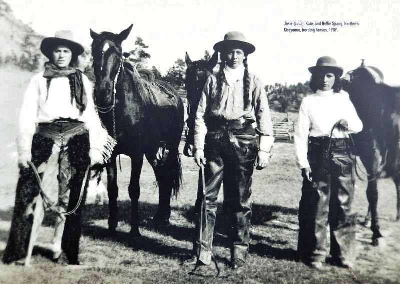
2. Marker detail: Josie (Julia), Kate, and Nellie Spang, Northern Cheyenne, herding horses, 1909
Other nearby markers. At least 8 other markers are within walking distance of this marker: The Parmly Billings Library Building (here, next to this marker); The Western Heritage Center (here, next to this marker); The Railroad Arrives (here, next to this marker); Billings — A Tale of Two Cities (a few steps from this marker); Frederick Billings (a few steps from this marker); The Clark Hotel - 1928 (within shouting distance of this marker); J.K. Ralston Cabin-Studio (within shouting distance of this marker); The Parmly Billings Library - 1901 (within shouting distance of this marker). Touch for a list and map of all markers in Billings.
Also see . . . Western Heritage Center. (Submitted on August 24, 2026, by Cosmos Mariner of Cape Canaveral, Florida.)
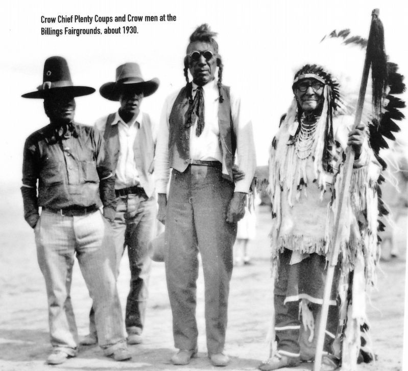
3. Marker detail: Crow Chief Plenty Coups and Crow men at the Billings Fairgrounds about 1930
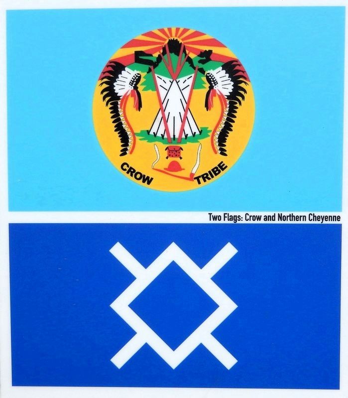
4. Marker detail: Crow and Northern Cheyenne Flags
Photographed by Cosmos Mariner, July 4, 2024
5. Indigenous Homeland Marker
Looking northwest along North 29th Street; Montana Avenue crosses in the background.
Credits. This page was last revised on August 24, 2026. It was originally submitted on August 22, 2026, by Cosmos Mariner of Cape Canaveral, Florida. This page has been viewed 15 times since then. Photos: 1, 2, 3, 4, 5. submitted on August 24, 2026, by Cosmos Mariner of Cape Canaveral, Florida.
