Chesterfield in Chesterfield County, Virginia — The American South (Mid-Atlantic)
Enslaved Quarters

Photographed by Evan Dwyer, August 22, 2026
1. Enslaved Quarters Marker
Erected by Chesterfield Historical Society.
Topics. This historical marker is listed in these topic lists: African Americans • Anthropology & Archaeology • Architecture.
Location. 37° 22.489′ N, 77° 30.403′ W. Marker is in Chesterfield, Virginia, in Chesterfield County. It can be reached from Iron Bridge Road (Virginia Route 10) east of Courtview Lane, on the left when traveling west. Marker is behind Magnolia Grange House Museum, in the rear yard. Touch for map. Marker is at or near this postal address: 10020 Iron Bridge Road, Chesterfield VA 23832, United States of America. Touch for directions.

Regionally, this marker is in the Piedmont, in Central Virginia, and in the Richmond Metropolitan Area. It is also in the American South, specifically in the Upper South, and on the Eastern Seaboard. Globally,
this page online
Other nearby markers. At least 8 other markers are within walking distance of this marker: Smoke House (a few steps from this marker); Kitchen (a few steps from this marker); Magnolia Grange (about 300 feet away, measured in a direct line); Chesterfield County Courthouse (about 400 feet away); Veterans Memorial Wall (about 400 feet away); World War I in Chesterfield County (about 500 feet away); a different marker also named Chesterfield Court House (about 500 feet away); Confederate Memorial (about 600 feet away). Touch for a list and map of all markers in Chesterfield.
Another marker is no longer nearby. Chesterfield Court House (was about 500 feet away but has been replaced with another marker now near it).
More about this marker. Magnolia Grange is operated as a museum by Chesterfield County. This

Photographed by Evan Dwyer, August 22, 2026
2. Enslaved Quarters Marker
And outline of the quarters (timber beams and brick pillars showing the footprint of the structure). The marker is not clear about whether the division of the outline represents the two rooms of the enslaved quarters or delineates the size of the earlier structure that stood here first. Presumably it shows the size of the two rooms described.
Related markers. Click here for a list of markers that are related to this marker. These markers interpret the grounds of Magnolia Grange.
Also see . . . Department of Historic Resources - Magnolia Grange. This link includes the National Register of Historic Places Nomination Form, which details the architecture, history, and significance of the house. (Submitted on August 22, 2026, by Evan Dwyer of Richmond, Virginia.)

Photographed by Evan Dwyer, August 22, 2026
3. Enslaved Quarters Marker
The enslaved quarters marker and outline are at center distant, beyond the much smaller rectangular outline.
Photographed by Evan Dwyer, August 22, 2026
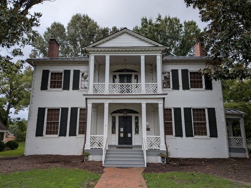
4. Magnolia Grange
Completed in 1825, this is the front of the house.

Photographed by Evan Dwyer, September 21, 2024
5. Example Enslaved Quarters
This ca. 1840 quarters is roughly representative of how these types of structures were built. Note this is not intended to match the Magnolia Grange outline precisely, or even in specific function; in this instance, the building combines the kitchen and laundry on the lower floor across two rooms with separated lofts on each side of the chimney for two-family occupancy - and further, it was renovated for single-family residency later in its history. This example is located at the Banks House, part of Pamplin Historical Park.
Credits. This page was last revised on August 22, 2026. It was originally submitted on August 22, 2026, by Evan Dwyer of Richmond, Virginia. This page has been viewed 14 times since then. Photos: 1, 2, 3, 4, 5. submitted on August 22, 2026, by Evan Dwyer of Richmond, Virginia.
