
Midland in Simcoe County, Ontario — Central Canada (North America)
Saint-Marie Among the Hurons
⎯⎯⎯
Saint-Marie-au-pays-des-Hurons
(1639-1649)

Photographed by Tim Boyd, August 20, 2026
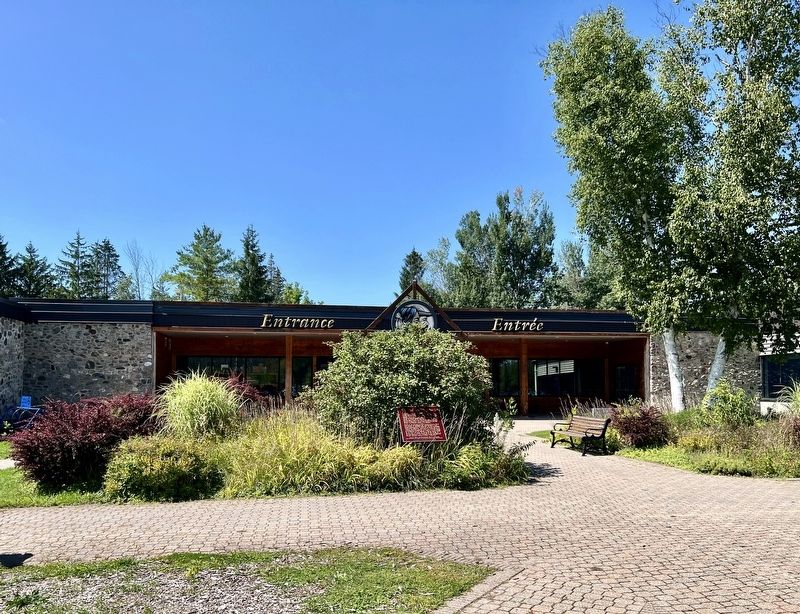
1. Saint-Marie Among the Hurons/Saint-Marie-au-pays-des-hurons Marker

Founded by the Jesuits in 1639, Sainte-Marie was designed as a central residence for the mission to the Wendat (Huron) peoples. For a decade Sainte Marie was a major French community, the earliest in what is now Ontario. Prolonged daily contact between native people and Europeans profoundly affected both groups. By the winter of 1648-1649, Huronia was so ravaged by disease and conflict that the Jesuits abandoned and burned Sainte-Marie and with some Wendat followers moved to Christian Island. The following year the Jesuits and Hurons withdrew to Québec.
Fondé par les Jésuites en 1639, le poste de Sainte-Marie était le lieu de résidence des missionnaires venus évangéliser les Wendats (Hurons). Ce fut le premier grandétablissement francais du territoire qui forme aujourd'hui 1'Ontario. Autochtones et Européens, en contact quotidien pendant toute une décennie, furent profondément marqués par ces rapports. La dévastation de la Huronie par la maladie et par la guerre incita les Jésuites, au cours de l'hiver 1648 - 1649, à abandonner et à bruler Sainte-Marie.
this page online
Erected by Historic Sites and Monuments Board of Canada.
Topics. This historical marker is listed in these topic lists: Indigenous Peoples and Communities • Religion & Religious Structures • Settlements & Settlers. A significant historical year for this entry is 1639.
Location. 44° 44.046′ N, 79° 50.637′ W. Marker is in Midland, Ontario, in Simcoe County. It can be reached from Ontario Highway 12. The marker is near the main public entrance to the Saint Marie Among the Hurons site, approx. 700 metres from the entrance on Highway 12. Touch for map. Marker is at or near this postal address: 16164 ON-12, Midland ON L0K 1R0, Canada. Touch for directions.

Regionally, this marker is in Central Ontario Cottage Country and specifically in Georgian Bay Country. It is also in Central Canada. Globally, it is in North America, on the Great Lakes, in the Western Hemisphere, in the Western World, and in the Anglosphere. Historically, it finds itself in what was once a British colony, the Viceroyalty
Photographed by Tim Boyd, August 20, 2026
2. Saint-Marie Among the Hurons/Saint-Marie-au-pays-des-Hurons Marker
Other nearby markers. At least 8 other markers are within 10 kilometers of this marker, measured as the crow flies: Gateway to Huronia (approx. half a kilometer away); The Founding of Midland (approx. 3.6 kilometers away); The Arrival of the Jesuits in New France (approx. 5 kilometers away); Ataronchronon Village (approx. 5 kilometers away); Franz Johnston (approx. 5.4 kilometers away); John Graves Simcoe (1752-1806) (approx. 8.5 kilometers away); Father Laboureau (approx. 8.5 kilometers away); Athol Murray (approx. 8.5 kilometers away).
Photographed by Tim Boyd, August 20, 2026
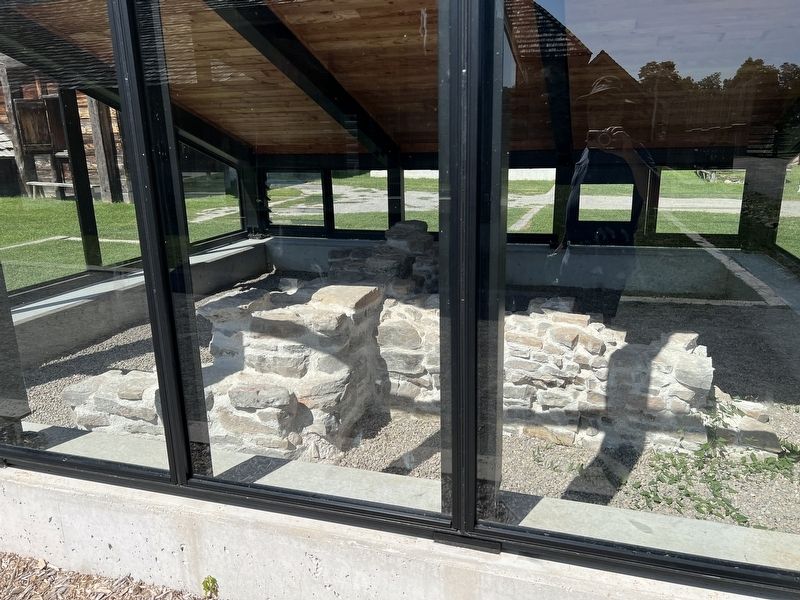
3. Protected original foundation at Saint-Marie Among the Hurons
Photographed by Tim Boyd, August 20, 2026
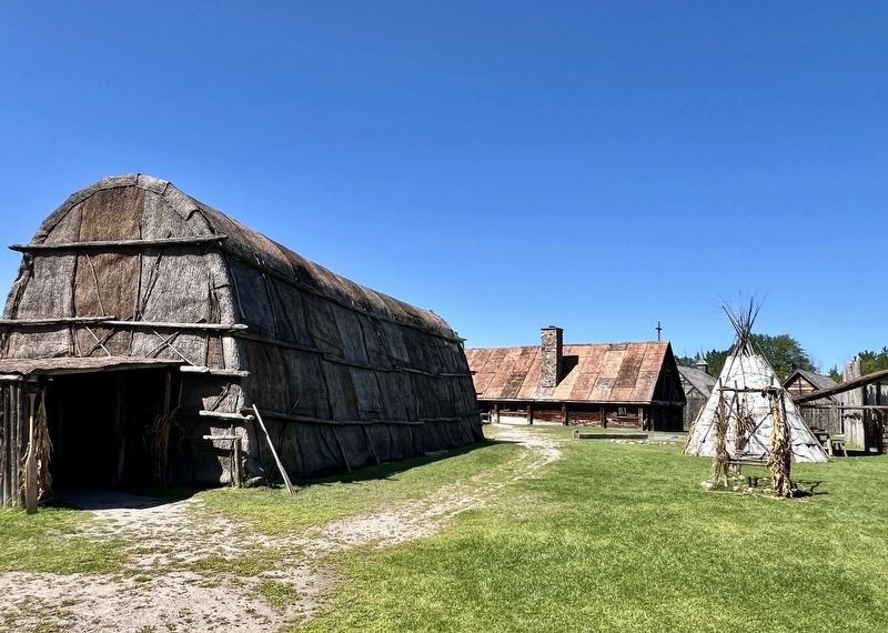
4. Reconstructed Indigenous and French structures at Saint-Marie Among the Hurons
Credits. This page was last revised on August 27, 2026. It was originally submitted on August 23, 2026, by Tim Boyd of Hamilton, Ontario. This page has been viewed 9 times since then. Photos: 1, 2, 3, 4. submitted on August 23, 2026, by Tim Boyd of Hamilton, Ontario. • Andrew Ruppenstein was the editor who published this page.
