Southwest Portland in Multnomah County, Oregon — The American West (Northwest)
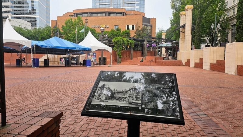
The Portland Hotel
1890–1951

Photographed by Ian Lefkowitz, June 25, 2026
1. The Portland Hotel Marker
1890–1951
The block now occupied by Pioneer Courthouse Square was for more than 60 years the site of the imposing Portland Hotel. From 1890 to 1951, the hotel played a prominent role in Portland’s social and business life and counted eleven U.S. Presidents among its guests.
Previously the site of Portland’s first public school, in 1883 the block was sold to railroad magnate Henry Villard, and the school was moved. Villard began building a grand hotel, intending to serve the travelers who would start arriving in Portland that year aboard the first transcontinental railroad. However, only the hotel’s foundations had been completed when Villard’s finances collapsed. For more than four years, the site was known as “Villard’s ruins,” until a public subscription raised the money to complete the hotel.
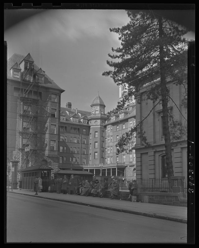
For decades after its opening, the six-story, 284-room Portland Hotel was a downtown landmark. Gradually, though, the building aged and, in an era when historic structures were not highly valued, renovation was considered too expensive. In 1951 the hotel was torn down and replaced with a parking lot. The parking lot
this page online
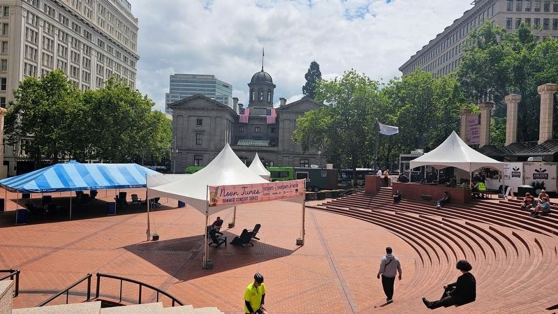
Eventually, after widespread public discussion about the future of the block, it was decided that a public park would better serve the people of Portland. Pioneer Courthouse Square opened to the public on the weekend of April 6–8, 1984, to coincide with the birthday of both the City of Portland and the Portland Hotel.
(Captions)
Oregon Historical Society Library
Part of the hotel’s iron fence (visible in the photo above) is at your left.
Topics. This historical marker is listed in these topic lists: Industry & Commerce • Parks & Recreational Areas. A significant historical date for this entry is April 6, 1984.
Location. 45° 31.138′ N, 122° 40.731′ W. Marker is in Portland, Oregon, in Multnomah County. It is in Southwest Portland. It is at the intersection of Southwest 6th Avenue and Southwest Morrison Street, on the left when traveling north on Southwest 6th Avenue. Touch for map. Marker is at or near this postal address: 700 SW 6th Avenue, Portland OR 97204, United States of America. Touch for directions.

Regionally, this marker is in the Columbia River Gorge and in the Willamette Valley. It is also on the American
Photographed by Ian Lefkowitz, June 25, 2026
2. The Portland Hotel Marker
The marker is located in Portland's Pioneer Courthouse Square. Portland's famed Weather Machine can be seen in line with the marker.
Other nearby markers. At least 8 other markers are within walking distance of this marker: Pioneer Post Office (within shouting distance of this marker); Portland's First Public School (within shouting distance of this marker); Selling Building, 1910 (about 300 feet away, measured in a direct line); Portland is a Public Market City (about 300 feet away); Simon and Helen Director Park / Teachers Fountain (about 600 feet away); Imperial Hotel, 1894–95 (about 700 feet away); United States National Bank Building (approx. 0.2 miles away); Simon Benson (approx. 0.2 miles away). Touch for a list and map of all markers in Portland.
Photographed by Ian Lefkowitz, June 26, 2026
3. Pioneer Courthouse Square
Pioneer Courthouse Square, with Pioneer Courthouse looming in the distance. The marker is towards the left of the photo, with the fencing in the marker description obscured by the white awning.
Minor White, Courtesy of Oregon Historical Society, March 8, 1939
4. The Portland Hotel
The Portland Hotel, also known as the Hotel Portland, constructed in 1890, looking west from Yamhill Street, between Fifth and Sixth Avenues. People wait on the sidewalk at a streetcar stop.
Credits. This page was last revised on August 26, 2026. It was originally submitted on August 23, 2026, by Ian Lefkowitz of New York, New York. This page has been viewed 18 times since then. Photos: 1, 2, 3, 4. submitted on August 23, 2026, by Ian Lefkowitz of New York, New York. • Andrew Ruppenstein was the editor who published this page.
