
Elmvale near Tay in Simcoe County, Ontario — Central Canada (North America)
Heritage & Rural Tay
Photographed by Tim Boyd, August 21, 2026
1. Heritage & Rural Tay Marker
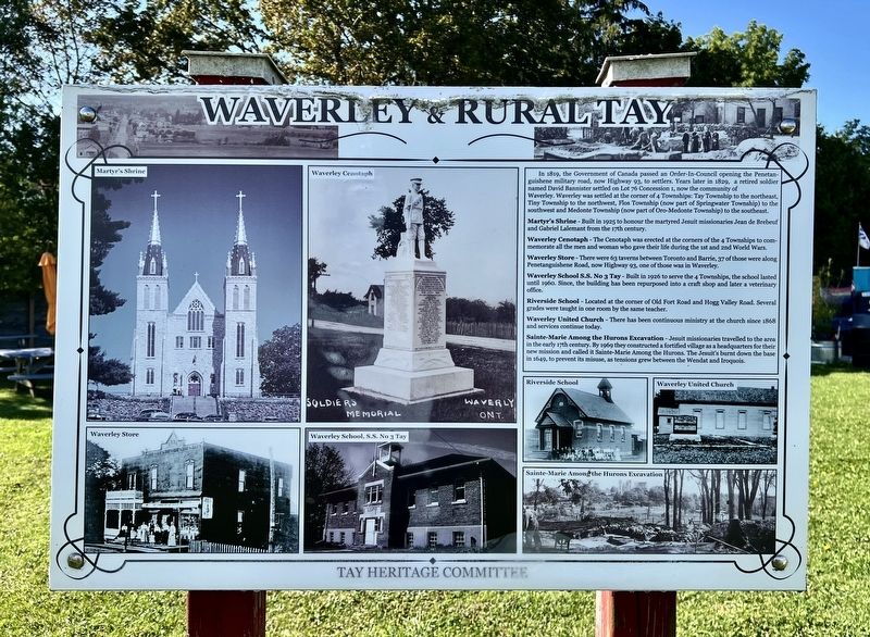
Martyr's Shrine - Built in 1925 to honour the martyred Jesuit missionaries Jean de Brebeuf and Gabriel Lalemant from the 17th century.
Waverley Cenotaph - The Cenotaph was erected at the corners of the 4 Townships to commemorate all the men and woman who gave their life during the 1st and 2nd World Wars.
Waverley Store - There were 63 taverns between Toronto and Barrie, 37 of those were along Penetanguishene Road, now Highway 93, one of those was in Waverley.
Waverley School S.S. No 3 Tay - Built in 1926 to serve the 4 Townships, the school lasted until 1960. Since, the building has been repurposed into a
this page online
Riverside School - Located at the corner of Old Fort Road and Hogg Valley Road. Several grades were taught in one room by the same teacher.
Waverley United Church - There has been continuous ministry at the church since 1868 and services continue today.
Sainte-Marie Among the Hurons Excavation - Jesuit missionaries travelled to the area in the early 17th century. By 1969 they constructed a fortified village as a headquarters for their new mission and called it Sainte-Marie Among the Hurons. The Jesuit's burnt down the base in 1649, to prevent its misuse, as tensions grew between the Wendat and Iroquois.
Erected by Tar Heritage Committee.
Topics. This historical marker is listed in these topic lists: Education • Religion & Religious Structures • Roads & Vehicles • Settlements & Settlers. A significant historical year for this entry is 1819.
Location. 44° 38.456′ N, 79° 49.389′ W. Marker is near Tay, Ontario, in Simcoe County. It is in Elmvale. It is at the intersection of Ontario Highway 93 and County Road 27, on the right when traveling south on Ontario Highway 93.
Photographed by Tim Boyd, August 21, 2026
2. Heritage & Rural Tay Marker
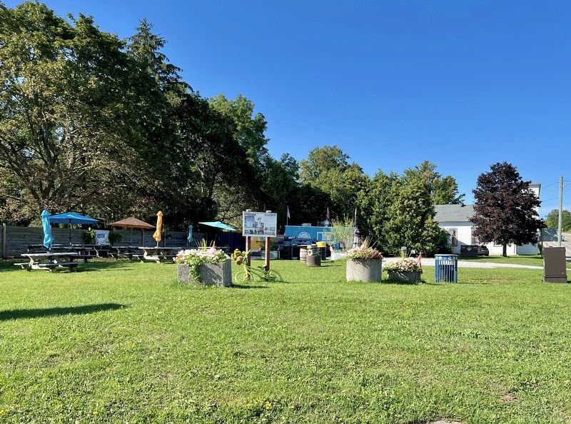
Facing west

Regionally, this marker is in Central Ontario Cottage Country and specifically in Georgian Bay Country. It is also in Central Canada. Globally, it is in North America, on the Great Lakes, in the Western Hemisphere, in the Western World, and in the Anglosphere. Historically, it finds itself in what was once a British colony, the Viceroyalty of New France, the Haudenosaunee (Iroquois) Confederacy, and Rupert’s Land.
Other nearby markers. At least 8 other markers are within 13 kilometers of this marker, measured as the crow flies: Hamilton Inn (approx. 6.5 kilometers away); Franz Johnston (approx. 7.6 kilometers away); Ataronchronon Village (approx. 10.4 kilometers away); The Arrival of the Jesuits in New France (approx. 10.4 kilometers away); Saint-Marie Among the Hurons / Saint-Marie-au-pays-des-Hurons (approx. 10.5 kilometers away); Gateway to Huronia (approx. 11 kilometers away); St. Ignace II (approx. 12.1 kilometers away); The Founding of Midland (approx. 12.9 kilometers away). Touch for a list and map of all markers in Tay.
Credits. This page was last revised on August 26, 2026. It was originally submitted on August 24, 2026, by Tim Boyd of Hamilton, Ontario. This page has been viewed 10 times since then. Photos: 1, 2. submitted on August 24, 2026, by Tim Boyd of Hamilton, Ontario. • Andrew Ruppenstein was the editor who published this page.
