Natural Bridge in Winston County, Alabama — The American South (East South Central)
Byler Road Displaced by the Railroad
Winston County
Photographed by Jimmy Emerson, August 23, 2026
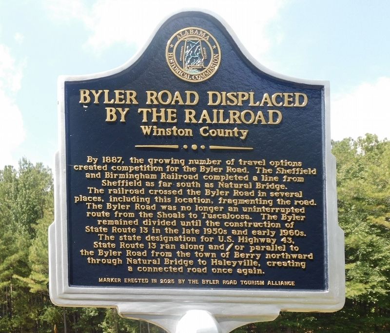
1. Byler Road Displaced by the Railroad Marker
By 1887, the growing number of travel options created competition for the Byler Road. The Sheffield and Birmingham Railroad completed a line from Sheffield as far south as Natural Bridge. The railroad crossed the Byler Road in several places, including this location, fragmenting the road. The Byler Road was no longer an uninterrupted route from the Shoals to Tuscaloosa. The Byler remained divided until the construction of State Route 13 in the late 1950s and early 1960s. The state designation for U.S. Highway 43, State Route 13 ran along and/or parallel to the Byler Road from the town of Berry northward through Natural Bridge to Haleyville, creating a connected road once again.
Erected 2026 by Byler Road Tourism Alliance and Alabama Historical Commission.
Topics. This historical marker is listed in these topic lists: Railroads & Streetcars • Roads & Vehicles. A significant historical year for this entry is 1887.
Location. 34° 5.664′ N, 87° 36.062′ W. Marker is in Natural Bridge, Alabama, in Winston County. It is at the intersection of Natural Bridge Drive and Alabama Highway 13, on the left when traveling
this page online

Regionally, this marker is in North Alabama. It is also in the American South, specifically in the Deep South, in Appalachia, and specifically in Southern Appalachia. Globally, it is in North America, a Gulf of Mexico state, the Western Hemisphere, the Western World, and the Anglosphere. Historically, it finds itself in what was once the territory of the Mississippian Culture, one of the Confederate States of America, and the Antebellum South.
Other nearby markers. At least 8 other markers are within 10 miles of this marker, measured as the crow flies: Byler Road / History of Natural Bridge (approx. half a mile away); Bald Rock / Rock House (approx. 0.6 miles away); The Free State of Winston / Natural Bridge (approx. 0.8 miles away); Natural Bridge Park (approx. 0.9 miles away); Yankee Trace (approx. 4 miles away); Whitehouse Cemetery Grounds (approx. 7.9 miles away); Haleyville Ice Company (approx. 8.9 miles away); First 9-1-1 Call (approx.

Photographed by Jimmy Emerson, August 23, 2026
2. Byler Road Displaced by the Railroad Marker
The railroad is in the background and on the other side of it is the original route of the Byler Road.
Another marker is no longer nearby. Whitehouse Cemetery Grounds (was approx. 7.9 miles away but has been replaced with another marker now near it).
More about this marker. Marker was actually installed July 22, 2026
Credits. This page was last revised on August 26, 2026. It was originally submitted on August 24, 2026, by Jimmy Emerson of Dalton, Georgia. This page has been viewed 23 times since then. Photos: 1, 2. submitted on August 24, 2026, by Jimmy Emerson of Dalton, Georgia. • James Hulse was the editor who published this page.
