
Salem in Harrison County, West Virginia — The American South (Appalachia)
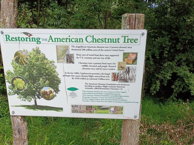
Restoring The American Chestnut Tree
Photographed by Craig Doda, August 2, 2026
1. Restoring The American Chestnut Tree Marker
The magnificent American chestnut tree (Castanea dentata) once dominated 200 million acres of the eastern United States.
Many uses of wood from these trees supported the U.S. economy and our way of life.
Chestnuts were a primary food source for wildlife, livestock and people. Roasted chestnuts were sold by street vendors.
In the late 1800s Cryphonectria parasitica, the fungal pathogen that causes chestnut blight, arrived from Asia. By 1950 it killed an estimated 4 billion trees.
The American Chestnut Foundation uses backcross breeding to produce blight-resistant American chestnuts, called Restoration Chestnuts 1.0.
The McGrew Society welcomes the addition of the American Chestnut trees to the J.C. McGrew's historic grove of trees, which includes five state champions.
Erected by West Virginia Chapter of the American Chestnut Foundation.
Topics. This historical marker is listed in these topic lists: Environment • Horticulture & Forestry • Industry & Commerce. A significant historical year for this entry is 1950.
Location. 39° 17.347′ N, 80° 33.914′ W. Marker is in Salem, West Virginia, in Harrison
this page online

Regionally, this marker is in West Virginia’s Little Kanawha Valley. It is also in the American South, specifically in the Upper South, in Appalachia, and specifically in Northern Appalachia. Globally, it is in North America, the Western Hemisphere, the Western World, and the Anglosphere. Historically, it finds itself in what was once the territory of the Mississippian Culture.
Other nearby markers. At least 8 other markers are within walking distance of this marker: Fort New Salem (within shouting distance of this marker); Salem World War I Honor Roll (approx. 0.4 miles away); Salem Fork Pilot Watershed (approx. 0.4 miles away); Melvin Mayfield (approx. 0.4 miles away); World War II Honor Roll (approx. 0.4 miles away); Salem Veterans Memorial (approx. 0.4 miles away); Salem (approx. 0.4 miles away); Salem at the Turn of the Century (approx. 0.6 miles away).
Photographed by Craig Doda, August 2, 2026
2. Restoring The American Chestnut Tree Marker
Credits. This page was last revised on August 31, 2026. It was originally submitted on August 26, 2026, by Craig Doda of Napoleon, Ohio. This page has been viewed 12 times since then. Photos: 1, 2. submitted on August 26, 2026, by Craig Doda of Napoleon, Ohio. • Devry Becker Jones was the editor who published this page.
