Sonoma in Sonoma County, California — The American West (Pacific Coastal)
Gottenburg's Garage
Photographed by Alvis Hendley
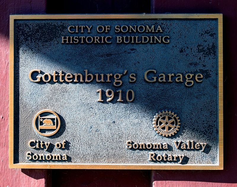
1. Gottenburg's Garage Marker
City of Sonoma Historic Building
Gottenburgs's Garage
1910
City of Sonoma
Sonoma Valley Rotary
Erected by Sonoma Valley Rotary.
Topics and series. This historical marker is listed in these topic lists: Industry & Commerce • Roads & Vehicles. In addition, it is included in the Rotary International series list. A significant historical year for this entry is 1910.
Location. 38° 17.511′ N, 122° 27.346′ W. Marker is in Sonoma, California, in Sonoma County. It is on East Napa Street. Touch for map. Marker is at or near this postal address: 146-148 East Napa Street, Sonoma CA 95476, United States of America. Touch for directions.

Regionally, this marker is in Wine Country, in the San Francisco Bay Area, in the North Coast, and specifically on the Coast Ranges. It is also on the American Pacific Coast. Globally, it is in North America, on the Ring of Fire, on the Pacific Rim, in the Western Hemisphere, in the Western World, and in the Anglosphere. Historically, it finds itself in what was once New Spain and also Mexico’s Alta California.
Other nearby markers. At least 8 other markers are within
this page online
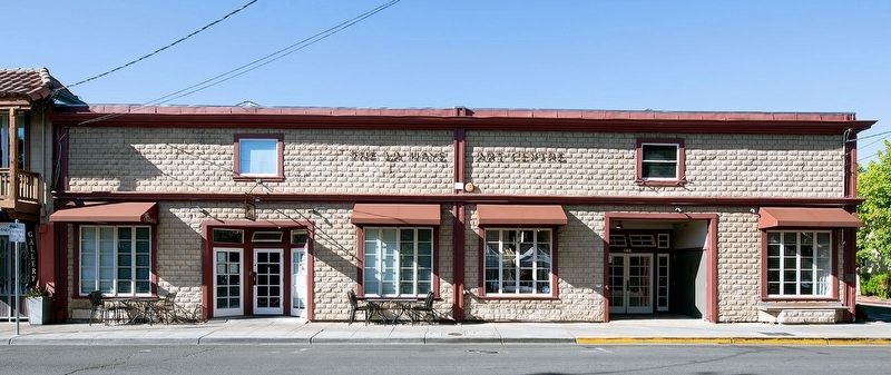
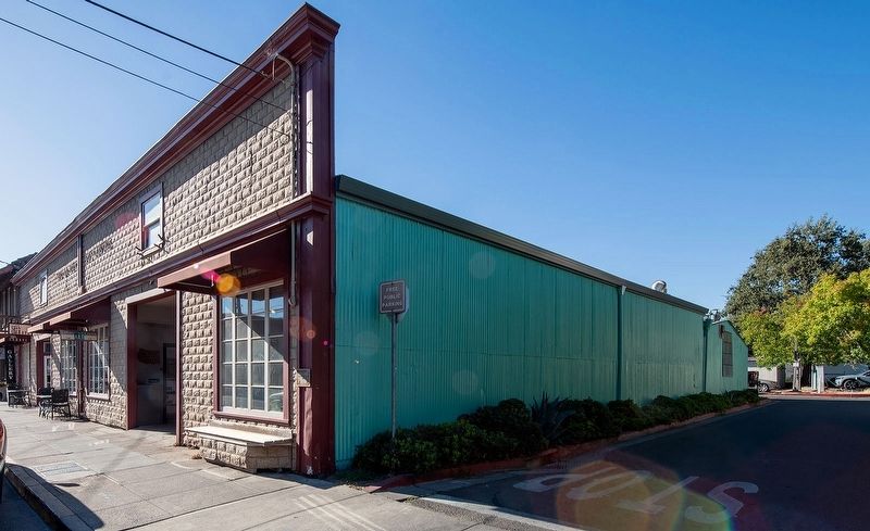
Regarding Gottenburg's Garage. The building at 146-148 East Napa Street contributes to the Sonoma Plaza Historic District which was originally listed on the National Register of Historic Places in 1975 with a boundary increase in 1992. The 1992 nomination form describes this building as: "Two-story former garage building, built about 1910, with a tin false front molded to look like stone. With a simple metal belt course and molded cornice. The first floor openings have been modified with large windows and recessed entries outside the period of significance. There are two small double hung wood windows at the second level."
Also see . . .
1. NRHP nomination form for Sonoma Plaza Historic District.
Photographed by Alvis Hendley, August 24, 2026
2. 146-148 East Napa Street
On June 14, 1846, a group of 33 Americans seized Sonoma, major military post, and took prisoner Mariano Guadalupe Vallejo, Commandante-General [sic] of the Northern Frontier of Alta California and the dominant Mexican figure in the north. After electing William B. Ide as president of their new republic, the Americans raised in the plaza their homemade Bear Flag as the symbol of their independent California. These actions marked the beginning of the Bear Flag Revolt, which preceded receipt of news in California of the official outbreak of war between Mexico and the United States.(Submitted on August 26, 2026, by Alvis Hendley of San Francisco, California.)
2. NRHP nomination form for Sonoma Plaza Historic District Boundary Increase.
The National Register District increase is along Braodway [sic] and the north side of East Napa Street. The District is essentially a commercial and residential district with relatively few intrusions....The district has undergone minor change but still retains a great deal of integrity from the period of significance (1835-1944). The district contains buildings from the 1830s through the 1930s.(Submitted on August 26, 2026, by Alvis Hendley of San Francisco, California.)The district in its past had the look of a small country town center. It essentially still retains that character.Photographed by Alvis Hendley, August 24, 20263. 146-148 East Napa StreetThe marker is on the corner of the building.
Credits. This page was last revised on August 27, 2026. It was originally submitted on August 26, 2026, by Alvis Hendley of San Francisco, California. This page has been viewed 18 times since then. Photos: 1, 2, 3. submitted on August 26, 2026, by Alvis Hendley of San Francisco, California. • Andrew Ruppenstein was the editor who published this page.
