Great Malvern in Worcestershire, England, United Kingdom — Northwestern Europe (the British Isles)
The Water Cure
| — | Great Malvern Route to the Hills | — |
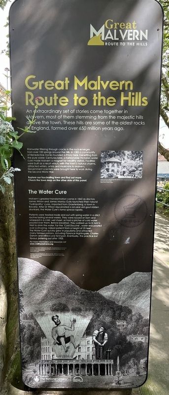
Photographed by Ray Gurganus, May 13, 2026
1. The Water Cure Marker
Patients were treated inside and out with spring water in a strict routine lasting several weeks. They were roused at 5am and wrapped in a cold, wet sheet, or had a pitcher of cold water poured over them. Before breakfast, they walked up to St Ann's Well to drink the water. For the 'Cold Douche', water was poured over a shivering, naked patient from a height of 20 feet. The Water Cure quickly grew in popularity and attracted many famous patrons, including Florence Nightingale, Charles Darwin and Alfred Lord Tennyson. Eventually, the practice lost favour, petering out after 1905.
Topics. This historical marker is listed in this topic list: Science & Medicine. A significant historical year for this entry is 1842.
Location. 52° 6.672′ N, 2° 19.792′ W. Marker is in Great Malvern, England, in Worcestershire. It is on Wells Road, on the right when traveling south. Touch for map. Marker is at or near this postal address: 31 Wells Road, Great Malvern, England WR14 3ES, United Kingdom. Touch for directions.

Regionally, this marker is in the Midlands. Globally, it is on the Atlantic Ocean, in the North Atlantic Region, in Europe, in Atlantic Europe, on one of the British Isles, in the Western World, and in the Anglosphere. Historically, it finds itself in what was once the Roman Empire.
Other nearby markers. At least 8 other markers are within 11 kilometers of this marker, measured as the crow flies: Malvhina Spout of Malvern Spring Water (here, next to this marker); Sandstones (within shouting distance of this marker);
this page online
Credits. This page was last revised on August 27, 2026. It was originally submitted on August 27, 2026, by Ray Gurganus of Washington, District of Columbia. This page has been viewed 9 times since then. Photo 1. submitted on August 27, 2026, by Ray Gurganus of Washington, District of Columbia. • Andrew Ruppenstein was the editor who published this page.
