Chatham in Chatham-Kent, Ontario — Central Canada (North America)
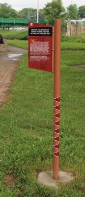
British Encampment: Forks of the Thames
Sunday, October 3, 1813
⎯⎯⎯
Campement Britanique: Les Fourches De La Rivière Thames
Le Dimanche 3 Octobre 1813
| — | Tecumseh Parkway / La Route de Tecumseh | — |
Photographed by Dale K. Benington, July 23, 2013
1. British Encampment: Forks of the Thames Marker

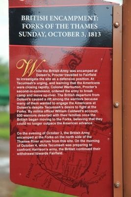
While British Army was encamped at Dolsen's, Procter travelled to Fairfield to investigate the site as a defensive position. At Tecumseh's urging, and learning that the Americans were closing rapidly, Colonel Warburton, Procter's second-in-command, ordered the army to break camp and move up-river. The British departure from Dolsen's caused a rift among the warriors because many of them wanted to engage the Americans at Dolsen's despite Tecumseh's desire to fight at the Forks. By militia officer William Caldwell's account, 600 warriors deserted with their families once the British began moving to the Forks, believing that they could no longer outpace the American advance.
On the evening of October 3, the British Army encamped at the Forks on the north side of the Thames River across from this site. On the morning of October 4, while Tecumseh was preparing to confront Harrison's army, the British continued their withdrawal towards Fairfield.
Le Dimanche 3 Octobre 1813
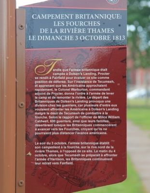
Tandis que l'armée britannique était campée à Dolsen's Landing, Procter se rendit à Fairfield pour évaluer ce site comme position de défense. Sur l'insistance de Tecumseh, ét apprenant que les Américains approchaient rapidement, le Colonel Warburton, commandant adjoint de Procter, donna l'ordre à l'armée de lever le camp et de remonter la rivière. Le départ des Britanniques de Dolsen's Landing provoqua une division chez les guerriers, car plusieurs d'entre eux voulaient affronter les Américains à Dolsen's Landing malgré le désir de Tecumseh de combattre à la fourche. Selon le rapport de l'officier de Milice William Caldwell, 600 guerriers, ainsi que leurs familles, désertèrent lorsque les Britanniques commencèrent à avancer vers les Fourches, croyant qu'ils ne pourraient
this page online
Le soir du 3 octobre, l'armée britannique établit son campement à la fourche, sur la rive nord de la rivière Thames, à l'opposé de ce site. Le matin du 4 octobre, alors que Tecumseh se préparait à affronter l'armée d'Harrison, les Britanniques continuèrent leur retrait vers Fairfield.
Erected by Tecumseh Parkway.
Topics. This historical marker is listed in these topic lists: Indigenous Peoples and Communities • War of 1812. A significant historical date for this entry is October 3, 1794.
Location. Marker is missing. It was located near 42° 24.4′ N, 82° 11.066′ W. Marker was in Chatham, Ontario, in Chatham-Kent. It could be reached from the intersection of William Street North and Murray Street, on the left when traveling north. The historical marker is located in Chatham, at the point of "The Forks" of the Thames River, in Tecumseh Park, situated along a park walkway. Touch for map. Marker was at or near this postal address: 89 William Street North, Chatham ON N7M 4L5, Canada. Touch for directions.

Regionally, this marker was in the Southwest Ontario Area and in Southwestern Ontario.
Photographed by Dale K. Benington, July 23, 2013
2. British Encampment: Forks of the Thames Marker
Close-up view, looking west, of the English text side of the historical marker.
Other nearby markers. At least 8 other markers are within walking distance of this location: Skirmish at the Forks (here, next to this marker); The Forks (here, next to this marker); Casualties of the Skirmish / Les Pertes Survenues Lors de l'Escarmouche (here, next to this marker); Tecumseh (within shouting distance of this marker); Chatham Blockhouse (within shouting distance of this marker); Kent Regiment (about 90 meters away, measured in a direct line); Chatham Armoury (about 150 meters away); Carnegie Library (approx. 0.4 kilometers away). Touch for a list and map of all markers in Chatham.
Another marker is no longer nearby. Skirmish at the Forks (was here, next to this marker but has been confirmed missing).
Photographed by Dale K. Benington, July 23, 2013
3. British Encampment: Forks of the Thames Marker
Close-up view, looking east, of the French text side of the historical marker.
Photographed by Dale K. Benington, July 23, 2013
4. British Encampment: Forks of the Thames Marker
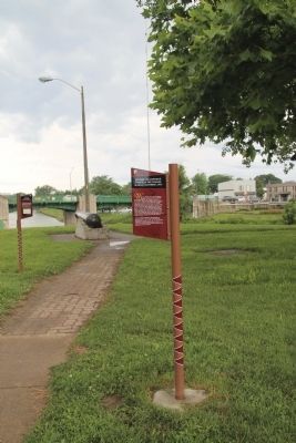
View of the historical marker in the foreground, with a view of the "The Forks" of the Thames River in the background.
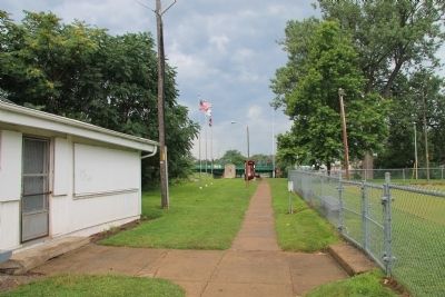
Photographed by Dale K. Benington, July 23, 2013
5. British Encampment: Forks of the Thames Marker
View of the park walkway that leads to "The Forks" of the Thames River, where several Tecumseh Parkway historical markers are located.
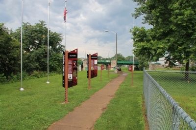
Photographed by Dale K. Benington, July 23, 2013
6. British Encampment: Forks of the Thames Marker
View of the "The Forks" of the Thames River, where several Tecumseh Parkway historical markers are located.
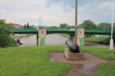
Photographed by Dale K. Benington, July 23, 2013
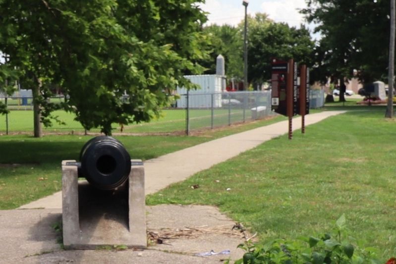
7. View of The Forks
View of the cannon situated at "The Forks" of the Thames River.
Photographed by Dale K. Benington, July 23, 2013
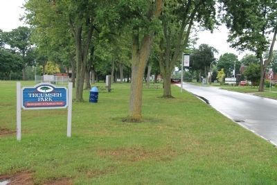
8. Tecumseh Park Sign
View, looking north on William Street North, of the sign for Tecumseh Park, where the historical marker is located, and a distant view of the Tecumseh Parkway sign used to alert motorists of the presence of these historical markers.
Photographed by Dale K. Benington, July 23, 2013
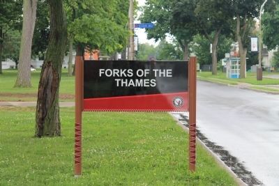
9. The Forks of the Thames Sign
View, looking north on William Street North, of the Tecumseh Parkway sign used to alert motorists of the presence of these historical markers in Tecumseh Park.
Photographed by Trevor L Whited, August 8, 2026
10. British Encampment: Forks of the Thames Marker
only 2 of the 5 markers remain
Credits. This page was last revised on August 28, 2026. It was originally submitted on January 19, 2014, by Dale K. Benington of Toledo, Ohio. This page has been viewed 867 times since then and 32 times this year. Last updated on August 27, 2026, by Trevor L Whited of Kokomo, Indiana. Photos: 1, 2, 3, 4, 5, 6, 7, 8, 9. submitted on January 19, 2014, by Dale K. Benington of Toledo, Ohio. 10. submitted on August 27, 2026, by Trevor L Whited of Kokomo, Indiana. • Devry Becker Jones was the editor who published this page.
