Prince Rupert in North Coast, British Columbia — Canada’s West Coast (North America)
Franklin D. Roosevelt Park
Photographed by Bradley Owen, August 14, 2026
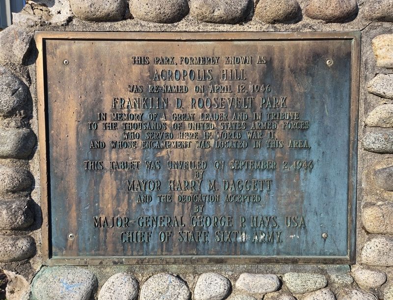
1. Franklin D. Roosevelt Park Marker
Acropolis Hill
was re-named on April 12, 1946
Franklin D. Roosevelt Park
in memory of a great leader and in tribute to the thousands of United States Armed Forces who served here in World War II and whose encampment was located in this area.
This tablet was unveiled on
September 2, 1946 by
Mayor Harry M. Daggett
and the dedication accepted by
Major-General George P. Hays, USA
Chief of Staff, Sixth Army.
Erected 1946.
Topics and series. This historical marker is listed in these topic lists: Parks & Recreational Areas • War, World II. In addition, it is included in the Former U.S. Presidents: #32 Franklin D. Roosevelt series list. A significant historical date for this entry is April 12, 1946.
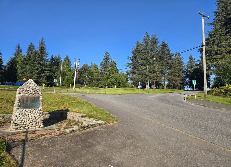
Location. 54° 18.422′ N, 130° 19.615′ W. Marker is in Prince Rupert, British Columbia, in North Coast. It is on Summit Avenue south of Taylor Street, on the left when traveling south. Touch for map. Marker is at or near this postal address: 842 Summit Avenue, Prince Rupert BC V8J 1V4, Canada. Touch for directions.

Regionally, this marker is in Northern BC. Globally, it is in North America,
this page online
Other nearby markers. At least 8 other markers are within walking distance of this marker: Grizzly Bear Pole (about 240 meters away, measured in a direct line); Prince Rupert B. C. (about 240 meters away); Former Federal Building/City Hall (approx. 0.6 kilometers away); Anget Pole of Ninstints (approx. 0.6 kilometers away); Charles Melville Hays (approx. 0.6 kilometers away); Alder House Frontal Pole (approx. 0.7 kilometers away); Lieutenant Colonel Cyrus Wesley Peck, VC, DSO & Bar (approx. 0.8 kilometers away); Kwinitsa Railway Museum (approx. 0.8 kilometers away). Touch for a list and map of all markers in Prince Rupert.
Photographed by Bradley Owen, August 14, 2026
2. Franklin D. Roosevelt Park Marker
Credits. This page was last revised on August 27, 2026. It was originally submitted on August 27, 2026, by Bradley Owen of Morgantown, West Virginia. This page has been viewed 12 times since then. Photos: 1, 2. submitted on August 27, 2026, by Bradley Owen of Morgantown, West Virginia.
