Elizabeth Township near Pedro in Lawrence County, Ohio — The American Midwest (Great Lakes)
Vesuvius Iron Furnace
| — | Historic Underground Railroad Site | — |
Photographed by Craig Doda, August 9, 2026
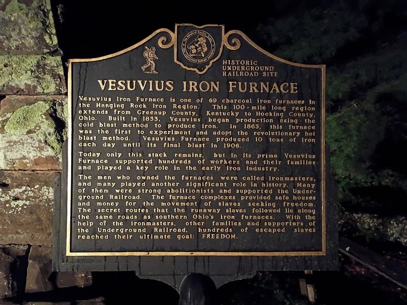
1. Vesuvius Iron Furnace Marker
Vesuvius Iron Furnace is one of 69 charcoal iron furnaces in the Hanging Rock Iron Region. This 100-mile long region extends from Greenup County, Kentucky to Hocking County, Ohio. Built in 1833, Vesuvius began production using the cold blast method to produce iron. In 1863, this furnace was the first to experiment and adopt the revolutionary hot blast method. Vesuvius Furnace produced 10 tons of iron each day until its final blast in 1906.
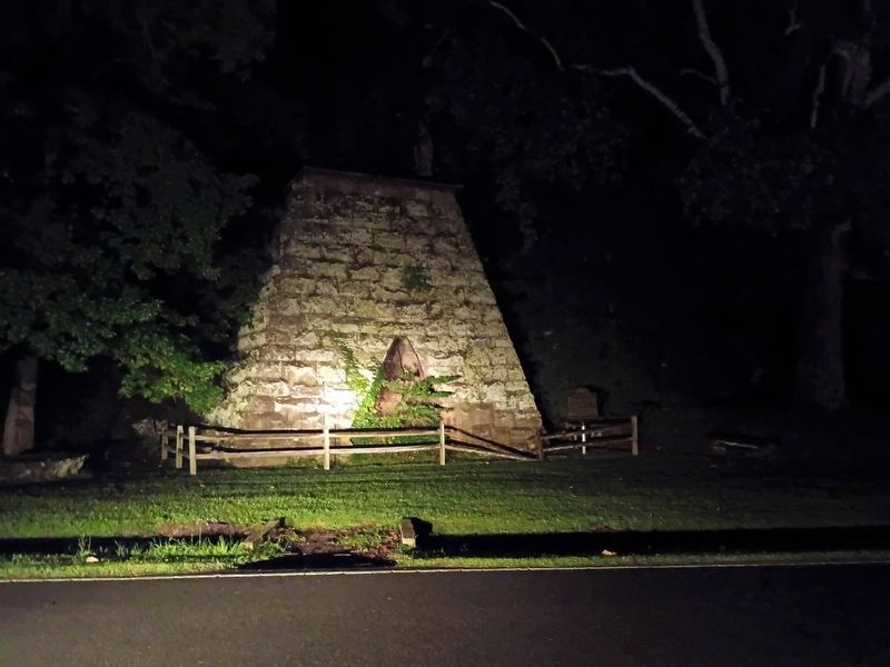
Today only this stack remains, but in its prime Vesuvius Furnace supported hundreds of workers and their families and played a key role in the early iron industry.
The men who owned the furnaces were called ironmasters, and many played another significant role in history. Many of them were strong abolitionists and supported the Under- ground Railroad. The furnace complexes provided safe houses and money for the movement of slaves seeking freedom. The secret routes that the runaway slaves followed lie along the same roads as southern Ohio's iron furnaces. With the help of the ironmasters, other families and supporters of the Underground Railroad, hundreds of escaped slaves reached
this page online
Erected by The Friends of Freedom Society; Ohio Underground Railroad Association.
Topics. This historical marker is listed in these topic lists: Abolition & Underground RR • African Americans • Industry & Commerce. A significant historical year for this entry is 1833.
Location. 38° 36.316′ N, 82° 37.804′ W. Marker is near Pedro, Ohio, in Lawrence County. It is in Elizabeth Township. It is at the intersection of Ellisonville-Paddle Creek Road and Sugar Creek Ridge-Vesuvius Road, on the right when traveling east on Ellisonville-Paddle Creek Road. Touch for map. Marker is at or near this postal address: 1008 Ellison-Paddle Creek Road, Pedro OH 45659, United States of America. Touch for directions.

Regionally, this marker is in the Kyova Tri-State Region. It is also in the American Midwest, in the Ohio River Valley, in Appalachia, and specifically in Northern Appalachia. Globally, it is in North America, the Western Hemisphere, the Western World, and the Anglosphere. Historically, it finds itself in what was once the Haudenosaunee (Iroquois) Confederacy, the territory of the Mississippian
Photographed by Craig Doda, August 9, 2026
2. Vesuvius Iron Furnace
Other nearby markers. At least 8 other markers are within 6 miles of this marker, measured as the crow flies: Veterans Memorial (approx. 3 miles away); World War II Memorial (approx. 5 miles away); Historic State Route 75 (approx. 5.1 miles away); Commerce on the Big River (approx. 5.4 miles away); Tourism Along the Byway (approx. 5.4 miles away); Did You Know? (approx. 5.4 miles away); John Campbell (approx. 5.4 miles away); There is Much to See on the Ohio River Scenic Byway (approx. 5.4 miles away).
Credits. This page was last revised on September 1, 2026. It was originally submitted on August 28, 2026, by Craig Doda of Napoleon, Ohio. This page has been viewed 19 times since then. Photos: 1, 2. submitted on August 28, 2026, by Craig Doda of Napoleon, Ohio. • Devry Becker Jones was the editor who published this page.
