
Vancouver in Clark County, Washington — The American West (Northwest)
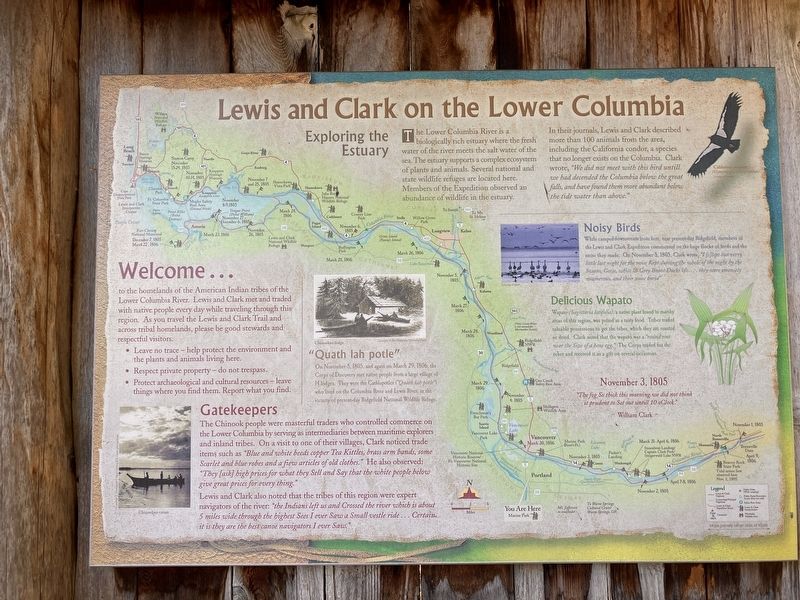
Lewis and Clark on the Lower Columbia
Photographed by Barry Swackhamer, June 11, 2026
1. Lewis and Clark on the Lower Columbia Marker
Click on this image to enlarge is and examine details of the Lewis and Clark Expedition map.
Welcome ...
to the homelands of the American Indian tribes of the Lower Columbia River. Lewis and Clark met and traded with native people every day while traveling through this region. As you travel the Lewis and Clark Trail and cross tribal homelands, please be good stewards and respectful visitors.
Leave no trace - help protect the environment and the plants and animals liven here.
Respect private property - do not trespass.
Protect archaeological and cultural resources - leave things where you find them. Report what you find.
Gatekeepers
The Chinook people were masterful traders who controlled commerce on the Lower Columbia by serving as intermediaries between maritime explorers and inland tribes. On a visit to one of their villages, Clark noticed trade items such as "Blue and white beeds coper Tea Kittles, bras arm bands, some Scarlet and blue robes and a few articles of old clothes." He also observed:"They [ask] high prices for what they Sell and Say that the white people below give great prices for every thing."
Lewis and Clark also noted that the tribes of this region were expert navigators
this page online
"Quath lah pole"
On November 5, 1805, and again on March 29, 1806, the Corps of Discovery met native people from a large village of 14 lodges. The were the Catlapotles ("Quath lah potle") who lived on the Columbia River and Lewis River, in the vicinity of present-day Ridgefield National Wildlife Refuge.
Exploring the Estuary
The Lower Columbia River is a biologically rich estuary where the fresh water of the river meets the salt water of the sea. The estuary supports a complex ecosystem of plants and animals. Several national and state wildlife refuges are located here. Members of the Expedition observed abundance of wildlife in the estuary.
In their journals, Lewis and Clark described more than 100 animals from the area, including the California condor, a species that no longer exists on the Columbia. Clark wrote, We did not meet with this bird untilll we had decended the Columbia below the great falls, and have found them more abundant below the tide water than above."
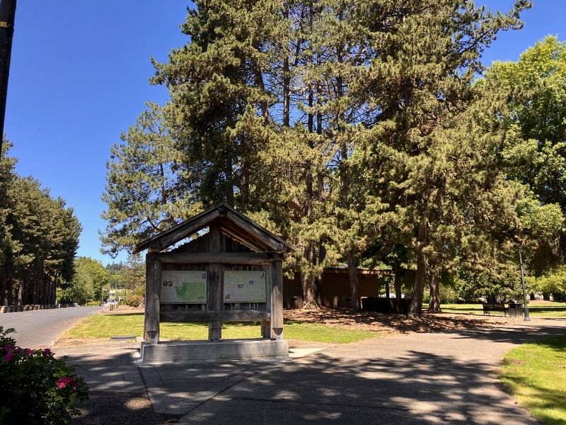
Photographed by Barry Swackhamer, June 11, 2026
2. Lewis and Clark on the Lower Columbia Marker
Noisy Birds
While camped downstream from here, near present-day Ridgefield, members of the Lewis and Clark Expedition commented on the huge flocks of birds and the noise they made. On November, 3, 1805, Clark wrote "I {S)lept but verry little last night for the noise Kept during the whole of the night by the Swans, Geese, white & Grey Brant, Ducks &c... they were emencly noumerous, and their noise horrid."
Delicious Wapato
Wapato (Sagittaria latifolia), a native plant found in marshy areas of this region, was prized as a tasty food. Tribes traded valuable possessions to get the tuber, which they ate roasted or dried. Clark noted that the wapato was a "round root near the Size of a hens egg." The Corps traded for the tuber and received it as a gift on several occasions.
"The fog So thick this morning we did not think it prudent to Set out untill 10 oClock.
Erected by Washington Lewis & Clark Bicentennial Commission.
Topics. This historical marker is listed in these topic lists: Exploration • Indigenous Peoples and Communities. A significant historical date for this entry is March 5, 1805.
Location. 45° 36.879′ N, 122° 37.64′ W. Marker is in Vancouver, Washington, in Clark County. It is on Southeast Marine Park Way near Southeast Columbia Way, on the right when traveling north. This marker is located at Marine Park. Touch for map. Marker is in this post office area: Vancouver WA 98661, United States of America. Touch for directions.

Regionally, this marker is in Greater Portland Area and in Southwest Washington State. It is also on the American Pacific Coast, in the Pacific Northwest, and in the Lewis & Clark Corridor. Globally, it is in North America, the Pacific Rim, the Western Hemisphere, the Western World, and the Anglosphere.
Other nearby markers. At least 8 other markers are within 2 miles of this marker, measured as the crow flies: Lewis and Clark National Historic Trail (here, next to this marker); Lewis's Vision of the Future (here, next to this marker); Densely Populated Region (a few steps from this marker); The First Fort Vancouver (approx. 0.9 miles away); From Military to Municipal Airfield (approx. 1.2 miles away); Ilchee (approx. 1.3 miles away); U. S. Grant Memorial (approx. 1.4 miles away); Whose Anchor? (approx. 1.6 miles away). Touch for a list and map of all markers in Vancouver.
Credits. This page was last revised on August 28, 2026. It was originally submitted on August 28, 2026, by Barry Swackhamer of Brentwood, California. This page has been viewed 5 times since then. Photos: 1, 2. submitted on August 28, 2026, by Barry Swackhamer of Brentwood, California.
