
Fort Loramie in Shelby County, Ohio — The American Midwest (Great Lakes)
On September 26, 1748
Photographed by Craig Doda, July 11, 2026
1. On September 26, 1748 Marker
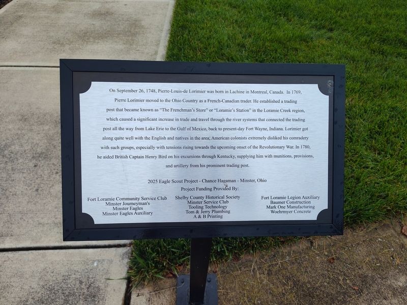
On September 26, 1748, Pierre-Louis-de Lorimier was born in Lachine in Montreal, Canada. In 1769, Pierre Lorimier moved to the Ohio Country as a French-Canadian trader. He established a trading post that became known as "The Frenchman's Store" or "Loramie's Station" in the Loramie Creek region, which caused a significant increase in trade and travel through the river systems that connected the trading post all the way from Lake Erie to the Gulf of Mexico, back to present-day Fort Wayne, Indiana. Lorimier got along quite well with the English and natives in the area; American colonists extremely disliked his comradery with such groups, especially with tensions rising towards the upcoming onset of the Revolutionary War. In 1780, he aided British Captain Henry Bird on his excursions through Kentucky, supplying him with munitions, provisions, and artillery from his prominent trading post.
Project Funding Provided By: Fort Loramie Community Service Club • Minster Journeyman's • Minster Eagles • Minster Eagles Auxiliary • Shelby County Historical Society • Minster Service Club • Tooling Technology • Tom & Jerry Plumbing
this page online
Erected 2025 by Eagle Scout Project - Chance Hagaman - Minster, Ohio.
Topics. This historical marker is listed in these topic lists: Colonial Era • Exploration • Industry & Commerce • Settlements & Settlers. A significant historical date for this entry is September 26, 1748.
Location. 40° 21.055′ N, 84° 22.504′ W. Marker is in Fort Loramie, Ohio, in Shelby County. It is at the intersection of West Main Street and Water Street, on the right when traveling south on West Main Street. Touch for map. Marker is at or near this postal address: 22 W Main St, Fort Loramie OH 45845, United States of America. Touch for directions.

Regionally, this marker is in Ohio’s Till Plains. It is also in the American Midwest and in the Corn Belt. Globally, it is in North America, the Western Hemisphere, the Western World, and the Anglosphere. Historically, it finds itself in what was once the Haudenosaunee (Iroquois) Confederacy, the territory of the Mississippian Culture, and the Northwest Territory.
Other nearby markers. At
Photographed by Craig Doda, July 11, 2026
2. On September 26, 1748 Marker
Credits. This page was last revised on September 2, 2026. It was originally submitted on August 28, 2026, by Craig Doda of Napoleon, Ohio. This page has been viewed 6 times since then. Photos: 1, 2. submitted on August 28, 2026, by Craig Doda of Napoleon, Ohio. • Devry Becker Jones was the editor who published this page.
