Montross in Westmoreland County, Virginia — The American South (Mid-Atlantic)
Bushfield

Three miles north of here is Bushfield, built by the Bushrod family in the mid-18th century on land acquired in the 1660s. This was the home of John Augustine Washington, brother of George Washington, and his wife, Hannah Bushrod Washington. George Washington visited on occasion. Bushrod Washington, born here in 1762, became a justice of the U.S. Supreme Court in 1798 and later resided at Mount Vernon, which he inherited from his uncle. Bushfield, originally a tobacco plantation sustained by enslaved labor, was damaged by the British during the War of 1812. Prominent architect Waddy Butler Wood enlarged and renovated the house in the Colonial Revival style in 1916. The family cemetery remains.
Erected 2025 by Department of Historic Resources. (Marker Number JT-5.)
Topics and series. This historical marker is listed in these topic lists: Architecture • Colonial Era • War of 1812. In addition, it is included in the Virginia Department of Historic Resources (DHR) series list. A significant historical year for this entry is 1762.
Location. 38° 5.484′ N, 76° 43.124′ W. Marker is in Montross, Virginia, in Westmoreland
this page online

Regionally, this marker is on Virginia’s Northern Neck. It is also in the American South, specifically in the Upper South, in the Tidewater, in the Chesapeake Bay Region, and on the Eastern Seaboard. Globally, it is in the North Atlantic Region, North America, the Western Hemisphere, the Western World, and the Anglosphere. Historically, it finds itself in what was once the territory of the Mississippian Culture, one of the original Thirteen Colonies, one of the Confederate States of America, and the Antebellum South.
Other nearby markers. At least 8 other markers are within 4 miles of this marker, measured as the crow flies: The Glebe (a few steps from this marker); Morgan Jones Kiln (a few steps from this marker); Nominy Church (approx. 0.8 miles away); The War of 1812 / British Landing at Nomini Ferry (approx. 0.8 miles away); Nomini Hall
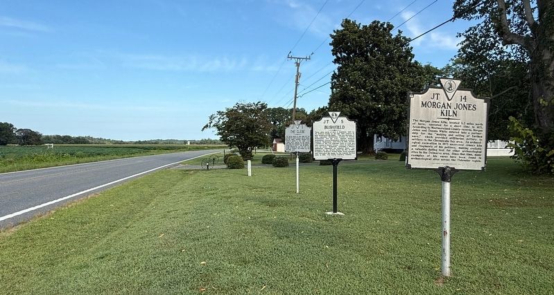
Photographed by Devry Becker Jones (CC0), August 30, 2026
2. Three Virginia Department of Historic Resources Markers on Display
Another marker is no longer nearby. Bushfield (was a few steps from this marker but has been replaced with another marker now near it).
Related marker. Click here for another marker that is related to this marker. This marker has replaced the linked marker.
Credits. This page was last revised on August 30, 2026. It was originally submitted on August 30, 2026, by Devry Becker Jones of Washington, District of Columbia. This page has been viewed 13 times since then. Photos: 1, 2. submitted on August 30, 2026, by Devry Becker Jones of Washington, District of Columbia.
