Hilton Beach in Algoma District, Ontario — Central Canada (North America)
Making Do/Se débrouiller avec les moyens du bord
| — | Fort Saint Joseph National Historic Site | — |
Photographed by Cosmos Mariner, June 10, 2024
1. Making Do/Se débrouiller avec les moyens du bord Marker

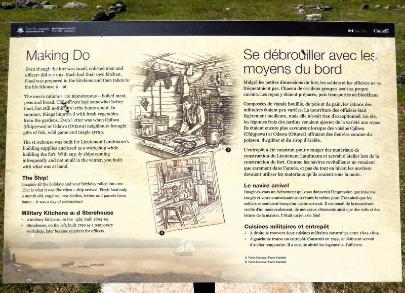
Even though the fort was small, enlisted men and officers did not mix. Each had their own kitchen. Food was prepared in the kitchens and then taken to the blockhouse to eat.
The men's rations were monotonous — boiled meat, peas and bread. The officers had somewhat better food, but still nothing to write home about. In summer, things improved with fresh vegetables from the gardens. Even better was when Ojibwa (Chippewa) or Odawa (Ottawa) neighbours brought gifts of fish, wild game and maple syrup.
The storehouse was built for Lieutenant Landmann's building supplies and used as a workshop while building the fort. With supply ships coming infrequently and not at all in the winter, you built with what was at hand.
The Ship!
Imagine all the holidays and your birthday rolled into one. That is what it was like when a ship arrived. Fresh food only a month old, supplies, new clothes, letters and parcels from home — it was a day of celebration!
Military Kitchens and Storehouse
• 2 military kitchens, on the right, built 1804-05.
• Storehouse, on the left, built 1799 as a temporary workshop, later became quarters
this page online
Malgré les petites dimensions du fort, les soldats et les officiers ne se fréquentaient pas. Chacun de ces deux groupes avait sa propre cuisine. Les repas y étaient préparés, puis transportés au blockhaus.
Composées de viande bouillie, de pois et de pain, les rations des militaires étaient peu variées. La nourriture des officiers était légèrement meilleure, mais elle n'avait rien d'exceptionnel. En été, les légumes frais des jardins venaient ajouter de la variété aux repas. Ils étaient encore plus savoureux lorsque des voisins Ojibwa (Chippewa) et Odawa (Ottawa) offraient des denrées comme du poisson, du gibier et du sirop d'érable.
L'entrepôt a été construit pour y ranger des matériaux de construction du Lieutenant Landmann et servait d'atelier lors de la construction du fort. Comme les navires ravitailleurs ne venaient que rarement dans l'année, et pas du tout en hiver, les ouvriers devaient utiliser les matériaux qu'ils avaient sous la main.
Le navire arrive!
Imaginez-vous un événement qui vous donnerait l'impression que tous vos congés et votre anniversaire sont réunis
Photographed by Cosmos Mariner, June 10, 2024
2. Making Do/Se débrouiller avec les moyens du bord Marker
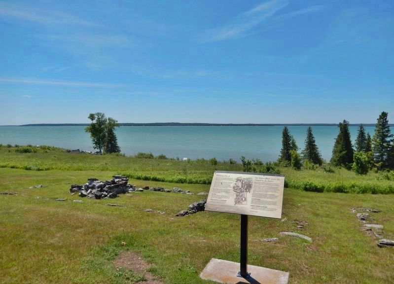
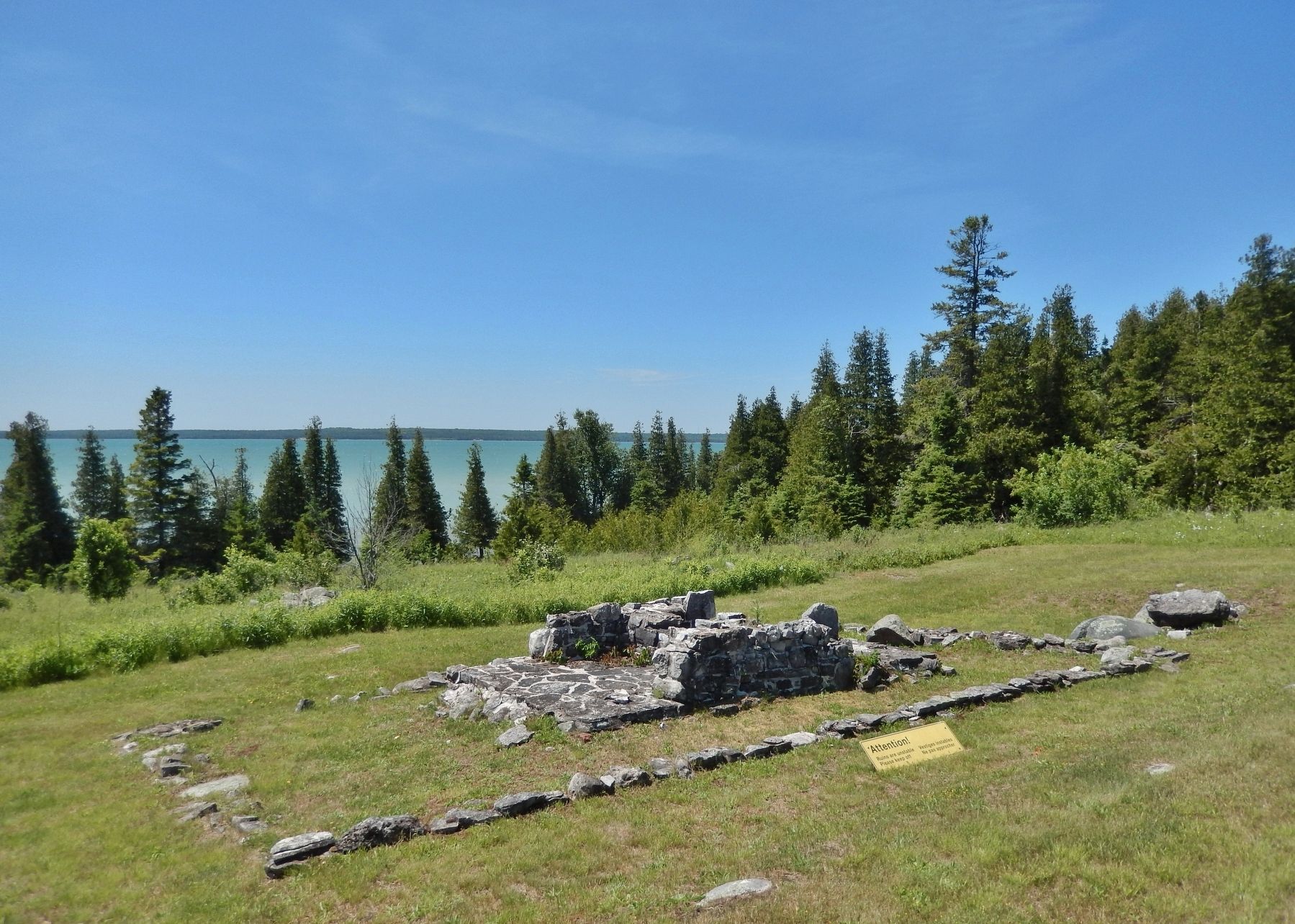
Looking south across Fort Saint Joseph National Historic Site. Storehouse ruins (1799) are on the left. The St. Marys River is in the distant background.
Cuisines militaires et entrepôt
• À droite se trouvent deux cuisines militaires construites entre 1804-1805.
• À gauche se trouve un entrepôt. Construit en 1799, ce bâtiment servait d'atelier temporaire. Il a ensuite abrité les logements d'officiers.
Erected by Parks Canada / Parcs Canada.
Topics. This historical marker is listed in these topic lists: Forts and Castles • Indigenous Peoples and Communities. A significant historical year for this entry is 1799.
Location. 46° 3.783′ N, 83° 56.809′ W. Marker is in Hilton Beach, Ontario, in Algoma District. It can be reached from Fort Road 4.8 kilometers west of A Line Road. The marker is on the Fort St. Joseph National Historic Site interpretive trail. Touch for map. Marker is at or near this postal address: 185 Fort Road, Hilton Beach ON P0R 1G0, Canada. Touch for directions.

Regionally, this marker is in the Sault Ste. Marie and Algoma Area
Photographed by Cosmos Mariner, June 10, 2024
3. Fort St. Joseph Military Kitchen Ruins (1804-1805)
Other nearby markers. At least 8 other markers are within walking distance of this marker: What's the Story?/Histoire de la cheminée (a few steps from this marker); Want to be a Soldier?/Vous voulez être un soldat? (within shouting distance of this marker); Black Hole or Flogging/Le trou noir, ou le fouet? (within shouting distance of this marker); The Importance of Friends/L'importance des amis (within shouting distance of this marker); Land of Little Comfort / Un Territoire offrant peu de confort (within shouting distance of this marker); Build it Better/Une construction améliorée (within shouting distance of this marker); Inside the Walls/À l'intérieur des remparts (within shouting distance of this marker); Major Intersection/Une intersection importante (within shouting distance of this marker). Touch for a list and map of all markers in Hilton Beach.
Related markers. Click here for a list of markers that are related to this marker. Fort Saint Joseph National Historic Site
Also see . . . Fort St. Joseph National Historic Site (Parks Canada).
Excerpt: Explore the ruins of Fort St. Joseph National Historic Site and feel the rich War of 1812 history that lingers – a history that saw a powerful alliance struck between the British and the First Nations People of the western Great Lakes region.(Submitted on August 31, 2026, by Cosmos Mariner of Cape Canaveral, Florida.)
Credits. This page was last revised on September 1, 2026. It was originally submitted on August 30, 2026, by Cosmos Mariner of Cape Canaveral, Florida. This page has been viewed 14 times since then. Photos: 1, 2, 3. submitted on August 31, 2026, by Cosmos Mariner of Cape Canaveral, Florida.
