
Hudgins in Mathews County, Virginia — The American South (Mid-Atlantic)
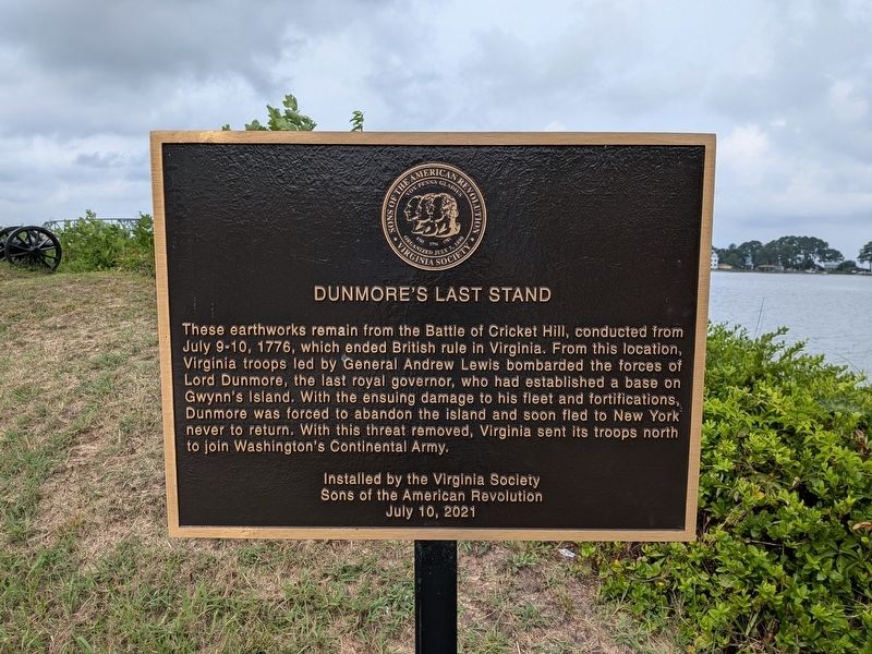
Dunmore's Last Stand
Photographed by Evan Dwyer, August 29, 2026
1. Dunmore's Last Stand Marker
Sons of the American Revolution
July 10, 2021
Erected 2021 by Virginia Society Sons of the American Revolution.
Topics and series. This historical marker is listed in these topic lists: Colonial Era • Forts and Castles • Patriots & Patriotism • War, US Revolutionary. In addition, it is included in the Sons of the American Revolution (SAR) series list. A significant historical date for this entry is July 9, 1776.
Location. 37° 29.296′ N, 76° 18.437′ W. Marker is in Hudgins, Virginia, in Mathews County. It can be reached from Mill Point Road (Virginia
this page online

Regionally, this marker is on the Middle Peninsula and in the Hampton Roads Metropolitan Area. It is also in the American South, specifically in the Upper South, in the Tidewater, in the Chesapeake Bay Region, and on the Eastern Seaboard. Globally, it is in the North Atlantic Region, North America, the Western Hemisphere, the Western World, and the Anglosphere. Historically, it finds itself in what was once the territory of the Mississippian Culture, one of the original Thirteen Colonies, one of the Confederate States of America, and the Antebellum South.
Other nearby markers. At least 8 other markers are within 4 miles of this marker, measured as the crow flies: Battle of Cricket Hill (here, next to this marker); Captain Louis d'Ohicky Arundel (a few steps from this marker); a different marker also named Battle of Cricket Hill

Photographed by Evan Dwyer, August 29, 2026
2. Dunmore's Last Stand Marker & Earthworks
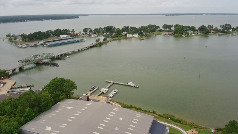
The remaining earthworks described in the marker (visible beyond it) are for three of the four 9-pounders mounted east of the Narrows; another two guns, both 18-pounders, were in a different position to the west (and no longer exist). The gun positions shown were tasked with shelling Dunmore's camp and Fort Hamond on the southwest tip of Gwynn's Island, where Narrows Marina now stands. The 18-pounder battery to the west focused on the British flagship Dunmore, anchored just offshore in Hill's Bay.
Also see . . . Fort Cricket Hill Historic Register Entry. Virginia Department of Historic Resources State & National Places/Landmarks Register with nomination form describing significance of the site and event. (Submitted on August 30, 2026, by Evan Dwyer of Richmond, Virginia.)
Photographed by Evan Dwyer, August 29, 2026
3. Battle of Cricket Hill Marker
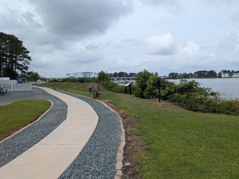
View of the pathway, marker, and earthworks. Both of the adjacent markers are related to the Cricket Hill battle as well.
Photographed by Evan Dwyer, circa August 2026
4. Fort Cricket Hill
Recreational Drone view. The remaining earthworks of "Fort Cricket Hill" are visible at lower center just in front of the marina's storage building. Their target was the camp and fort (no longer extant) on the southwest corner of Gwynn's Island just to the left of the bridge, opposite the narrow channel. The range, even for cannon of that era, was very short.
Credits. This page was last revised on August 30, 2026. It was originally submitted on August 30, 2026, by Evan Dwyer of Richmond, Virginia. This page has been viewed 11 times since then. Photos: 1, 2, 3, 4. submitted on August 30, 2026, by Evan Dwyer of Richmond, Virginia.
