Near Hancock in Washington County, Maryland — The American Northeast (Mid-Atlantic)
Sideling Hill Cut South Bench
Photographed by J. J. Prats, August 13, 2006
1. Sideling Hill Cut South Bench Marker
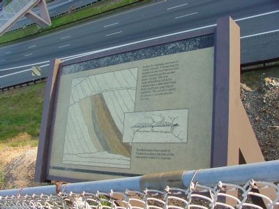
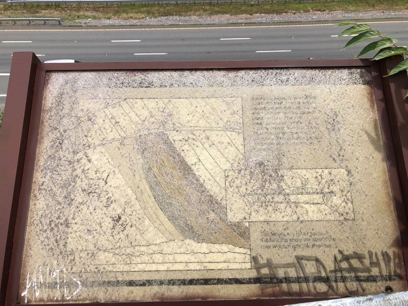
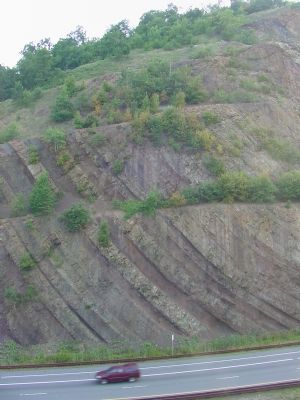
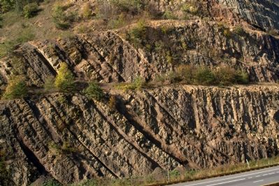
Across the highway, you have a clue to the past. The slanting tan sandstone was the bed of a river which scoured out the curved place you see. The river meandered away and left a marshy area or lake which was filled with dark gray mud or claystone. This cut-off is called an oxbow or buried stream channel.
The Monocacy River south of Frederick is about the size of the river which made this channel.
Topics. This historical marker is listed in this topic list: Natural Features.
Location. 39° 43.14′ N, 78° 16.886′ W. Marker is unreadable. Marker is near Hancock, Maryland, in Washington County. It is on the westbound Sideling Hill Rest Area (Interstate 68 at milepost 75) west of Exit 77 (Maryland Route 144), on the right when traveling west. The marker can also be reached from the eastbound Rest Area by crossing the footbridge. Touch for map. Marker is in this post office area: Hancock MD 21750, United States of America. Touch for directions.

Regionally, this marker is in Western Maryland. It is also in the American Mid-Atlantic, in Appalachia, and specifically in
this page online
Other nearby markers. At least 8 other markers are within 5 miles of this location, measured as the crow flies: The Challenge of Sideling Hill (within shouting distance of this marker); Explore Maryland Civil War Trails (within shouting distance of this marker); Interstate 68 Maryland Vietnam Memorial (about 600 feet away); a different marker also named Explore Maryland Civil War Trails (approx. ¼ mile away); Round Top Sand Company (approx. 4 miles away); Round Top Heritage Area (approx. 4 miles away); Round Top Cement Mill (approx. 4.1 miles away); a different marker also named Round Top Cement Mill (approx. 4.1 miles away). Touch for a list and map of all markers in Hancock.
Other markers no longer nearby. Sideling Hill and Town Hill Mountains (was within shouting distance of this marker but has been confirmed missing); Sideling Hill Cut North Bench (was within shouting distance of this marker but has been permanently
Photographed by Devry Becker Jones (CC0), July 12, 2020
2. Sideling Hill Cut South Bench Marker
Unfortunately the marker has experienced significant weather damage and has also been defaced.
More about this marker. This marker is approx 1297 feet above sea level.
Also see . . . Geology of the Sideling Hill Road Cut. Maryland Geological Survey website entry (Submitted on January 21, 2007.)
Additional commentary.
1. About the marker
This marker was submitted
Photographed by J. J. Prats, August 13, 2006
3. Sideling Hill Cut South Bench
— Submitted September 1, 2026, by Devry Becker Jones of Washington, District of Columbia.
Photographed by Jakub Kaluzny, October 9, 2007
4. Sideling Hill Cut South Bench
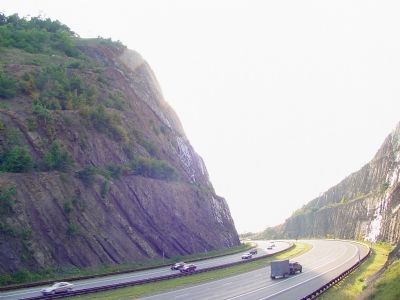
Photographed by J. J. Prats, August 13, 2006
5. Sideling Hill Cut South Bench
Credits. This page was last revised on September 1, 2026. It was originally submitted on January 21, 2007, by J. J. Prats of Powell, Ohio. This page has been viewed 3,728 times since then and 45 times this year. Last updated on September 1, 2026, by Carl Gordon Moore Jr. of North East, Maryland. Photos: 1. submitted on January 21, 2007, by J. J. Prats of Powell, Ohio. 2. submitted on July 14, 2020, by Devry Becker Jones of Washington, District of Columbia. 3. submitted on January 21, 2007, by J. J. Prats of Powell, Ohio. 4. submitted on October 24, 2007, by Jakub Kaluzny of Rockville, Maryland. 5. submitted on January 21, 2007, by J. J. Prats of Powell, Ohio. • Devry Becker Jones was the editor who published this page.
