Terrace Bay in Thunder Bay District, Ontario — Central Canada (North America)
Terrace Bay
1947-1997
Photographed by Cosmos Mariner, June 8, 2022
1. Terrace Bay Marker
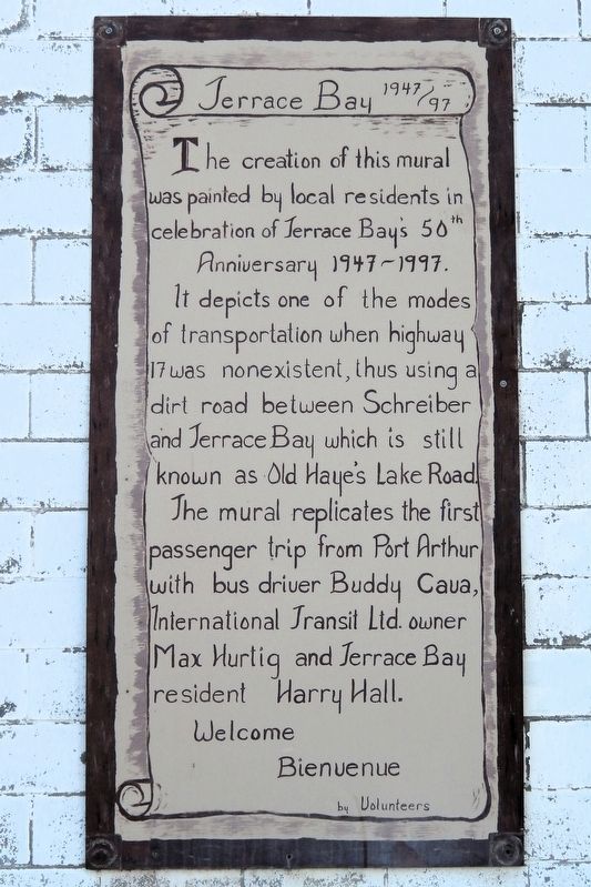
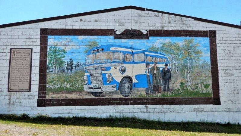
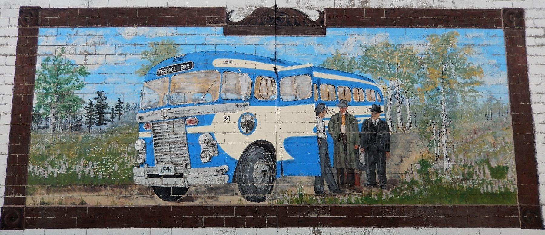
The creation of this mural was painted by local residents in celebration of Terrace Bay’s 50th Anniversary 1947-1997.
It depicts one of the modes of transportation when highway 17 was nonexistent, thus using a dirt road between Schreiber and Terrace Bay which is still known as Old Haye’s Lake Road.
The mural replicates the first passenger trip from Port Arthur with bus driver Buddy Cava, International Transit Ltd. Owner Max Hurtig and Terrace Bay resident Harry Hall.
Welcome Bienvenue
by Volunteers
Erected 1997.
Topics. This historical marker is listed in these topic lists: Roads & Vehicles • Settlements & Settlers. A significant historical year for this entry is 1947.
Location. 48° 46.991′ N, 87° 6.012′ W. Marker is in Terrace Bay, Ontario, in Thunder Bay District. It is on Simcoe Plaza just west of Hudson Drive, on the right when traveling west. The marker and mural span the east wall of the building at this location. Touch for map. Marker is at or near this postal address: 41 Simcoe Plaza, Terrace Bay ON P0T 2W0, Canada. Touch for directions.

Regionally, this marker is in Northern Ontario and specifically in Northwest Ontario. It is also in Central Canada. Globally, it is in North America, in the Great North Woods, on the Great Lakes, on Lake Superior’s North Shore, in the Western Hemisphere, in the Western World, and in the Anglosphere. Historically, it finds itself in what was once a British colony, the Viceroyalty of New France, the Haudenosaunee (Iroquois) Confederacy, and Rupert’s Land.
Other nearby markers. At least 4 other markers are within 13 kilometers of this marker, measured as the crow flies: Glacial Terraces (approx. 0.3 kilometers away); Japanese-Canadian Road Camps (approx. 12.5 kilometers away); Sir Collingwood Schreiber (approx. 12.5 kilometers away); Schreiber World War I Memorial
this page online
Also see . . . Terrace Bay (Wikipedia).
Excerpt: Terrace Bay originated as a company town in the 1940s when a pulp and paper mill was established there by the Longlac Pulp & Paper Company, later renamed Kimberly-Clark Forest Products. On September 1, 1947, Terrace Bay was granted status as an Improvement District. The pulp mill was the lead developer with construction of the community's basic infrastructure. By the end of 1948, Terrace Bay consisted of about 230 houses serviced with sewer, water and electricity but surrounded only by bush as the highway was still not completed through the town. In 1951, the Lakeview subdivision was started, with sewer, water and electrical services provided for well over 100 houses. The town name originates from a series of lake terraces formed as the water level in Lake Superior lowered following the latest ice age.(Submitted on September 2, 2026, by Cosmos Mariner of Cape Canaveral, Florida.)
Photographed by Cosmos Mariner, June 8, 2022
2. Terrace Bay Marker & Mural
The marker and mural span the east wall of the building at this location.
Photographed by Cosmos Mariner, June 8, 2022
3. Terrace Bay 1947 Mural
Credits. This page was last revised on September 2, 2026. It was originally submitted on September 1, 2026, by Cosmos Mariner of Cape Canaveral, Florida. This page has been viewed 7 times since then. Photos: 1, 2, 3. submitted on September 2, 2026, by Cosmos Mariner of Cape Canaveral, Florida.
