Summerside, Prince Edward Island — The Atlantic Provinces (North America)
The Drill Shed
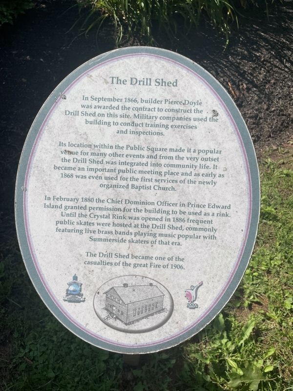
Photographed by Jay Noble, August 28, 2026
1. The Drill Shed Marker
In September 1866, builder Pierce Doyle was awarded the contract to construct the Drill Shed on this site. Military companies used the building to conduct training exercises and inspections.
Its location within the Public Square made it a popular venue for many other events and from the very outset the Drill Shed was integrated into community life. It became an important public meeting place and as early as 1868 was even used for the first services of the newly organized Baptist Church.
In February 1880 the Chief Dominion Officer in Prince Edward Island granted permission for the building to be used as a rink. Until the Crystal Rink was opened in 1886 frequent public skates were hosted at the Drill Shed, commonly featuring live brass bands playing music popular with Summerside skaters of that era.
The Drill Shed became one of the casualties of the great Fire of 1906.
Topics. This historical marker is listed in these topic lists: Military • Parks & Recreational Areas. A significant historical month for this entry is February 1880.
Location. 46° 23.639′ N, 63° 47.369′ W. Marker is in Summerside, Prince Edward Island. It
this page online

Regionally, this marker is in the Maritimes and in Atlantic Canada. Globally, it is in the North Atlantic Region, North America, the Western Hemisphere, the Western World, and the Anglosphere. Historically, it finds itself in what was once a British colony and also the Viceroyalty of New France.
Other nearby markers. At least 8 other markers are within walking distance of this marker: In Memory of Sir Ira Enman (within shouting distance of this marker); R.C.A.F. Station/C. F. B. Summerside 1941-1992 (within shouting distance of this marker); British Commonwealth Air Training Plan Memorial (within shouting distance of this marker); Former Summerside Post Office / L'Ancien Bureau de Poste de Summerside (about 120 meters away, measured in a direct line); Georgina Fane Pope (about 150 meters away); The Great Fire of 1906 (about 150 meters away); The Summerside Armoury (about 180 meters away); In memory of Carrie Ellen Holman

Photographed by Jay Noble, August 28, 2026
2. The Drill Shed Marker
Credits. This page was last revised on September 1, 2026. It was originally submitted on September 1, 2026, by Jay Noble of Charlottetown, Prince Edward Island. This page has been viewed 10 times since then. Photos: 1, 2. submitted on September 1, 2026, by Jay Noble of Charlottetown, Prince Edward Island. • Andrew Ruppenstein was the editor who published this page.
