
Morell, Prince Edward Island — The Atlantic Provinces (North America)
St. Peters Harbour Lighthouse
⎯⎯⎯
Le phare du port de St. Peters
Photographed by Jay Noble, September 1, 2026
1. St. Peters Harbour Lighthouse Marker

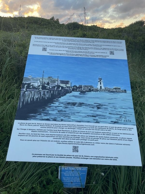
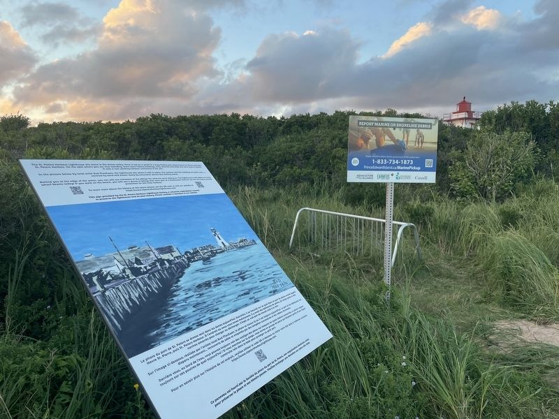
The St. Peters Harbour Lighthouse sits alone in the dunes today. Once, it sat on a wharf in a busy fishing port named Havre St. Pierre and later, St. Peters Harbour. On the spot where you are now standing, there were fishery buildings, long wharves and ships tied up to load or unload. It was a real working harbour connected to the sea.
In the picture below by local artist Bud MacEwen, the lighthouse sits where it still is today. The harbour and the buildings are gone now................ covered by sand and blown away by successive storms and shifting sands.
Behind you at the edge of the water, you can still see remnants of the pilings the wharves were sitting on. The lighthouse is still sitting on those wharf beams today! If you walk on the beach, you will see a group of pilings that were part of a breakwater built far out into the bay to provide protection for this little harbour.
To learn more about the history of this place please use the QR code or visit our website at https://www.stpetersharbourlighthouse.com
This sign provided by the St. Peters Harbour Lighthouse
this page online
Le phare du port de St. Peters se dresse seul dans les dunes aujourd'hui. Autrefois, il se trouvait sur un quai dans un port de pêche animé appelé Havre St. Pierre, puis St. Peters Harbour. À l'endroit où vous vous tenez maintenant, il y avait des bâtiments de pêche, de longs quais et des navires amarrés pour charger ou décharger. C'était un vrai port de travail relié à la mer.
Sur l'image ci-dessous, réalisée par l'artiste local Bud MacEwen, le phare se trouve là où il est toujours aujourd'hui. Le port et les bâtiments ont disparu maintenant... recouverts de sable et emportés par des tempêtes successives et des sables mouvants.
Derrière vous, au bord de l'eau, vous pouvez toujours voir des vestiges des pieux sur lesquels les quais étaient construits. Le phare repose toujours sur ces poutres de quai aujourd'hui ! Si vous marchez sur la plage, vous verrez un groupe de pieux qui faisaient partie d'une digue construite loin dans la baie pour protéger ce petit port.
Pour
Photographed by Jay Noble, September 1, 2026
2. St. Peters Harbour Lighthouse Marker
Erected by St. Peters Harbour Lighthouse Society.
Topics and series. This historical marker is listed in this topic list: Waterways & Vessels. In addition, it is included in the Lighthouses series list.
Location. 46° 26.474′ N, 62° 44.865′ W. Marker is in Morell, Prince Edward Island. It is on Lighthouse Road. Touch for map. Marker is at or near this postal address: 302 Lighthouse Road, Morell PE C0A 1S0, Canada. Touch for directions.

Regionally, this marker is in the Maritimes and in Atlantic Canada. Globally, it is in the North Atlantic Region, North America, the Western Hemisphere, the Western World, and the Anglosphere. Historically, it finds itself in what was once a British colony and also the Viceroyalty of New France.
Other nearby markers. At least 5 other markers are within 11 kilometers of this marker, measured as the crow flies: The Sanderson Farm/La ferme Sanderson (approx. 3.8 kilometers away); Mussel Power/Les moules plus d'une utilité (approx. 4 kilometers away); Havre Saint Pierre (approx. 4.1 kilometers away); St. Peters (approx. 4.1 kilometers away); Bishop A. B. Mac Eachern / Mgr. A.B. Mac Eachern (approx. 10.4 kilometers away).
Credits. This page was last revised on September 5, 2026. It was originally submitted on September 2, 2026, by Jay Noble of Charlottetown, Prince Edward Island. This page has been viewed 5 times since then. Photos: 1, 2. submitted on September 2, 2026, by Jay Noble of Charlottetown, Prince Edward Island. • Andrew Ruppenstein was the editor who published this page.
