Parker in Collin County, Texas — The American South (West South Central)
Welcome to the Preserve
Photographed by James Hulse, September 2, 2026
1. Welcome to the Preserve Marker
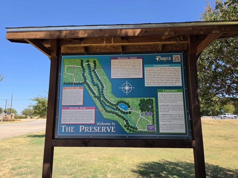
Cotton Gin
William C. Parker was a farmer and successful businessman who owned a gristmill and cotton gin. The cotton gin first used mule power and later a steam engine fueled by wood and coal. After World War II, farmers began to move to cities to work, and cotton production declined. The gin in Parker fell silent. Today all that remains of the Parker Gin is part of the original foundation.
Nature Trail
The Nature Trail winds through the Preserve in a long loop, perfect for jogging or strolling. The Trail is about 4,250 feet, or 0.8 miles. Some stretches are crushed granite, other portions are concrete. In rainy weather, the ground to either side of the Trail can become muddy, but the Trail remains largely navigable. The path is particularly pleasant as you wander beneath the trees and near Maxwell Creek or the pond.
Maxwell Creek
Maxwell Creek stretches from just north of Parker Road, southward through the Preserve into Murphy, and east to a pond near Wylie. It was once much larger, with water supplied by the surrounding grasslands and scattered mini-forests. There was significant water flowing down the Creek
this page online
Environment
The Preserve is in a geographic area termed “The Blackland Prairie”. The soil is “Houston clay”, a Rendzina soil with gray/black surface layers of organic matter overlaying softer, lighter layers of marl, chalk, and limestone. Almost the entire Preserve lies in the flood plain of Maxwell Creek, and the normal annual rainfall is 30-40 inches. You are likely to see many kinds of wildlife in the Preserve: ducks, egrets, cardinals, jays, swallows and many other bird species; bobcats, coyotes, opossum, rabbits, raccoons, skunks, armadillos and squirrels.
Landmarks
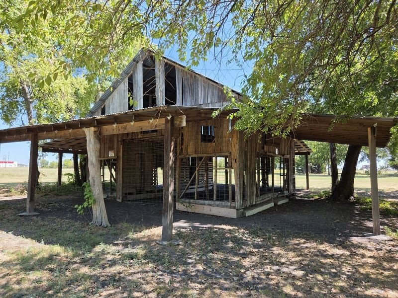
The Barn was built by John Gray in 1847 and expanded in 1943 for more hay and pigs. For safety reasons, visitors are no longer allowed to enter it, but you can still appreciate its historic beauty as you walk along the pond or the Nature Trail.
The Wishing Well is a Scout project tucked away in the trees north of the Gazebo. The mouth of the well
Photographed by James Hulse, September 2, 2026
2. Welcome to the Preserve Marker
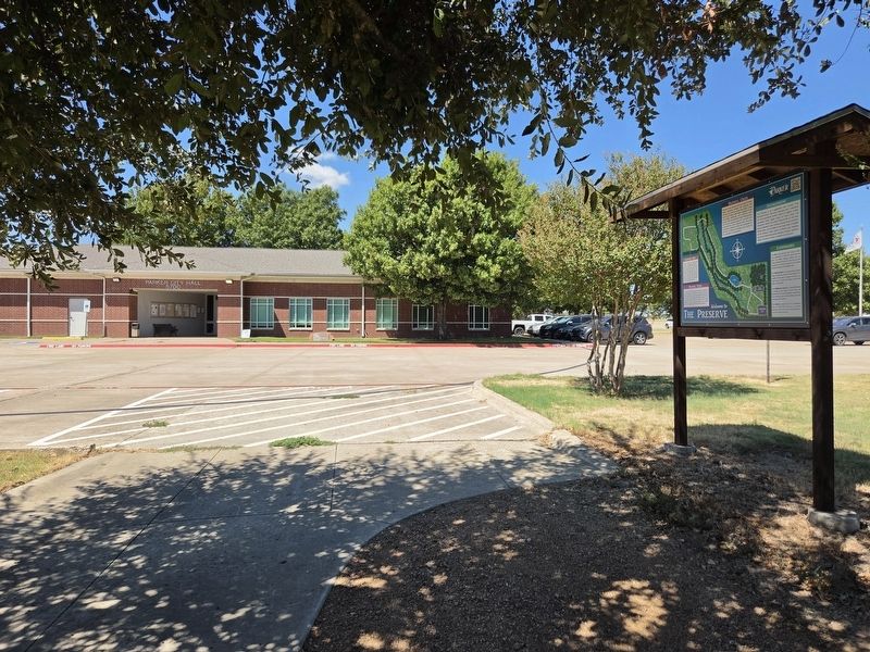
The view of the marker at the trailhead with Parker City Hall in the background.
The Wildflower Garden is a beautiful work in progress just south of the trees. Be careful not to tread the garden under foot, but stroll by and see what flowers may be coming up this month.
The Gazebo is open to all. It is a welcome spot for relief from the sun in summer months, to rest for lunch and conversation, or just to enjoy the view. Suggested corrections: None.
Topics. This historical marker is listed in these topic lists: Exploration • Parks & Recreational Areas. A significant historical year for this entry is 1847.
Location. 33° 3.288′ N, 96° 37.274′ W. Marker is in Parker, Texas, in Collin County. It is at the intersection of East Parker Road and McMenamy Ln, on the right when traveling east on East Parker Road. The marker is located on the grounds of the Parker City Hall. Touch for map. Marker is at or near this postal address: 5700 E Parker Rd, Allen TX 75002, United States of America. Touch for directions.

Regionally, this marker is in the Prairies & Lakes Region and in the Dallas-Fort Worth Metropolitan Area. Globally,
Photographed by James Hulse, September 2, 2026
3. Welcome to the Preserve Marker
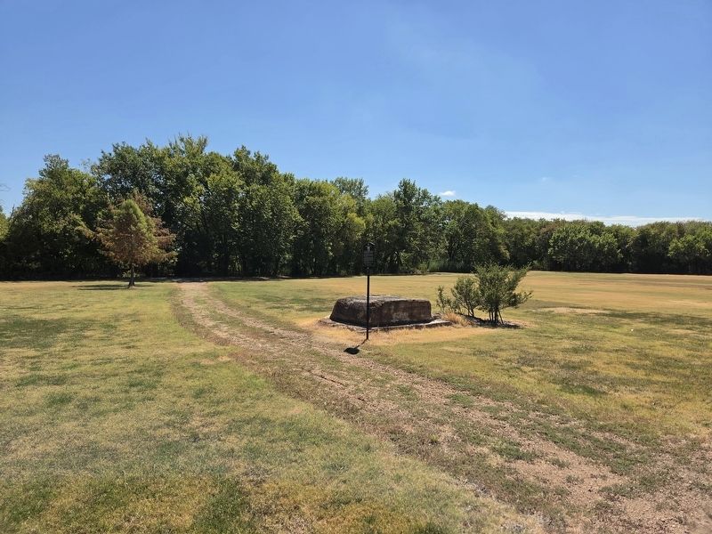
The view of the cotton gin’s foundation stone along the trail.
Other nearby markers. At least 8 other markers are within 2 miles of this marker, measured as the crow flies: William C. Parker (here, next to this marker); T.L. Johnson Store (a few steps from this marker); 1st Lt. Charles P. Moses, U.S. Army (within shouting distance of this marker); Parker Cotton Gin (within shouting distance of this marker); Corinth Presbyterian Church (about 500 feet away, measured in a direct line); Comfort Allen and Lydia McMillen Farm (approx. 1½ miles away); First Baptist Church of Murphy (approx. 1.8 miles away); McMillen Cemetery (approx. 1.9 miles away). Touch for a list and map of all markers in Parker.
Photographed by James Hulse, September 2, 2026
4. Welcome to the Preserve Marker
The view of the barn along the trail.
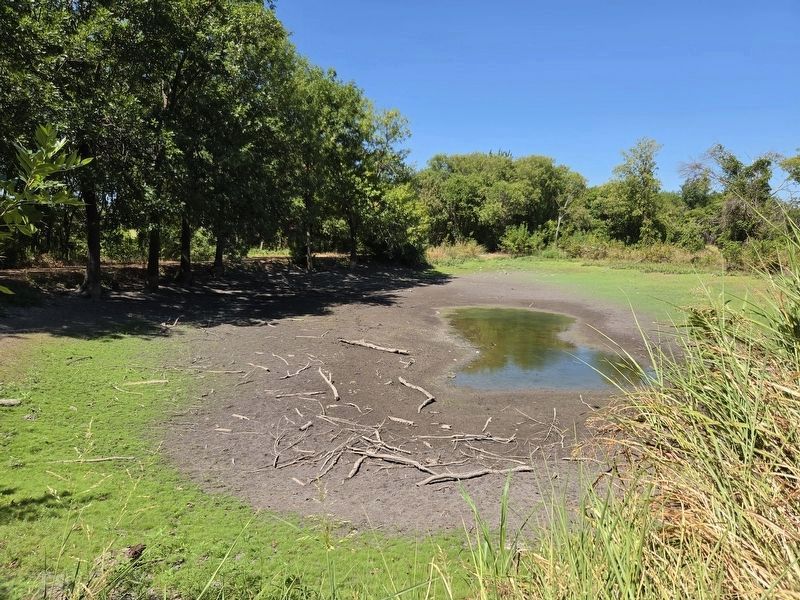
Photographed by James Hulse, September 2, 2026
5. Welcome to the Preserve Marker
The view of the pond along the trail.
Credits. This page was last revised on September 4, 2026. It was originally submitted on September 2, 2026, by James Hulse of Medina, Texas. This page has been viewed 9 times since then. Photos: 1, 2, 3, 4, 5. submitted on September 4, 2026, by James Hulse of Medina, Texas.
