North Bonneville in Skamania County, Washington — The American West (Northwest)
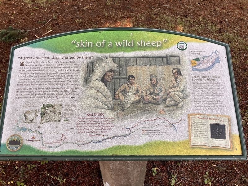
"skin of a wild sheep"
Photographed by Barry Swackhamer, June 12, 2026
1. "skin of a wild sheep" Marker
"a great orniment...highly prised by them"
On April 10, 1806, the explorers of the Lewis and Clark Expedition stopped for breakfast at the "Clah-dah lab" village located along the Columbia River downstream from here. When the villagers offered a mountain goat skin and cap for sale, Clark wrote, " nothing could be more acceptable except the Animal itself." Lewis described the offering: "the head of the sheep with the horns remaining was cased in such manner as to fit the head of a man by whom it was worn and highly prized as an ornament." The captains traded a knife and two elk skins for the prized goat skin and cap.
The "Cash-dah lab" people told them the animals could be found in great abundance in the cliffs of the nearby mountains.
The Skin we obtained appeared to be the Skin of a Sheep not fully grown, the wool fine, the Horns were abought 4 inches long, Celindrie, Smooth, black; a little bending backwards and pointed; they rise from the Middle of the foeheard, and a little above the eyes..."
William Clark
Follow These Trails to Strawberry Island.
While westbound in fall 1805,
this page online
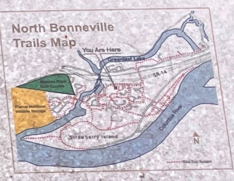
Follow the trails shown above to "Strawberry Island." On the way, look for woodland strawberries. From the island, you will have a panoramic view of the Columbia River.
Erected by Washington Lewis and Clark Expedition Bicentennial Commission.
Topics. This historical marker is listed in these topic lists: Exploration • Indigenous Peoples and Communities. A significant historical date for this entry is April 10, 1806.
Location. 45° 38.335′ N, 121° 58.542′ W. Marker is in North Bonneville, Washington, in Skamania County. It can be reached from Cascade Drive near Bonneville Drove. Touch for map. Marker is in this post office area: North Bonneville WA 98639, United States of America. Touch for directions.

Regionally, this marker is in the Columbia River Gorge and in Southwest Washington State. It is also on the American Pacific Coast, in the Pacific Northwest,
Photographed by Barry Swackhamer, June 12, 2026
2. "skin of a wild sheep" Marker (detail)
North Bonneville Trail Map
Other nearby markers. At least 8 other markers are within 3 miles of this marker, measured as the crow flies: Beacon Rock (approx. 0.9 miles away in Oregon); Sturgeon Habitat (approx. 1.1 miles away in Oregon); Bradford Island Fishway (approx. 1.6 miles away in Oregon); This Old Turbine (approx. 1.6 miles away in Oregon); a different marker also named Beacon Rock (approx. 2.3 miles away); Warrendale (approx. 2.3 miles away in Oregon); a different marker also named "Beacon Rock" (approx. 2.3 miles away); Beacon Rock State Park (approx. 2.4 miles away). Touch for a list and map of all markers in North Bonneville.
Photographed by Barry Swackhamer, June 12, 2026
3. "skin of a wild sheep" Marker
Credits. This page was last revised on September 3, 2026. It was originally submitted on September 3, 2026, by Barry Swackhamer of Brentwood, California. This page has been viewed 8 times since then. Photos: 1, 2, 3. submitted on September 3, 2026, by Barry Swackhamer of Brentwood, California.
