Central Business District in Melbourne, Victoria, Australia — Oceania
St Paul's Cathedral c1860
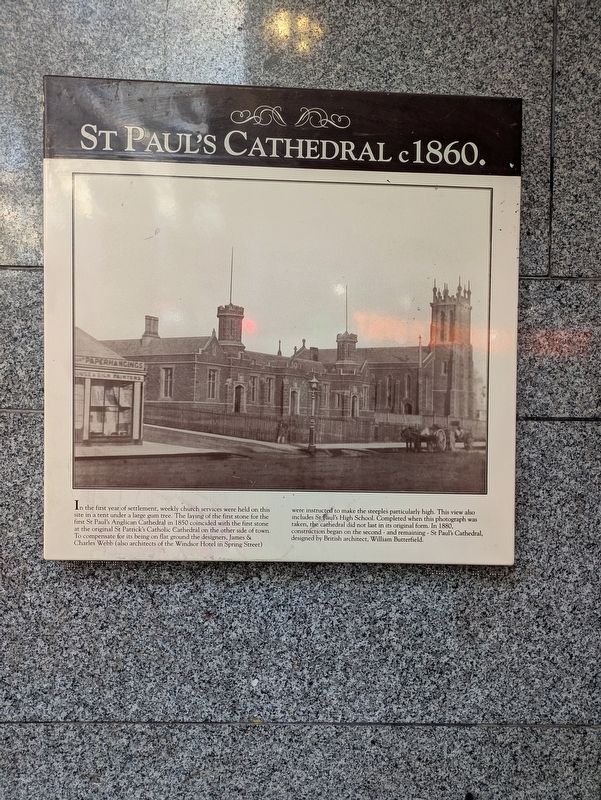
Photographed by Dean Barton-Ancliffe, July 23, 2026
1. St Paul's Cathedral c1860 Marker
Topics. This historical marker is listed in these topic lists: Architecture • Colonial Era • Religion & Religious Structures • Settlements & Settlers. A significant historical year for this entry is 1850.
Location. 37° 48.992′ S, 144° 58.009′ E. Marker is in Melbourne, Victoria. It is in the Central Business District. It is at the intersection of Flinders Lane
this page online

Regionally, it is in Oceania, in Australasia, in the Pacific Ocean, in South Pacific, on the Pacific Rim, in the Western World, and in the Anglosphere. Historically, it finds itself in what was once a British colony.
Other nearby markers. At least 8 other markers are within walking distance of this marker: You Should Have Seen It (about 90 meters away, measured in a direct line); The First Melbourne Land Auction (about 90 meters away); St Pauls Cathedral Precinct (about 120 meters away); Princes Bridge Hotel (about 120 meters away); Town Hall Foundation Stone (about 120 meters away); Melbourne Town Hall (about 150 meters away); The Athenaeum Building (about 150 meters away); The Melbourne Athenaeum (about 150 meters away). Touch for a list and map of all markers in Melbourne.
Also see . . . St Paul's Cathedral, Melbourne. Wikipedia
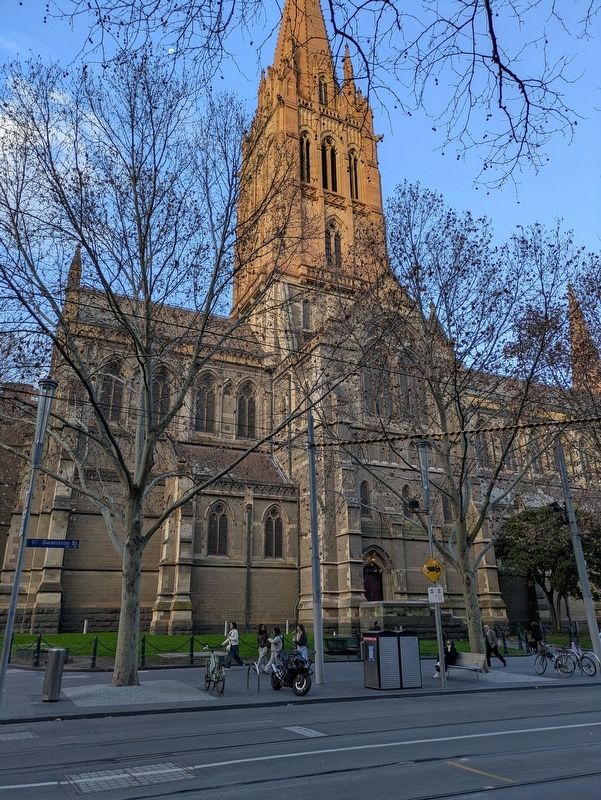
St Paul's Cathedral is built on the site where the first public Christian service(Submitted on September 3, 2026, by Dean Barton-Ancliffe of Rowville, Victoria.)in Melbourne was conducted in 1835. The block was then a government reserve far from the centre of town to the west, and used as a corn market. By 1848 the site was then adjacent to the first Princes Bridge across the Yarra River, and the prominent site was granted to the Anglican Church. The bluestone Church of St Paul the Apostle was consecrated in 1852Photographed by Dean Barton-Ancliffe, July 23, 20262. The Current St Paul's Cathedral as seen from the Marker
Credits. This page was last revised on September 4, 2026. It was originally submitted on September 3, 2026, by Dean Barton-Ancliffe of Rowville, Victoria. This page has been viewed 6 times since then. Photos: 1, 2. submitted on September 3, 2026, by Dean Barton-Ancliffe of Rowville, Victoria. • Andrew Ruppenstein was the editor who published this page.
