
York in Stanhope Bayshore, Prince Edward Island — The Atlantic Provinces (North America)
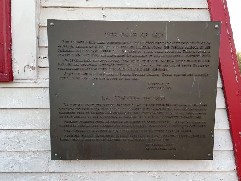
The Gale of 1851
Photographed by Jay Noble, September 2, 2026
1. The Gale of 1851 Marker

The forenoon had been particularly balmy. Schooners had sailed into the shallow waters in search of mackerel and cod. But darkness found the vessels trapped in the stillness close to land. There was no breeze to carry them offshore. That evening a strong wind blew from the northeast. By midnight it had raged into a powerful gale.
For several days the wind and waves gathered strength. On the mourning of the fourth day, the sea subsided. Battered ships were strewn along the north shore. Bodies of sailors and fishermen were entangled amongst the wreckage.
Many men were buried here in Prince Edward Island. Their graves are a silent reminder of the changing moods of the sea.
Yankee Gale
October 3, 1851
La matinee ayant ete particulierement calme, des goelettes s'etaient aventurees dans des eaux peu profondes pour pecher le maquereau et la morue. La noirceur les surprit immobiles pres de la rive. Sans brise, ils ne pouvaient regagner le large. A la nuit tombee, un vent violent se mit a souffler du nord-est et a minuit, la tempete faisait rage.
Pendant plusieurs
this page online
Les cadavres des marins et des pecheurs etaient empetres dans les debris.Plusieurs de ces infortunes furent enterres ici, sur l'Ile-du-Prince-Edouard. Leurs tombes silencieuses rappellent les caprices de la mer.
La tempête « Yankee »
3 octobre 1851
Topics. This historical marker is listed in these topic lists: Disasters • Waterways & Vessels. A significant historical date for this entry is October 3, 1851.
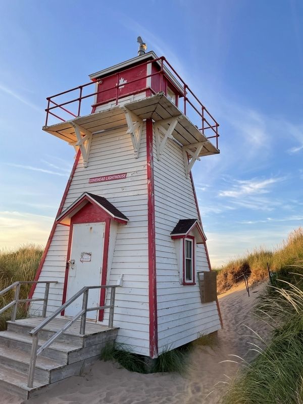
Location. 46° 25.809′ N, 63° 8.587′ W. Marker is in Stanhope Bayshore, Prince Edward Island. It is in York. It is on Gulf Shore Parkway East, on the left when traveling east. Located on side of Covehead Lighthouse. Touch for map. Marker is at or near this postal address: 1530 Gulf Shore Parkway E, Stanhope Bayshore PE C0A 1P0, Canada. Touch for directions.

Regionally, this marker is in the Maritimes and in Atlantic Canada. Globally, it is in the North Atlantic Region, North America, the Western Hemisphere, the Western World, and the Anglosphere. Historically, it finds
Photographed by Jay Noble, September 2, 2026
2. The Gale of 1851 Marker
Other nearby markers. At least 8 other markers are within 21 kilometers of this marker, measured as the crow flies: The Changing Landscape / Un paysage en évolution (approx. 0.9 kilometers away); Bushing the Bay / Buissons sur la Baie (approx. 0.9 kilometers away); Stanhope Community Cemetery (approx. 4.1 kilometers away); The Village of North Rustico (approx. 12.7 kilometers away); North Rustico War Memorial (approx. 13.4 kilometers away); Andrew's Millpond (approx. 17.7 kilometers away); Ardgowan (approx. 19.9 kilometers away); Canada Department of Agriculture Research Branch (approx. 20.1 kilometers away).
Credits. This page was last revised on September 4, 2026. It was originally submitted on September 4, 2026, by Jay Noble of Charlottetown, Prince Edward Island. This page has been viewed 5 times since then. Photos: 1, 2. submitted on September 4, 2026, by Jay Noble of Charlottetown, Prince Edward Island. • Andrew Ruppenstein was the editor who published this page.
