Fayetteville in Cumberland County, North Carolina — The American South (South Atlantic)
Scotch Spring
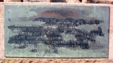
Photographed by William Fischer, Jr., July 28, 2009
1. Scotch Spring Marker
Topics. This historical marker is listed in these topic lists: Settlements & Settlers • Waterways & Vessels.
Location. 35° 3.288′ N, 78° 53.03′ W. Marker is in Fayetteville, North Carolina, in Cumberland County. It is at the intersection of Hay Street and Pittman Street, on the left when traveling east on Hay Street. Marker is about 300 feet ESE of the Amtrak passenger train station. Touch for map. Marker is at or near this postal address: 450 Hay Street, Fayetteville NC 28301, United States of America. Touch for directions.

Regionally, this marker is in the Coastal Plain. It is also in the American South and specifically in the Upper South. Globally, it is in North America, the Western Hemisphere, the Western
this page online
Other nearby markers. At least 8 other markers are within walking distance of this marker: Sherman's Army (about 500 feet away, measured in a direct line); Settlement of the Upper Cape Fear (about 700 feet away); Currahee Rocks (approx. 0.2 miles away); World War I Memorial (approx. 0.2 miles away); In Memory of All Veterans (approx. 0.2 miles away); Korean War Memorial (approx. 0.2 miles away); Vietnam War Memorial (approx. 0.2 miles away); Global War on Terror Memorial (approx. 0.2 miles away). Touch for a list and map of all markers in Fayetteville.
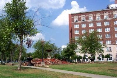
Photographed by William Fischer, Jr., July 28, 2009
2. Scotch Spring Marker
Marker among stones below the fountain. Looking east, with the Hotel Prince Charles dominating right side of photo.
Credits. This page was last revised on November 28, 2019. It was originally submitted on May 21, 2010, by William Fischer, Jr. of Reynoldsburg, Ohio. This page has been viewed 898 times since then and 34 times this year. Photos: 1, 2. submitted on May 21, 2010, by William Fischer, Jr. of Reynoldsburg, Ohio.
