Bankston in Fayette County, Alabama — The American South (East South Central)
Bankston
Fayette County
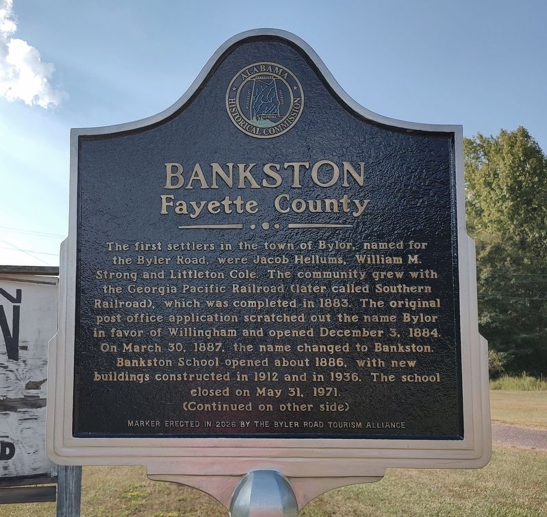
Photographed by Jimmy Emerson, September 5, 2026
1. Bankston Marker
The first settlers in the town of Bylor, named for the Byler Road, were Jacob Hellums, William M. Strong and Littleton Cole. The community grew with the Georgia Pacific Railroad (later called Southern Railroad), which was completed in 1883. The original post office application scratched out the name Bylor in favor of Willingham and opened December 3, 1884. On March 30, 1887, the name changed to Bankston. Bankston School opened about 1886, with new buildings constructed in 1912 and in 1936. The school closed on May 31, 1971.
(Reverse Side)
Bankston continued to grow, with Masonic Lodge #290 (Gillespie) formed about 1860. Bankston Baptist Church formed in 1888 and Bankston Church of Christ formed in 1914. A canning factory operated in Bankston until it burned in 1901. Sawmill businesses included Propst Brothers, Pocahontas Lumber Company, Dominic Company, and Newton Lumber Company. In 1937, the segment of the Byler Road in Bankston was paved. A tornado damaged Bankston businesses on February 20, 1951. J.L. Williamson's store, Pan-Am Service Station, the post office, Joe Williamson's warehouse. T.C.
this page online
Erected 2026 by Byler Road Tourism Alliance and Alabama Historical Commission.
Topics. This historical marker is listed in these topic lists: Education • Railroads & Streetcars • Religion & Religious Structures • Roads & Vehicles. A significant historical year for this entry is 1883.
Location. 33° 40.619′ N, 87° 40.577′ W. Marker is in Bankston, Alabama, in Fayette County. It is on Alabama 18 0.2 miles west of County Road 67, on the right when traveling west. Touch for map. Marker is at or near this postal address: 2176 AL-18, Bankston AL 35542, United States of America. Touch for directions.

Regionally, this marker is in the American South and specifically in the Deep South. Globally, it is in North America, a Gulf of Mexico state, the Western Hemisphere, the Western World, and the Anglosphere. Historically, it finds itself in what was once the territory of the Mississippian Culture, one of the Confederate States of America, and the Antebellum South.
Other nearby markers. At least 8 other
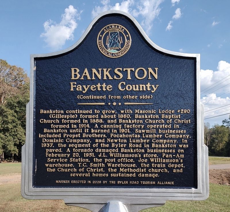
Photographed by Jimmy Emerson, September 5, 2026
2. Bankston Marker

Photographed by Jimmy Emerson, September 5, 2026
3. Bankston Marker
Credits. This page was last revised on September 7, 2026. It was originally submitted on September 5, 2026, by Jimmy Emerson of Dalton, Georgia. This page has been viewed 19 times since then. Photos: 1, 2, 3. submitted on September 5, 2026, by Jimmy Emerson of Dalton, Georgia. • James Hulse was the editor who published this page.
