Montgomery in Montgomery County, Texas — The American South (West South Central)
Montgomery Memorial Cemetery
1865
Photographed by James Hulse, September 5, 2026
1. Montgomery Memorial Cemetery Marker
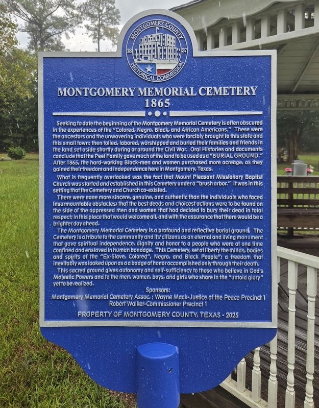
Seeking to date the beginning of the Montgomery Memorial Cemetery is often obscured in the experiences of the “Colored, Negro, Black, and African Americans.” These were the ancestors and the unwavering individuals who were forcibly brought to this state and this small town; then toiled, labored, worshipped and buried their families and friends in the land set aside shortly during or around the Civil War. Oral Histories and documents conclude that the Peel Family gave much of the land to be used as a “BURIAL GROUND.” After 1865, the hard-working Black-men and women purchased more acreage, as they gained their freedom and independence here in Montgomery, Texas.
What is frequently overlooked was the fact that Mount Pleasant Missionary Baptist Church was started and established in this Cemetery under a “brush arbor.” It was in this setting that the Cemetery and Church co-existed.
There were none more sincere, genuine, and authentic than the individuals who faced insurmountable obstacles; that the best deeds and choicest actions were to be found on the side of the oppressed men and women that had decided to bury their
this page online
The Montgomery Memorial Cemetery is a profound and reflective burial ground. The Cemetery is a tribute to the community and its’ citizens as an eternal and living monument that gave spiritual independence, dignity and honor to a people who were at one time confined and enslaved in human bondage. This Cemetery, set at liberty the minds, bodies and spirits of the “Ex-Slave, Colored”, Negro, and Black People”; a freedom that inevitably was looked upon as a badge of honor accomplished only through their death.
This sacred ground gives autonomy and self-sufficiency to those who believe in God’s Majestic Powers and to the men, women, boys, and girls who share in the “untold glory” yet to be realized.
Erected 2025 by Montgomery Memorial Cemetery Assoc.; Wayne Mack-Justice of the Peace Precinct 1; Robert Walker-Commissioner Precinct 1 and Montgomery County Historical Commission.
Topics. This historical marker is listed in these topic lists: African Americans • Cemeteries & Burial Sites. A significant historical year for this entry is 1865.
Location. 30° 24.216′ N,
Photographed by James Hulse, September 5, 2026
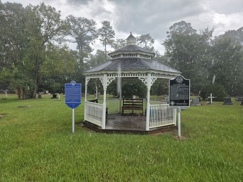
2. Montgomery Memorial Cemetery Marker (Left Side)

Regionally, this marker is in the Houston Metropolitan Area. It is also on the American Gulf Coast. Globally, it is in North America, a Gulf of Mexico state, the Western Hemisphere, the Western World, and the Anglosphere. Historically, it finds itself in what was once New Spain, the Republic of Texas, one of the Confederate States of America, and the Antebellum South.
Other nearby markers. At least 8 other markers are within walking distance of this marker: J. Goldstein DuPree (here, next to this marker); a different marker also named Montgomery Memorial Cemetery (within shouting distance of this marker); Mt Pleasant Missionary Baptist Church (approx. ¼ mile away); Montgomery County, C.S.A. (approx. 0.8 miles away); Montgomery County Jail (approx. 0.8 miles away); James Jordan (Jardine) Log House (approx. 0.8 miles away); Town of Montgomery (approx. 0.8 miles away); Charles Bellinger Stewart (approx. 0.9 miles away). Touch for a list and map of all markers in Montgomery.
Credits. This page was last revised on September 5, 2026. It was originally submitted on September 5, 2026, by James Hulse of Medina, Texas. This page has been viewed 14 times since then. Photos: 1, 2. submitted on September 5, 2026, by James Hulse of Medina, Texas.
